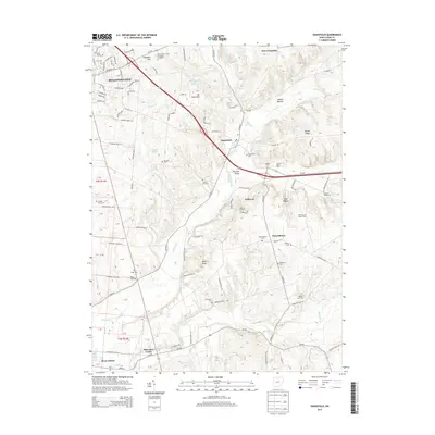
2013 Map of Zanesfield
USGS Topo · Published 2013About this map
Campbell Hill and the surrounding Logan County uplands define the topography of this region, which includes the headwaters of the Mad River. The landscape is a mix of small settlements and recreational sites, such as the Valley Hi Ski Area and Marmon Valley Farm. Historical structures like the Macochee Castle sit south of Zanesfield, marking the cultural heritage of the Macochee Creek valley. Educational and agricultural development is evident through the Ohio Hi Point Joint Vocational School District and specialized locations like the Rustic Acres Alpaca Farm. Numerous family and community burial grounds, including Tharps Run Cemetery, Goshen Cemetery, and the Pickrelltown Cemetery, provide significant points of interest for genealogists tracing early families in the area between Bellefontaine and West Liberty.
Find a feature on this map
107 named features on this map. Tap any name to fly to it.
Don’t see what you’re looking for? This feature index may not catch every label — zoom into the map to look around manually.
Map Details
Editions of this 2013 Zanesfield Map
This is the sole edition of this map. No revisions or reprints were ever made.
Other maps of this area

1913 · Bellefontaine
USGS Topo · 1:48,000

1913 · East Liberty
USGS Topo · 1:62,500

1914 · St. Paris
USGS Topo · 1:62,500

1914 · Mechanicsburg
USGS Topo · 1:62,500

1915 · Bellefontaine
USGS Topo · 1:62,500

1915 · East Liberty
USGS Topo · 1:62,500

1916 · Mechanicsburg
USGS Topo · 1:62,500

1916 · St. Paris
USGS Topo · 1:62,500

1944 · East Liberty
USGS Topo · 1:62,500

1944 · Mechanicsburg
USGS Topo · 1:62,500