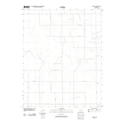
2009 Map of Zenda SE
USGS Topo · Published 2009About this map
Cottonwood Creek and its many tributaries define the drainage of this rural Barber County landscape. The terrain is marked by a network of sectional roads following the grid of the Public Land Survey System, though many routes such as Thistle Rd and Blackmare Rd navigate the local topography. One significant cultural landmark, Baird Cemetery, sits in the eastern portion of the quadrangle, serving as a vital point of interest for genealogists and local historians tracking early settlement families. In the south, US Hwy 160 provides the primary east-west corridor, cutting across a landscape dominated by riparian corridors like West Sandy Creek and West Branch Bluff Creek. The map documents the persistent agricultural and ranching character of the region during the early twenty-first century.
Find a feature on this map
23 named features on this map. Tap any name to fly to it.
Don’t see what you’re looking for? This feature index may not catch every label — zoom into the map to look around manually.
Map Details
Editions of this 2009 Zenda SE Map
This is the sole edition of this map. No revisions or reprints were ever made.
Other maps of this area

1889 · Anthony
USGS Topo · 1:125,000

1891 · Anthony
USGS Topo · 1:125,000

1955 · Pratt
USGS Topo · 1:250,000

1959 · Pratt
USGS Topo · 1:250,000

1972 · Attica
USGS Topo · 1:24,000

1972 · Sharon South
USGS Topo · 1:24,000

1972 · Crisfield
USGS Topo · 1:24,000
1973 · Spivey
USGS Topo · 1:24,000
1973 · Crystal Springs
USGS Topo · 1:24,000
1973 · Sharon North
USGS Topo · 1:24,000