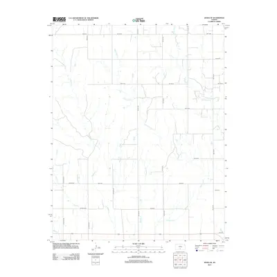
2012 Map of Zenda SE
USGS Topo · Published 2012About this map
Cottonwood Creek and its many tributaries define the drainage patterns of this rural landscape in Barber County, Kansas. The terrain is marked by a network of sectional roads and creek crossings, highlighting the agrarian structure of the region in the early 21st century. Baird Cemetery stands as a primary genealogical landmark on the eastern side of the map, situated near the headwaters of several unnamed drainages. Water courses like West Sandy Creek and West Branch Bluff Creek meander through the prairie, following the natural contours of the land. Small local road identifiers such as Blackmore and Se Walstead provide specific geographic points of reference for those researching local family history or land ownership within the sprawling sections of the Zenda SE quadrangle.
Find a feature on this map
25 named features on this map. Tap any name to fly to it.
Don’t see what you’re looking for? This feature index may not catch every label — zoom into the map to look around manually.
Map Details
Editions of this 2012 Zenda SE Map
This is the sole edition of this map. No revisions or reprints were ever made.
Other maps of this area

1889 · Anthony
USGS Topo · 1:125,000

1891 · Anthony
USGS Topo · 1:125,000

1955 · Pratt
USGS Topo · 1:250,000

1959 · Pratt
USGS Topo · 1:250,000

1972 · Attica
USGS Topo · 1:24,000

1972 · Sharon South
USGS Topo · 1:24,000

1972 · Crisfield
USGS Topo · 1:24,000
1973 · Spivey
USGS Topo · 1:24,000
1973 · Crystal Springs
USGS Topo · 1:24,000
1973 · Sharon North
USGS Topo · 1:24,000