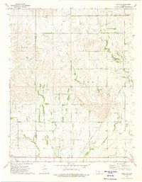
1973 Map of Zenda SE
USGS Topo · Published 1975About this map
Sharon Twp in Harper County reveals a landscape defined by an extensive Oil and Gas Field during the early 1970s. The terrain is deeply carved by a network of drainage systems, including West Branch Bluff Creek, Cottonwood Creek, and Sandy Creek, which flow through the southern Kansas countryside. The infrastructure of the energy industry is a dominant theme here, with numerous Oil Wells, a significant Compressor Station, and a web of Pipelines cutting across the section lines.
Find a feature on this map
22 named features on this map. Tap any name to fly to it.
Don’t see what you’re looking for? This feature index may not catch every label — zoom into the map to look around manually.
Map Details
Editions of this 1973 Zenda SE Map
This is the sole edition of this map. No revisions or reprints were ever made.
Other maps of this area

1889 · Anthony
USGS Topo · 1:125,000

1891 · Anthony
USGS Topo · 1:125,000

1955 · Pratt
USGS Topo · 1:250,000

1959 · Pratt
USGS Topo · 1:250,000

1972 · Attica
USGS Topo · 1:24,000

1972 · Sharon South
USGS Topo · 1:24,000

1972 · Crisfield
USGS Topo · 1:24,000
1973 · Spivey
USGS Topo · 1:24,000
1973 · Crystal Springs
USGS Topo · 1:24,000
1973 · Sharon North
USGS Topo · 1:24,000