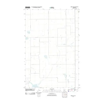
2010 Map of Zerkel NW
USGS Topo · Published 2010About this map
The Wild Rice River flows through the southern reaches of this landscape, feeding into the expansive Lower Rice Lake. This hydrographic network defines the local geography, with Mosquito Creek meandering across the central and eastern sections. The terrain is characterized by a grid-like system of rural roads and highways, including County Hwy-25 and County Hwy-31, which connect scattered homesteads and agricultural plots. Small bodies of water like Sand Lake and Mud Lake dot the northwestern corner, serving as landmarks in an area dominated by wetlands and watercourses. The inclusion of Res Hwy 18 near the river reflects the specific infrastructure of this northern Minnesota region at the start of the decade.
Find a feature on this map
17 named features on this map. Tap any name to fly to it.
Don’t see what you’re looking for? This feature index may not catch every label — zoom into the map to look around manually.
Map Details
Editions of this 2010 Zerkel NW Map
This is the sole edition of this map. No revisions or reprints were ever made.
Other maps of this area

1919 · Fosston
USGS Topo · 1:62,500

1943 · Bagley
USGS Topo · 1:62,500

1954 · Bemidji
USGS Topo · 1:250,000

1957 · Bemidji
USGS Topo · 1:250,000

1958 · Bemidji
USGS Topo · 1:250,000

1969 · Ebro
USGS Topo · 1:24,000

1969 · Roy Lake
USGS Topo · 1:24,000

1969 · Fosston SE
USGS Topo · 1:24,000
1969 · Bagley
USGS Topo · 1:24,000

1969 · Shevlin
USGS Topo · 1:24,000