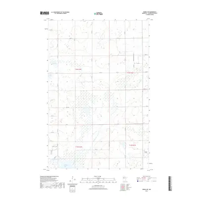
2019 Map of Zerkel NW
USGS Topo · Published 2019About this map
The Wild Rice River flows through this corner of Clearwater County, feeding into the expansive Lower Rice Lake at the southern edge of the survey. This landscape is defined by its complex hydrology, where the river's path is joined by Mosquito Cr amidst a mosaic of wetlands and small water bodies like Sand Lake and Mud Lake. The road network reflects a shift toward recreational and conservation access, featuring the Community Loop and Wild Rice Loop near the riverbanks. Holland Field stands out as a clear landmark in the eastern portion of the quadrangle, while the presence of Dam Dr near the river suggests local water management infrastructure. This survey captures a pocket of Minnesota wilderness where the movement of water and the maintenance of backroads like Mosquito Creek Rd dictate the human footprint.
Find a feature on this map
42 named features on this map. Tap any name to fly to it.
Don’t see what you’re looking for? This feature index may not catch every label — zoom into the map to look around manually.
Map Details
Editions of this 2019 Zerkel NW Map
This is the sole edition of this map. No revisions or reprints were ever made.
Other maps of this area

1919 · Fosston
USGS Topo · 1:62,500

1943 · Bagley
USGS Topo · 1:62,500

1954 · Bemidji
USGS Topo · 1:250,000

1957 · Bemidji
USGS Topo · 1:250,000

1958 · Bemidji
USGS Topo · 1:250,000

1969 · Ebro
USGS Topo · 1:24,000

1969 · Roy Lake
USGS Topo · 1:24,000

1969 · Fosston SE
USGS Topo · 1:24,000
1969 · Bagley
USGS Topo · 1:24,000

1969 · Shevlin
USGS Topo · 1:24,000