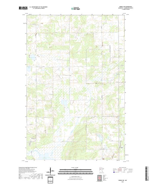
2022 Map of Zerkel NW
USGS Topo · Published 2022About this map
Lower Rice Lake and the Wild Rice River anchor the southern portion of this northern Minnesota landscape, where the terrain is defined by a dense network of wetlands and creek drainages. The Mosquito Cr corridor traverses the central area, surrounded by a complex system of local roads and sections of Minimum Maintenance Rd. This 2022 survey illustrates a region largely managed for natural preservation and limited access, with several circular routes like the Community Loop and Wild Rice Loop serving specific residential or recreational pockets. Apart from the natural water bodies such as Sand Lake and Mud Lake, human activity is noted at Holland Field near the eastern margin. The grid of township roads, including Co Rd 100 and 141st Ave, reveals the systematic division of this remote Clearwater County territory.
Find a feature on this map
37 named features on this map. Tap any name to fly to it.
Don’t see what you’re looking for? This feature index may not catch every label — zoom into the map to look around manually.
Map Details
Editions of this 2022 Zerkel NW Map
This is the sole edition of this map. No revisions or reprints were ever made.
Other maps of this area

1919 · Fosston
USGS Topo · 1:62,500

1943 · Bagley
USGS Topo · 1:62,500

1954 · Bemidji
USGS Topo · 1:250,000

1957 · Bemidji
USGS Topo · 1:250,000

1958 · Bemidji
USGS Topo · 1:250,000

1969 · Ebro
USGS Topo · 1:24,000

1969 · Roy Lake
USGS Topo · 1:24,000

1969 · Fosston SE
USGS Topo · 1:24,000
1969 · Bagley
USGS Topo · 1:24,000

1969 · Shevlin
USGS Topo · 1:24,000