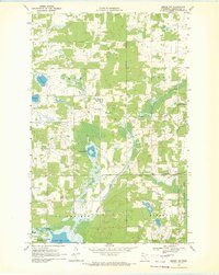
1969 Map of Zerkel NW
USGS Topo · Published 1972About this map
The White Earth Indian Reservation Boundary divides this landscape, where the wetland-rich terrain of Clearwater County meets established timber and wildlife reserves. The Wild Rice River flows across the southern portion of the sheet, feeding into the Lower Rice Lake area. This region is characterized by a dense network of water bodies and marshlands, including Tamarack Lake, Sand Lake, and Mud Lake, interspersed with managed lands like the White Earth State Forest and the Lower Rice Lake State Wildlife Management Area.
Find a feature on this map
23 named features on this map. Tap any name to fly to it.
Don’t see what you’re looking for? This feature index may not catch every label — zoom into the map to look around manually.
Map Details
Editions of this 1969 Zerkel NW Map
This is the sole edition of this map. No revisions or reprints were ever made.
Other maps of this area

1919 · Fosston
USGS Topo · 1:62,500

1943 · Bagley
USGS Topo · 1:62,500

1954 · Bemidji
USGS Topo · 1:250,000

1957 · Bemidji
USGS Topo · 1:250,000

1958 · Bemidji
USGS Topo · 1:250,000

1969 · Ebro
USGS Topo · 1:24,000

1969 · Roy Lake
USGS Topo · 1:24,000

1969 · Fosston SE
USGS Topo · 1:24,000
1969 · Bagley
USGS Topo · 1:24,000

1969 · Shevlin
USGS Topo · 1:24,000