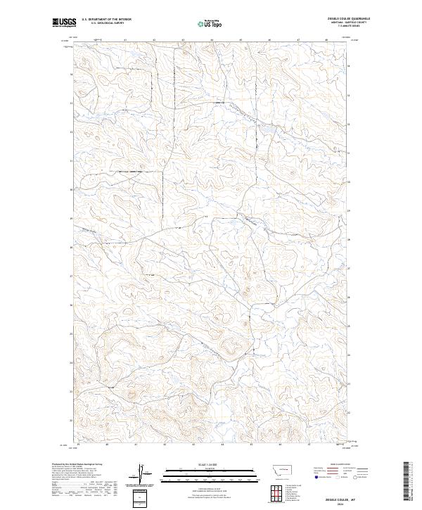
2024 Map of Ziegele Coulee
USGS Topo · Published 2024About this map
Southerland Coulee and McClay Coulee carve through the high plains of Garfield County, defining a landscape shaped by intermittent watercourses and expansive open range. This 2024 survey detail reveals the modern configuration of the Missouri River plateau, where the drainage patterns of Ziegele Coulee and Willis Coulee provide the primary geographic orientation. These features, along with Sand Creek and its tributary Long Branch, are critical landmarks for understanding land use and navigation in this sparse ranching country. The map illustrates the continuing importance of these natural drainages in a region where the vast township and range system, including boundaries like t17n r36e and t16n r37e, dictates property lines and local navigation.
Find a feature on this map
14 named features on this map. Tap any name to fly to it.
Don’t see what you’re looking for? This feature index may not catch every label — zoom into the map to look around manually.
Map Details
Editions of this 2024 Ziegele Coulee Map
This is the sole edition of this map. No revisions or reprints were ever made.
Other maps of this area

1954 · Jordan
USGS Topo · 1:250,000

1956 · Jordan
USGS Topo · 1:250,000

1958 · Jordan
USGS Topo · 1:250,000

1964 · Jordan
USGS Topo · 1:250,000

1964 · Jordan
USGS Topo · 1:24,000

1965 · Big Dry School
USGS Topo · 1:24,000

1965 · Darby Buttes
USGS Topo · 1:24,000

1965 · Ziegele Coulee
USGS Topo · 1:24,000
1965 · Darby Buttes SW
USGS Topo · 1:24,000
1965 · Fig Mountain
USGS Topo · 1:24,000