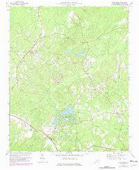
1977 Map of Zion Grove
USGS Topo · Published 1982About this map
Seven Lakes emerges as a significant development in Moore County on this map, reflecting 1970s and 1980s expansion within the North Carolina Sandhills. This planned community is surrounded by a landscape defined by traditional rural settlements like Eagle Springs and Thomas Crossroads. The industrial and transport history of the region is grounded by the Norfolk Southern railway line and the Southern Landing Strip, which serve the local agricultural and sand-mining economy.
Find a feature on this map
28 named features on this map. Tap any name to fly to it.
Don’t see what you’re looking for? This feature index may not catch every label — zoom into the map to look around manually.
Map Details
Editions of this 1977 Zion Grove Map
2 editions found
Other maps of this area

1942 · Troy
USGS Topo · 1:125,000

1948 · Southern Pines
USGS Topo · 1:62,500

1949 · West End
USGS Topo · 1:24,000

1949 · Jackson Springs
USGS Topo · 1:62,500

1950 · Southern Pines
USGS Topo · 1:24,000

1950 · Norman
USGS Topo · 1:24,000

1953 · Raleigh
USGS Topo · 1:250,000

1954 · Raleigh
USGS Topo · 1:250,000

1957 · Southern Pines
USGS Topo · 1:62,500
1957 · Southern Pines
USGS Topo · 1:24,000