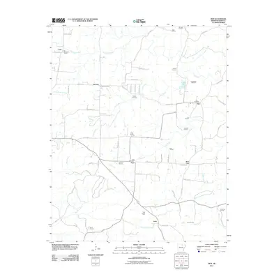
2011 Map of Zion
USGS Topo · Published 2011About this map
Larkin, LaCrosse, and Zion anchor this rural landscape in north-central Arkansas, where the topography is defined by the winding paths of Philadelphia Creek and Caney Creek. The area maintains its traditional character, centered around small communities and local post offices such as the Sage Post Office and La Crosse Post Office. For genealogists, the map is remarkably dense with burial grounds, including the Old Philadelphia Cemetery, Watkins Cemetery, and Bethlehem Cemetery, each serving as a geographical marker for the families who settled this part of Izard County. To the south near Stella, the Sage Lookout Tower stands as a notable landmark overlooking the headwaters of West Lafferty Creek and Poke Bayou. The network of secondary roads, like Possum Trot Rd, connects these scattered settlements and cemeteries, reflecting the enduring rural infrastructure of the early 21st century.
Find a feature on this map
70 named features on this map. Tap any name to fly to it.
Don’t see what you’re looking for? This feature index may not catch every label — zoom into the map to look around manually.
Map Details
Editions of this 2011 Zion Map
This is the sole edition of this map. No revisions or reprints were ever made.
Other maps of this area

1890 · Batesville
USGS Topo · 1:125,000

1891 · Batesville
USGS Topo · 1:125,000

1942 · Mt Pleasant
USGS Topo · 1:31,680

1943 · Sandtown
USGS Topo · 1:24,000

1951 · Melbourne
USGS Topo · 1:62,500

1953 · Memphis
USGS Topo · 1:250,000

1956 · Memphis
USGS Topo · 1:250,000

1957 · Poplar Bluff
USGS Topo · 1:250,000

1959 · Poplar Bluff
USGS Topo · 1:250,000

1960 · Poplar Bluff
USGS Topo · 1:250,000