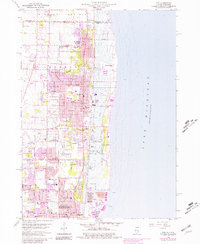
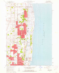
1960 Map of Zion
USGS Topo · Published 1981About this map
The northern reaches of the Illinois lakefront are defined by the expansive Illinois Beach State Park, stretching along the coast between Waukegan and the state line. This coastal landscape features the Dead River and Dead Lake, illustrating the unique wetland and dune ecology preserved at Farnum Point before residential expansion reached the shore. Inland, the planned grid of Zion is centered around Shiloh Park, showing a dense network of local institutions including Central Sch and Lakeview Sch.
Find a feature on this map
55 named features on this map. Tap any name to fly to it.
Don’t see what you’re looking for? This feature index may not catch every label — zoom into the map to look around manually.
Map Details
Editions of this 1960 Zion Map
3 editions found
Other maps of this area

1892 · Racine
USGS Topo · 1:62,500

1905 · Racine
USGS Topo · 1:62,500

1906 · Waukegan
USGS Topo · 1:62,500

1908 · Waukegan
USGS Topo · 1:62,500
1958 · Kenosha
USGS Topo · 1:24,000

1958 · Pleasant Prairie
USGS Topo · 1:24,000

1958 · Racine
USGS Topo · 1:250,000

1959 · Racine
USGS Topo · 1:62,500
1960 · Waukegan
USGS Topo · 1:24,000
1960 · Zion
USGS Topo · 1:24,000