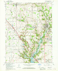
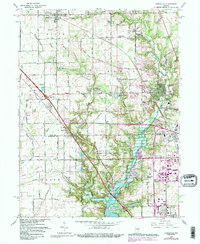
1966 Map of Zionsville
USGS Topo · Published 1968About this map
Zionsville and the surrounding townships of Eagle, Union, and Worth are captured during a period of significant hydrological and suburban change. The most striking development is the Eagle Creek Reservoir, shown with a dashed light-blue pattern indicating areas subject to controlled inundation. This transformation of the landscape affects the drainage of Eagle Creek and its tributaries like Fishback Creek and Little Eagle Creek. The map reflects a mix of traditional agricultural settlements and emerging mid-century residential developments such as Northern Meadows, Allens Acres, and Legendary Hills.
Find a feature on this map
84 named features on this map. Tap any name to fly to it.
Don’t see what you’re looking for? This feature index may not catch every label — zoom into the map to look around manually.
Map Details
Editions of this 1966 Zionsville Map
5 editions found
Other maps of this area

1948 · Indianapolis West
USGS Topo · 1:24,000

1952 · Carmel
USGS Topo · 1:24,000

1953 · Westfield
USGS Topo · 1:24,000

1953 · Fayette
USGS Topo · 1:24,000

1953 · Rosston
USGS Topo · 1:24,000

1953 · Brownsburg
USGS Topo · 1:24,000

1953 · Zionsville
USGS Topo · 1:24,000

1953 · Lebanon
USGS Topo · 1:24,000

1953 · Clermont
USGS Topo · 1:24,000

1953 · Danville
USGS Topo · 1:250,000