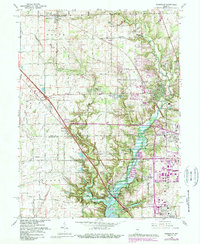
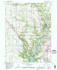
1966 Map of Zionsville
USGS Topo · Published 1988About this map
Eagle Creek Reservoir dominates the southern landscape of this mid-1960s survey, a major water feature that shaped the development of northern Marion and southern Boone Counties. The map captures the suburbanization of the corridor between Whitestown and Zionsville, where residential developments like Northern Meadows and Eaglewood Estates began to emerge alongside established agricultural lands. This period reflects a significant transition as the expansion of the interstate highway system, including multiple interchanges, restructured the local travel patterns formerly dictated by rural road grids and the Conrail railroad line.
Find a feature on this map
64 named features on this map. Tap any name to fly to it.
Don’t see what you’re looking for? This feature index may not catch every label — zoom into the map to look around manually.
Map Details
Editions of this 1966 Zionsville Map
5 editions found
Other maps of this area

1948 · Indianapolis West
USGS Topo · 1:24,000

1952 · Carmel
USGS Topo · 1:24,000

1953 · Westfield
USGS Topo · 1:24,000

1953 · Fayette
USGS Topo · 1:24,000

1953 · Rosston
USGS Topo · 1:24,000

1953 · Brownsburg
USGS Topo · 1:24,000

1953 · Zionsville
USGS Topo · 1:24,000

1953 · Lebanon
USGS Topo · 1:24,000

1953 · Clermont
USGS Topo · 1:24,000

1953 · Danville
USGS Topo · 1:250,000