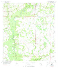
1956 Map of Zolfo Springs
USGS Topo · Published 1973About this map
The Peace River carves a winding path through this central Florida landscape, defining a region where citrus groves and ranching meet the riverine wetlands. Along its banks and tributaries like Troublesome Creek and Oak Creek, the map reveals a network of flowing wells that supported local agriculture during the mid-twentieth century. The settlement of Zolfo Springs serves as the primary hub, situated where the Atlantic Coast Line railroad runs north-to-south, a vital artery for the region's produce and freight.
Find a feature on this map
21 named features on this map. Tap any name to fly to it.
Don’t see what you’re looking for? This feature index may not catch every label — zoom into the map to look around manually.
Map Details
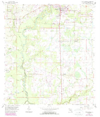
Editions of this 1956 Zolfo Springs Map
3 editions found
Other maps of this area

1955 · Ft. Green
USGS Topo · 1:24,000

1955 · Wauchula
USGS Topo · 1:24,000

1956 · Gardner
USGS Topo · 1:24,000

1956 · Ona
USGS Topo · 1:24,000

1956 · Sweetwater
USGS Topo · 1:24,000

1956 · Limestone
USGS Topo · 1:24,000

1956 · Zolfo Springs
USGS Topo · 1:24,000

1956 · Crewsville SW
USGS Topo · 1:24,000

1956 · Griffins Corner
USGS Topo · 1:24,000

1956 · Fort Pierce
USGS Topo · 1:250,000