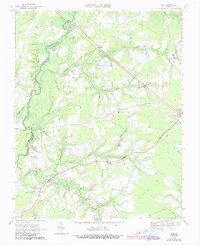
1969 Map of Zuni
USGS Topo · Published 1990About this map
The Blackwater River forms a significant natural boundary on this Tidewater landscape, separating Southampton and Isle of Wight counties. This late 1960s survey documents a rural environment characterized by extensive swamp networks, including Antioch Swamp, Horse Swamp, and Burnt Mills Swamp, which dictated the early settlement patterns of towns like Zuni and Walters. The Norfolk and Western railway cuts a diagonal path through the terrain, anchoring the development of Windsor and providing a vital transit corridor for the region's agricultural output.
Find a feature on this map
40 named features on this map. Tap any name to fly to it.
Don’t see what you’re looking for? This feature index may not catch every label — zoom into the map to look around manually.
Map Details
Editions of this 1969 Zuni Map
Other maps of this area

1919 · Smithfield
USGS Topo · 1:62,500

1919 · Suffolk
USGS Topo · 1:62,500

1920 · Holland
USGS Topo · 1:62,500

1920 · Ivor
USGS Topo · 1:62,500

1943 · Holland
USGS Topo · 1:62,500

1944 · Windsor
USGS Topo · 1:31,680

1944 · Ivor
USGS Topo · 1:24,000

1944 · Smithfield
USGS Topo · 1:24,000

1944 · Sedley
USGS Topo · 1:24,000

1944 · Raynor
USGS Topo · 1:24,000