1950s Maps of Aleutians East, Alaska
Explore 8 historic maps of Aleutians East from the 1950s. These maps offer a rare glimpse into what life looked like during the 1950s — showing old roads, neighborhoods, homes, and landmarks that have changed or disappeared over time.
Whether you're researching your family's past, planning a metal detecting trip, or studying how Aleutians East's landscape evolved across the 1950s, these high-resolution maps are a powerful tool for exploring the history of this region.
- Focus on a specific era: All maps on this page are from the 1950s, giving you a focused view of this time period.
- See what’s changed: Compare century-old streets, trails, and buildings to today's modern landscape using overlays and satellite layers.
- Research with precision: Use these maps for genealogy, historical research, land use analysis, or educational projects.
- View, download, or print: Maps are fully viewable online in high resolution, and can be downloaded or printed for your own records.
Start exploring Aleutians East's history through authentic maps from the 1950s. This is your window into the past.
Aleutians East, AK maps
(8)- 1950 Map of False Pass
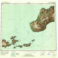
 1950 False Pass1950 Print · USGSThe western Aleutians in the mid-twentieth century are captured here, centered on the vital waters of Isanotski Strait. Trace early settlements at False Pass and Morzhovoi alongside the massive heights of Shishaldin Volcano.2 unique versions available
 - 1950 Map of Fort Randall
 1950 Fort Randall1950 Print · USGSThe Alaska Peninsula at the dawn of the 1950s reveals a rugged landscape of strategic airbases and isolated fishing settlements. Researchers can trace the layout of Thornbrough Air Force Base, find the site of a Cannery (Abandoned), or locate the coastal village of Belkofski.2 unique versions available
 - 1951 Map of Unalaska, 1952 Print
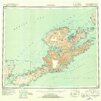 1951 Unalaska1952 Print · USGSThe Fox Islands are shown during the strategic post-war period when military installations still guarded the Aleutian chain. Genealogists and historians can trace the locations of Makushin and Kashega alongside the footprints of Fort Mears and Fort Glenn.10 unique versions available
 - 1951 Map of Unimak, 1952 Print
 1951 Unimak1952 Print · USGSThe Aleutian wilderness comes into focus in the early fifties, detailing the volcanic spine of Unimak Island and its surrounding straits. Maritime historians and researchers can locate remote outposts like Scotch Cap, the Cape Sarichef Lighthouse, and the massive Fisher Caldera.7 unique versions available
 - 1951 Map of Stepovak Bay, 1952 Print
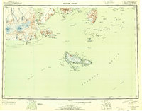
 1951 Stepovak Bay1952 Print · USGSThe Alaska Peninsula and Shumagin Islands are documented here during the early fifties, showing a remote maritime and coastal landscape. Researchers can trace early settlements and coastal landings such as Perryville, Bales Ldg, and the waters of Stepovak Bay.
 - 1953 Map of Port Moller
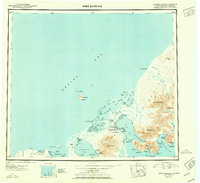
 1953 Port Moller1953 Print · USGSThe Alaska Peninsula during the early fifties reveals a maritime landscape of canneries, volcanic peaks, and strategic naval reserves. Researchers can trace remote Cabins, the Nelson Lagoon Cannery, and historical Ruins along the shores of Beaver Bay.3 unique versions available
 - 1958 Map of Unimak
 1958 Unimak1958 Print · USGSThe Fox Islands at the height of the Cold War reveal a landscape of active volcanic peaks and remote maritime outposts. Researchers can trace the navigational history of Unimak Pass via Scotch Cap and locate industrial sites like the Whaling Sta on Akutan Island.
 - 1958 Map of Unimak B-2 NE
 1958 Unimak B-2 NE1958 Print · USGSThe Unimak Island shoreline in the mid-twentieth century reveals a landscape shaped by the sea and steep coastal terrain. Maritime researchers can trace fathoms and sand bars around Cape Lutke as it meets the Pacific Ocean.
End of results
Showing maps 1-8 of 8
Top cities of Aleutians East
Frequently asked questions
- What are the different types of historical maps available for Aleutians East?
- What is the oldest map of Aleutians East?
- Where can I purchase historical maps of Aleutians East for my home or office?
- Where can I download high-res historical maps of Aleutians East?
- Are there historical topographic maps available for Aleutians East?
- Is there historical aerial imagery available for Aleutians East?
- Where are historical maps of Aleutians East sourced from?