1980s Maps of Aleutians East, Alaska
Explore 31 historic maps of Aleutians East from the 1980s. These maps offer a rare glimpse into what life looked like during the 1980s — showing old roads, neighborhoods, homes, and landmarks that have changed or disappeared over time.
Whether you're researching your family's past, planning a metal detecting trip, or studying how Aleutians East's landscape evolved across the 1980s, these high-resolution maps are a powerful tool for exploring the history of this region.
- Focus on a specific era: All maps on this page are from the 1980s, giving you a focused view of this time period.
- See what’s changed: Compare century-old streets, trails, and buildings to today's modern landscape using overlays and satellite layers.
- Research with precision: Use these maps for genealogy, historical research, land use analysis, or educational projects.
- View, download, or print: Maps are fully viewable online in high resolution, and can be downloaded or printed for your own records.
Start exploring Aleutians East's history through authentic maps from the 1980s. This is your window into the past.
Aleutians East, AK maps
(31)- 1983 Map of Port Moller B-6
 1983 Port Moller B-61983 Print · USGSThe volcanic wilderness of the Alaska Peninsula is documented here in the early eighties, showcasing a landscape of active peaks and coastal lagoons. Researchers can locate geological landmarks such as Pavlof Volcano, Mount Hague, and the tidal reaches of Long John Lagoon.
 - 1983 Map of Port Moller B-3
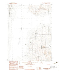 1983 Port Moller B-31983 Print · USGSThe northern reaches of Unga Island and the Alaska Peninsula are captured here in the early eighties. Researchers can trace the maritime landscape from Cape Aliaksin to Unga Spit, including remote coastal points and the waters of Beaver Bay.2 unique versions available
 - 1983 Map of Port Moller C-4
 1983 Port Moller C-41983 Print · USGSThe remote Aleutian coastline comes into focus in the early 1980s, highlighting the wild drainages and summits of the Alaska Peninsula. Researchers can trace the terrain from the heights of Mount Dana and Hoodoo Mtn down to the Tidal Flats of Canoe Bay.
 - 1983 Map of Port Moller B-4
 1983 Port Moller B-41983 Print · USGSThe Alaska Peninsula shoreline at the Pacific edge is captured in the early eighties, showcasing a wild coastal landscape. Researchers can trace the rugged drainage of Mino Creek and locate landmarks like Bobrovia Mountain and Seal Cape.
 - 1983 Map of Cold Bay A-1
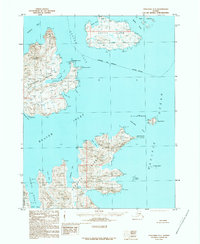
 1983 Cold Bay A-11983 Print · USGSThe western Alaska Peninsula in the early eighties shows a landscape of remote maritime settlements and vast wildlife preserves. Researchers can locate the coastal villages of King Cove and Belkofski, alongside features like Johnny Smith Lagoon and Mount Dutton.2 unique versions available
 - 1983 Map of Cold Bay B-1
 1983 Cold Bay B-11983 Print · USGSThe Alaska Peninsula in the early 1980s reveals a raw landscape of volcanic peaks and wildlife sanctuaries where no roads or towns yet reached. Researchers can trace the drainage of Cathedral River and the stark elevations of the Aghileen Pinnacles and Mount Emmons.
 - 1983 Map of Port Moller C-3
 1983 Port Moller C-31983 Print · USGSThe Alaska Peninsula in the early 1980s reveals a wilderness of coastal inlets and high volcanic peaks where few human structures remain. Researchers can locate the site of the Cannery Ruins on Herendeen Bay and trace the paths of the Beaver River and Lefthand River.
 - 1983 Map of Port Moller B-5
 1983 Port Moller B-51983 Print · USGSThe Alaska Peninsula at the start of the 1980s reveals a wild coast where maritime landmarks meet protected lands. Researchers can trace the shoreline from Cape Tolstoi to Settlement Point and out to Ukolnoi Island.
 - 1988 Map of Port Moller, 1991 Print
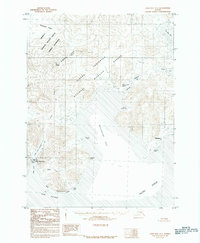
 1988 Port Moller1991 Print · USGSThe remote reaches of the Alaska Peninsula and the Shumagin Islands are detailed here as they appeared in the late twentieth century. Researchers can trace the maritime hubs of Sand Point and Squaw Harbor or find isolated outposts like Nelson Lagoon Village and Miner.
 - 1989 Map of Unimak C-1
 1989 Unimak C-11989 Print · USGSThe volcanic coastline of the Aleutian Islands meets the sea in the late twentieth century, showing a landscape without roads or settlements. Researchers can trace the massive Fisher Caldera and coastal features like Cape Rukavitsie and Promontory Cove.
 - 1989 Map of Unimak D-2
 1989 Unimak D-21989 Print · USGSUnimak Island in the late 1980s remains a roadless expanse of the Aleutian chain, defined by the Tugamak Range and the Aleutian Islands Wilderness. Researchers can trace the rugged coastline from Cape Mordvinot down to the remote waters of Urilia Bay.
 - 1989 Map of Unimak B-5
 1989 Unimak B-51989 Print · USGSAkun Island and the surrounding Bering Sea waters are captured here in the late twentieth century, showing the remote Aleutian landscape. Researchers can trace the volcanic topography of Mount Gilbert and the indented coastlines of Akutan Bay and Helianthus Cove.
 - 1989 Map of Unimak A-6
 1989 Unimak A-61989 Print · USGSAkutan Island in the late eighties remains a remote maritime outpost between the Bering Sea and Pacific Ocean. Researchers can trace landforms and coastal markers like Akutan Harbor, Battery Point, and the navigation Light at North Head.
 - 1989 Map of Unalaska D-1
 1989 Unalaska D-11989 Print · USGSThe western shores of Akutan Island are captured here in the late 1980s, showcasing a wild landscape of volcanic peaks and tidal passes. Researchers can trace the jagged coastline from Lava Point down to Cape Morgan and the Baby Islands.
 - 1989 Map of False Pass C-6
 1989 False Pass C-61989 Print · USGSUnimak Island in the late 1980s reveals a maritime landscape where the Pacific meets the protected peaks of the Aleutians. Researchers can trace the coastal settlement at Davis or explore the interior hydrology of the Lazaref River and Brown Peak 1288T.
 - 1989 Map of False Pass B-2
 1989 False Pass B-21989 Print · USGSThe eastern Aleutian archipelago comes into focus in the late 1980s, documenting a remote cluster of islands and reefs. Maritime historians and researchers can trace the intricate coastlines of Sanak Island, Caton Island, and the protected waters of Peterson Bay.
 - 1989 Map of Unimak D-1
 1989 Unimak D-11989 Print · USGSUnimak Island and the surrounding Aleutian chain appear in the 1980s as a preserved wilderness of lagoons and peaks. Researchers can trace the untamed northern coastline from Cape Lapin to the waters of Urilia Bay and Peterson Lagoon.
 - 1989 Map of Unimak B-3
 1989 Unimak B-31989 Print · USGSUnimak Island's rugged southwestern coast and the Aleutian Islands Wilderness are captured here as they appeared in the late eighties. Researchers can trace the wild drainage of Big River or locate coastal landmarks like Scotch Cap and Sennett Point.
 - 1989 Map of Unimak B-6
 1989 Unimak B-61989 Print · USGSThe Aleutian coast and the Bering Sea are the focus of this late-century maritime survey. Researchers can trace the indefinite borough boundaries and the rugged coastline of Akun Island where it meets the opening of Akutan Bay.
 - 1989 Map of Unimak B-2
 1989 Unimak B-21989 Print · USGSUnimak Island is depicted in the late eighties as a preserved maritime landscape within the Aleutians East Borough. Researchers can trace the coastal boundaries of the Aleutian Islands Wilderness and locate landmarks like Seal Cape and Promontory Hill.
 - 1989 Map of Cold Bay A-6
 1989 Cold Bay A-61989 Print · USGSUnimak Island and the northern Aleutian coastline are captured in the late eighties, showing a landscape defined by nature and wilderness. Map collectors and researchers can trace remote features like Swanson Lagoon, Coal Oil Creek, and Otter Point.
 - 1989 Map of Unalaska C-1
 1989 Unalaska C-11989 Print · USGSUnalaska and its neighboring islands are documented in the late 1980s, showcasing a landscape of complex straits and volcanic shorelines. Researchers can trace maritime points of interest like Fishermans Point, the Baby Islands, and Inner Signal across Beaver Inlet.
 - 1989 Map of False Pass B-3
 1989 False Pass B-31989 Print · USGSThe remote Aleutian archipelago comes into focus in the late eighties, documenting the island communities of the Sanak group. Researchers can locate the settlements of Sanak and Pauloff Harbor or trace the shoreline from Chicago Harbor to Sanak Peak.
 - 1989 Map of Unimak A-5
 1989 Unimak A-51989 Print · USGSThe eastern Krenitzin Islands are captured here in the late eighties, documenting the remote terrain of Akun Island and its surrounding straits. Researchers can trace the rugged coastline from the navigational Current Light to the protected Aleutian Islands Wilderness.
 - 1989 Map of False Pass C-4
 1989 False Pass C-41989 Print · USGSUnimak Island and the Ikatan Peninsula are captured in the late 1980s, showcasing a wild coastal landscape within the Aleutian Islands Wilderness. Maritime researchers and historians can trace the shoreline landmarks from Dora Harbor to the light at Cape Pankof.
Showing maps 1-25 of 31
Top cities of Aleutians East
Frequently asked questions
- What are the different types of historical maps available for Aleutians East?
- What is the oldest map of Aleutians East?
- Where can I purchase historical maps of Aleutians East for my home or office?
- Where can I download high-res historical maps of Aleutians East?
- Are there historical topographic maps available for Aleutians East?
- Is there historical aerial imagery available for Aleutians East?
- Where are historical maps of Aleutians East sourced from?