1960s Maps of Aleutians East, Alaska
Explore 54 historic maps of Aleutians East from the 1960s. These maps offer a rare glimpse into what life looked like during the 1960s — showing old roads, neighborhoods, homes, and landmarks that have changed or disappeared over time.
Whether you're researching your family's past, planning a metal detecting trip, or studying how Aleutians East's landscape evolved across the 1960s, these high-resolution maps are a powerful tool for exploring the history of this region.
- Focus on a specific era: All maps on this page are from the 1960s, giving you a focused view of this time period.
- See what’s changed: Compare century-old streets, trails, and buildings to today's modern landscape using overlays and satellite layers.
- Research with precision: Use these maps for genealogy, historical research, land use analysis, or educational projects.
- View, download, or print: Maps are fully viewable online in high resolution, and can be downloaded or printed for your own records.
Start exploring Aleutians East's history through authentic maps from the 1960s. This is your window into the past.
Aleutians East, AK maps
(54)- 1963 Map of Port Moller D-5, 1966 Print
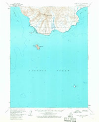
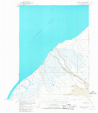
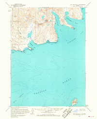
 1963 Port Moller D-51966 Print · USGSThe Alaska Peninsula coast is mapped here during the early sixties, showing a wilderness of marsh and meandering waterways before modern development. Researchers can locate isolated cabins and trace the complex paths of the Caribou Sapsuk River and David River.2 unique versions available
 - 1963 Map of Port Moller A-5, 1966 Print
 1963 Port Moller A-51966 Print · USGSThe Pavlof Islands are documented in the early 1960s, showing the remote maritime terrain of the Aleutians East region. Researchers can trace the rocky shorelines of Ukolnoi Island and Wosnesensk Island or locate navigational markers like Midway Rock.2 unique versions available
 - 1963 Map of Port Moller A-4, 1966 Print
 1963 Port Moller A-41966 Print · USGSThe Aleutian coast in the early sixties reveals a landscape of maritime isolation and scattered landmasses. Researchers can trace the rugged shorelines of Wosnesenski Island, Omega Island, and the Kennoys Islands amidst the soundings of the Pacific Ocean.2 unique versions available
 - 1963 Map of Port Moller C-5, 1966 Print
 1963 Port Moller C-51966 Print · USGSThe Alaska Peninsula coast comes into focus in the 1960s, showing a landscape shaped by volcanic activity and the sea. Researchers can trace remote sites like Jackson Harbor, the meandering Caribou River, and the distinct Sand and Ashes shoreline.
 - 1963 Map of Port Moller C-6, 1966 Print
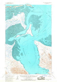
 1963 Port Moller C-61966 Print · USGSThe Alaska Peninsula in the early sixties is shown here as a landscape of interconnected waterways and coastal lagoons. Trace the remote terrain from Trader Mountain down to the shores of Pavlof Bay and the isolated Cabin at Chinaman Lagoon.3 unique versions available
 - 1963 Map of Port Moller A-1, 1966 Print
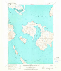
 1963 Port Moller A-11966 Print · USGSNagai Island and the surrounding Shumagin Islands are captured in the early 1960s, showing a landscape defined by deep harbors and rocky coastlines. Researchers can trace remote coastal landmarks and maritime refuges like Sanborn Harbor, Wooly Head, and Porpoise Harbor.2 unique versions available
 - 1963 Map of Port Moller A-6, 1966 Print
 1963 Port Moller A-61966 Print · USGSThe remote Pavlof Islands emerge from the Pacific in the 1960s, showing a maritime landscape shaped by tide and topography. Maritime historians can trace the deep-water reaches of Dolgoi Harbor and the narrow straits of Iliasik Passage near Goloi Island.2 unique versions available
 - 1963 Map of Port Moller D-3, 1967 Print
 1963 Port Moller D-31967 Print · USGSThe remote Alaska Peninsula coastline comes into focus during the early sixties, showing the complex interaction of land and sea. Researchers can trace early geography through industrial and family landmarks like Mine Harbor, Lundgren Creek, and Coal Valley.2 unique versions available
 - 1963 Map of Cold Bay C-2, 1967 Print
 1963 Cold Bay C-21967 Print · USGSThe Alaska Peninsula meets the Bering Sea in the early sixties, showing a wilderness of marsh and tide. Researchers can trace the shoreline of Bristol Bay or locate the solitary Cabin at the edge of the Izembek National Wildlife Range.2 unique versions available
 - 1963 Map of False Pass D-3, 1967 Print
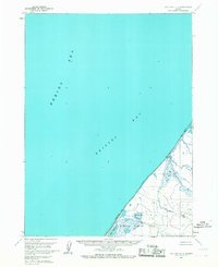
 1963 False Pass D-31967 Print · USGSThe remote Alaskan coast of the early sixties is captured here in its natural state, long before modern developments. Maritime history enthusiasts and researchers can trace seafaring routes past Amagat Island, Cape Tachilni, and the high reaches of South Walrus Peak.2 unique versions available
 - 1963 Map of Port Moller D-6, 1967 Print
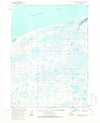
 1963 Port Moller D-61967 Print · USGSThe Alaska Peninsula coast meets the waters of Bristol Bay in this mid-century survey of the remote tundra. Researchers can trace the meandering paths of Steelhead Creek and David River or locate the solitary Franks Point Cabin.2 unique versions available
 - 1963 Map of Port Moller A-2, 1967 Print
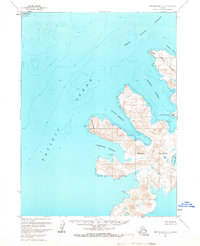
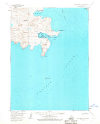 1963 Port Moller A-21967 Print · USGSUnga Island and the surrounding waters of the Shumagin Islands are detailed here in the early sixties, showing the vital maritime connection between remote coastal settlements. Researchers can trace the layout of the Unga townsite and Squaw Harbor, or locate the historic Apollo Mine near the island's interior peaks.3 unique versions available
 - 1963 Map of False Pass D-0, 1967 Print
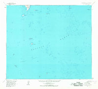 1963 False Pass D-01967 Print · USGSThe Aleutian coast comes into focus in the 1960s, showing the treacherous maritime environment of the Pacific Ocean. Maritime historians can trace the hazardous shoals of the Sandman Reefs and the isolated peaks of Outer Iliasik Island and Pinnacle Rock.2 unique versions available
 - 1963 Map of Stepovak Bay C-5 and C-6, 1967 Print
 1963 Stepovak Bay C-5 and C-61967 Print · USGSThe Kupreanof Peninsula and Stepovak Bay are documented here in the early 1960s, showing the complex shoreline before modern changes. Researchers can trace coastal landmarks like Kupreanof Point, Hag Peak, and the tidal zones of Island Bay.2 unique versions available
 - 1963 Map of Chignik C-4, 1967 Print
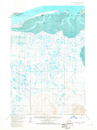
 1963 Chignik C-41967 Print · USGSCoastal Alaska on the Bristol Bay shoreline is captured in the early sixties, showing a landscape defined by water and wetlands. Researchers can trace the drainage of Ungashik River and identify localized landmarks like Shake, Negro, and the Seal Islands.2 unique versions available
 - 1963 Map of Port Moller B-2, 1967 Print
 1963 Port Moller B-21967 Print · USGSThe Shumagin Islands in the early sixties are captured here as maritime activity centered around Sand Point. Local historians and researchers can trace early infrastructure like the Landing Strip and Radio Towers or locate Ruins on the shore of Unga Island.2 unique versions available
 - 1963 Map of Port Moller C-2, 1967 Print
 1963 Port Moller C-21967 Print · USGSThe Alaska Peninsula coast in the early sixties reveals a landscape of isolated cabins and maritime landmarks. Researchers can trace the shoreline from Albatross Anchorage to Guillemot Island, identifying local features like Monolith Pt and Ballast Reef.2 unique versions available
 - 1963 Map of Chignik A-6, 1967 Print
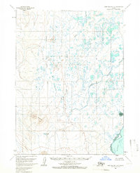
 1963 Chignik A-61967 Print · USGSThe Alaskan Peninsula during the early sixties reveals a landscape of complex river systems and glacial lakes. Geologists and local researchers can trace the intricate drainage of Sandy Lake and the braided paths of the Muddy River and Milky River.2 unique versions available
 - 1963 Map of Chignik B-7, 1967 Print
 1963 Chignik B-71967 Print · USGSThe Alaskan coast along Bristol Bay is documented here during the early 1960s. Researchers can trace the rugged shoreline from Cape Seniavin to Cape Kutuzof while identifying inland features like the Muddy River and Sand Dunes.2 unique versions available
 - 1963 Map of Simeonof Island D-2, 1967 Print
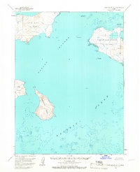
 1963 Simeonof Island D-21967 Print · USGSThe Shumagin Islands in the early sixties are captured here before the advent of modern satellite mapping. Maritime historians can trace coastal features across Chernabura Island and the protected waters of Northeast Harbor and Twelve Fathom Strait.
 - 1963 Map of Simeonof Island D-1, 1967 Print
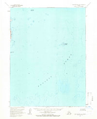
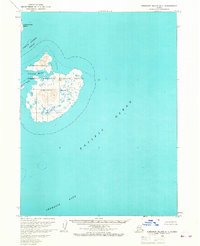 1963 Simeonof Island D-11967 Print · USGSSimeonof Island and its surrounding waters are preserved here during the mid-1960s, showing the island's topography and protected coastline. Genealogists and researchers can trace the bounds of the Simeonof National Wildlife Refuge and the depths of Simeonof Harbor.2 unique versions available
 - 1963 Map of Port Moller B-1, 1967 Print
 1963 Port Moller B-11967 Print · USGSCoastal life in the Shumagin Islands is captured here in the early sixties, showing a landscape of remote outposts and maritime navigation. Trace the sparse settlements on Korovin Island near the Cem and Cabin, or locate offshore landmarks like The Haystacks and High Island.
 - 1963 Map of Port Moller D-4, 1967 Print
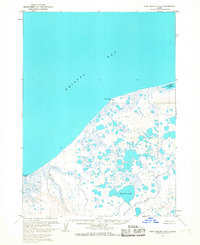
 1963 Port Moller D-41967 Print · USGSCoastal Alaska in the early sixties reveals a landscape of tidal flats and remote fishing outposts. Genealogists and historians can locate the Nelson Lagoon Village, the local Nelson Lagoon Cannery, and remote landmarks like Miner Hill.2 unique versions available
 - 1963 Map of Cold Bay D-1, 1967 Print
 1963 Cold Bay D-11967 Print · USGSThe coastal edge of the Alaska Peninsula is captured here in the early sixties as it transitions into the sea. Researchers can trace the shoreline around Cape Lieskof and explore the expansive Tidal Flat along Bristol Bay.2 unique versions available
 - 1963 Map of Port Moller C-1, 1967 Print
 1963 Port Moller C-11967 Print · USGSThe Alaska Peninsula coastline appears in the early sixties as a rugged intersection of mountains and deep water. Researchers can locate remote outposts like a lone Cabin and trace the contours of the shoreline from Chichagof Bay to the rocky shores of Karpa Island.2 unique versions available
Showing maps 1-25 of 54
Top cities of Aleutians East
Frequently asked questions
- What are the different types of historical maps available for Aleutians East?
- What is the oldest map of Aleutians East?
- Where can I purchase historical maps of Aleutians East for my home or office?
- Where can I download high-res historical maps of Aleutians East?
- Are there historical topographic maps available for Aleutians East?
- Is there historical aerial imagery available for Aleutians East?
- Where are historical maps of Aleutians East sourced from?