Old Maps of Aleutians East, Alaska for Metal Detecting
Plan your next treasure hunt with 407 historic maps of Aleutians East. Find old homesites, ghost towns, trails, and gathering spots that may be lost to time — perfect for identifying promising metal detecting locations.
- Locate forgotten sites: Uncover places like long-lost settlements, abandoned rail lines, or gathering spots.
- Plan better hunts: Use map overlays combined with LiDAR or satellite views to narrow in on historically rich areas.
- Made for detectorists: Thousands of hobbyists use these maps to discover relics, coins, and hidden history.
Use these historic maps to boost your research and find new opportunities beneath the surface of Aleutians East.
Aleutians East, AK maps
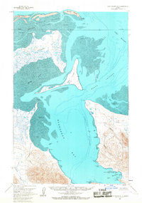
(407)- 1943 Map of Fort Randall, 1954 Print
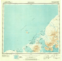 1943 Fort Randall1954 Print · USGSThe Alaska Peninsula and its wartime outposts are documented in this mid-forties survey. Researchers can trace the military footprint at Thornbrough Air Force Base and maritime hubs like King Cove and Belkofski.7 unique versions available
 - 1944 Map of Cold Bay Sheet No. 20 of 25
 1944 Cold Bay Sheet No. 20 of 251944 Print · USGSThe southwestern tip of the Alaska Peninsula is documented here during the wartime mobilization of the mid-forties. Researchers can trace the steep coastal terrain and offshore features like Amagat Island, Cape Tachilni, and the peaks around Morzhovoi Bay.
 - 1944 Map of Cold Bay Sheet No. 1 of 25
 1944 Cold Bay Sheet No. 1 of 251944 Print · USGSThe Aleutian coast comes into focus during the mid-forties as military engineers charted the strategic waters of the North Pacific. Researchers can trace the complex shoreline of Opperl Island where the Bering Sea meets the tides of Izembek Bay.
 - 1944 Map of Cold Bay Sheet No. 2 of 25
 1944 Cold Bay Sheet No. 2 of 251944 Print · USGSThe Alaska Peninsula's coastal terrain during the Aleutian Islands Campaign is meticulously recorded in this wartime survey. Genealogists and researchers can trace the shoreline of Moffet Bay and locate landmarks like Neumann Island and Moffet Point.
 - 1949 Map of False Pass, 1956 Print
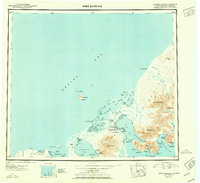
 1949 False Pass1956 Print · USGSThe Aleutian landscape at the end of the 1940s is defined by the vital maritime passage between the Bering Sea and Pacific. Genealogists and researchers can trace remote coastal settlements at False Pass and Morzhovoi, or locate landmarks like Shishaldin Volcano and Sanak Harbor.6 unique versions available
 - 1949 Map of Fort Randall, 1958 Print
 1949 Fort Randall1958 Print · USGSThe southern Alaska Peninsula and the entrance to the Aleutians are documented here during the late 1940s. Researchers can trace remote coastal outposts like Belkofski, locate the Air Force Base at Fort Randall, and find the abandoned cannery at Morzhovoi Bay.
 - 1950 Map of False Pass
 1950 False Pass1950 Print · USGSThe western Aleutians in the mid-twentieth century are captured here, centered on the vital waters of Isanotski Strait. Trace early settlements at False Pass and Morzhovoi alongside the massive heights of Shishaldin Volcano.2 unique versions available
 - 1950 Map of Fort Randall
 1950 Fort Randall1950 Print · USGSThe Alaska Peninsula at the dawn of the 1950s reveals a rugged landscape of strategic airbases and isolated fishing settlements. Researchers can trace the layout of Thornbrough Air Force Base, find the site of a Cannery (Abandoned), or locate the coastal village of Belkofski.2 unique versions available
 - 1951 Map of Unalaska, 1952 Print
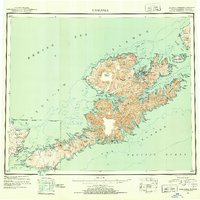 1951 Unalaska1952 Print · USGSThe Fox Islands are shown during the strategic post-war period when military installations still guarded the Aleutian chain. Genealogists and historians can trace the locations of Makushin and Kashega alongside the footprints of Fort Mears and Fort Glenn.10 unique versions available
 - 1951 Map of Unimak, 1952 Print
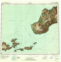 1951 Unimak1952 Print · USGSThe Aleutian wilderness comes into focus in the early fifties, detailing the volcanic spine of Unimak Island and its surrounding straits. Maritime historians and researchers can locate remote outposts like Scotch Cap, the Cape Sarichef Lighthouse, and the massive Fisher Caldera.7 unique versions available
 - 1951 Map of Stepovak Bay, 1952 Print
 1951 Stepovak Bay1952 Print · USGSThe Alaska Peninsula and Shumagin Islands are documented here during the early fifties, showing a remote maritime and coastal landscape. Researchers can trace early settlements and coastal landings such as Perryville, Bales Ldg, and the waters of Stepovak Bay.
 - 1953 Map of Port Moller
 1953 Port Moller1953 Print · USGSThe Alaska Peninsula during the early fifties reveals a maritime landscape of canneries, volcanic peaks, and strategic naval reserves. Researchers can trace remote Cabins, the Nelson Lagoon Cannery, and historical Ruins along the shores of Beaver Bay.3 unique versions available
 - 1958 Map of Unimak
 1958 Unimak1958 Print · USGSThe Fox Islands at the height of the Cold War reveal a landscape of active volcanic peaks and remote maritime outposts. Researchers can trace the navigational history of Unimak Pass via Scotch Cap and locate industrial sites like the Whaling Sta on Akutan Island.
 - 1958 Map of Unimak B-2 NE
 1958 Unimak B-2 NE1958 Print · USGSThe Unimak Island shoreline in the mid-twentieth century reveals a landscape shaped by the sea and steep coastal terrain. Maritime researchers can trace fathoms and sand bars around Cape Lutke as it meets the Pacific Ocean.
 - 1963 Map of Port Moller D-5, 1966 Print
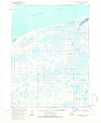 1963 Port Moller D-51966 Print · USGSThe Alaska Peninsula coast is mapped here during the early sixties, showing a wilderness of marsh and meandering waterways before modern development. Researchers can locate isolated cabins and trace the complex paths of the Caribou Sapsuk River and David River.2 unique versions available
 - 1963 Map of Port Moller A-5, 1966 Print
 1963 Port Moller A-51966 Print · USGSThe Pavlof Islands are documented in the early 1960s, showing the remote maritime terrain of the Aleutians East region. Researchers can trace the rocky shorelines of Ukolnoi Island and Wosnesensk Island or locate navigational markers like Midway Rock.2 unique versions available
 - 1963 Map of Port Moller A-4, 1966 Print
 1963 Port Moller A-41966 Print · USGSThe Aleutian coast in the early sixties reveals a landscape of maritime isolation and scattered landmasses. Researchers can trace the rugged shorelines of Wosnesenski Island, Omega Island, and the Kennoys Islands amidst the soundings of the Pacific Ocean.2 unique versions available
 - 1963 Map of Port Moller C-5, 1966 Print
 1963 Port Moller C-51966 Print · USGSThe Alaska Peninsula coast comes into focus in the 1960s, showing a landscape shaped by volcanic activity and the sea. Researchers can trace remote sites like Jackson Harbor, the meandering Caribou River, and the distinct Sand and Ashes shoreline.
 - 1963 Map of Port Moller C-6, 1966 Print
 1963 Port Moller C-61966 Print · USGSThe Alaska Peninsula in the early sixties is shown here as a landscape of interconnected waterways and coastal lagoons. Trace the remote terrain from Trader Mountain down to the shores of Pavlof Bay and the isolated Cabin at Chinaman Lagoon.3 unique versions available
 - 1963 Map of Port Moller A-1, 1966 Print
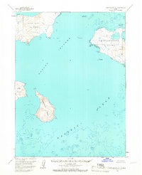
 1963 Port Moller A-11966 Print · USGSNagai Island and the surrounding Shumagin Islands are captured in the early 1960s, showing a landscape defined by deep harbors and rocky coastlines. Researchers can trace remote coastal landmarks and maritime refuges like Sanborn Harbor, Wooly Head, and Porpoise Harbor.2 unique versions available
 - 1963 Map of Port Moller A-6, 1966 Print
 1963 Port Moller A-61966 Print · USGSThe remote Pavlof Islands emerge from the Pacific in the 1960s, showing a maritime landscape shaped by tide and topography. Maritime historians can trace the deep-water reaches of Dolgoi Harbor and the narrow straits of Iliasik Passage near Goloi Island.2 unique versions available
 - 1963 Map of Port Moller D-3, 1967 Print
 1963 Port Moller D-31967 Print · USGSThe remote Alaska Peninsula coastline comes into focus during the early sixties, showing the complex interaction of land and sea. Researchers can trace early geography through industrial and family landmarks like Mine Harbor, Lundgren Creek, and Coal Valley.2 unique versions available
 - 1963 Map of Cold Bay C-2, 1967 Print
 1963 Cold Bay C-21967 Print · USGSThe Alaska Peninsula meets the Bering Sea in the early sixties, showing a wilderness of marsh and tide. Researchers can trace the shoreline of Bristol Bay or locate the solitary Cabin at the edge of the Izembek National Wildlife Range.2 unique versions available
 - 1963 Map of False Pass D-3, 1967 Print
 1963 False Pass D-31967 Print · USGSThe remote Alaskan coast of the early sixties is captured here in its natural state, long before modern developments. Maritime history enthusiasts and researchers can trace seafaring routes past Amagat Island, Cape Tachilni, and the high reaches of South Walrus Peak.2 unique versions available
 - 1963 Map of Port Moller D-6, 1967 Print
 1963 Port Moller D-61967 Print · USGSThe Alaska Peninsula coast meets the waters of Bristol Bay in this mid-century survey of the remote tundra. Researchers can trace the meandering paths of Steelhead Creek and David River or locate the solitary Franks Point Cabin.2 unique versions available
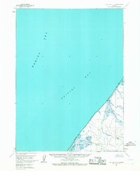
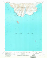
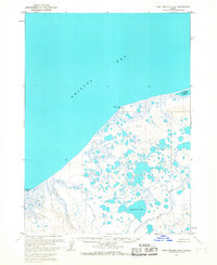
Showing maps 1-25 of 407
Top cities of Aleutians East
Frequently asked questions
- What are the different types of historical maps available for Aleutians East?
- What is the oldest map of Aleutians East?
- Where can I purchase historical maps of Aleutians East for my home or office?
- Where can I download high-res historical maps of Aleutians East?
- Are there historical topographic maps available for Aleutians East?
- Is there historical aerial imagery available for Aleutians East?
- Where are historical maps of Aleutians East sourced from?