1970s Maps of Matanuska-Susitna, Alaska
Explore 28 historic maps of Matanuska-Susitna from the 1970s. These maps offer a rare glimpse into what life looked like during the 1970s — showing old roads, neighborhoods, homes, and landmarks that have changed or disappeared over time.
Whether you're researching your family's past, planning a metal detecting trip, or studying how Matanuska-Susitna's landscape evolved across the 1970s, these high-resolution maps are a powerful tool for exploring the history of this region.
- Focus on a specific era: All maps on this page are from the 1970s, giving you a focused view of this time period.
- See what’s changed: Compare century-old streets, trails, and buildings to today's modern landscape using overlays and satellite layers.
- Research with precision: Use these maps for genealogy, historical research, land use analysis, or educational projects.
- View, download, or print: Maps are fully viewable online in high resolution, and can be downloaded or printed for your own records.
Start exploring Matanuska-Susitna's history through authentic maps from the 1970s. This is your window into the past.
Matanuska-Susitna, AK maps
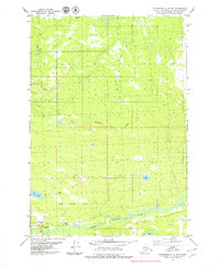
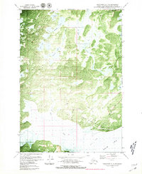
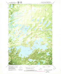
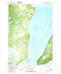
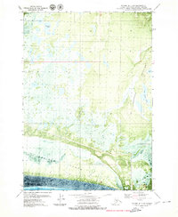
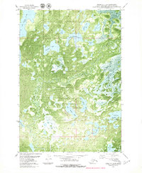
(28)- 1976 Map of Anchorage D-2, 1986 Print
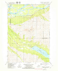
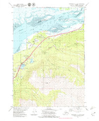
 1976 Anchorage D-21986 Print · USGSThe Matanuska Valley in the 1970s remains a corridor of roadside lodges and glacial terrain. Local historians can trace the Glenn Highway corridor to find the Meekins Roadhouse, Sheep Mountain Lodge, and the Landing Strip.
 - 1979 Map of Anchorage B-6 NW
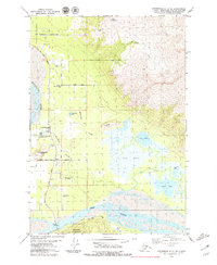
 1979 Anchorage B-6 NW1979 Print · USGSThe Matanuska-Susitna region in the late seventies is shown here as a vital corridor for transportation and energy between the peaks and the river. Trace the old routes of The Alaska Railroad and the Glenn Highway past Eklutna Powerhouse toward Eklutna Lake.2 unique versions available
 - 1979 Map of Anchorage C-7 NW
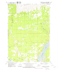
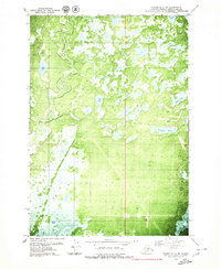
 1979 Anchorage C-7 NW1979 Print · USGSThe Meadow Lakes region and the Little Susitna River valley are captured in the late seventies as local infrastructure began to expand. Genealogists and researchers can trace the early layout of Pittman Road and Church Road near Totuck Lake.2 unique versions available
 - 1979 Map of Anchorage C-7 NE
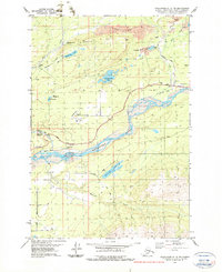
 1979 Anchorage C-7 NE1979 Print · USGSThe Matanuska-Susitna region in the late seventies reveals a transition from alpine mining heights to lake-dotted plains. You can locate high-country workings like Thorpe Mine and Grubstake or trace the drainage of the Little Susitna River.2 unique versions available
 - 1979 Map of Anchorage A-8 NW
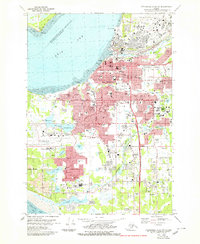 1979 Anchorage A-8 NW1979 Print · USGSAnchorage and its surrounding neighborhoods are shown during a time of major urban expansion in the late seventies. Researchers can trace the layout of early suburbs like Spenard and Turnagain Heights or locate civic landmarks like Merrill Field and Memorial Park.3 unique versions available
 - 1979 Map of Anchorage B-7 NE
 1979 Anchorage B-7 NE1979 Print · USGSThe Eklutna valley in the late seventies serves as a vital corridor where the rail line and highway meet the tidal flats. Researchers can locate the historic Eklutna settlement and its Cem, alongside local landmarks like Thunder Bird Falls and Eklutna Siding.3 unique versions available
 - 1979 Map of Anchorage C-6 SE
 1979 Anchorage C-6 SE1979 Print · USGSThe Matanuska Valley's agricultural and residential heart comes into focus in the late 1970s as the community of Butte grows between two major rivers. Researchers can locate family landmarks like the Matanuska Valley Sch and Valley Memory Garden (Cemetery) alongside the distinctive Bodenburg Butte.3 unique versions available
 - 1979 Map of Anchorage C-6 NW
 1979 Anchorage C-6 NW1979 Print · USGSThe Matanuska Valley at the end of the 1970s shows a landscape defined by industrial heritage and a growing road network. Genealogists and historians can trace the Old Grade Railroad and mining sites like the Premier Mine and local Quarries.2 unique versions available
 - 1979 Map of Anchorage C-6 NE
 1979 Anchorage C-6 NE1979 Print · USGSThe coal-mining district around Sutton and the Matanuska Valley are shown here in the late seventies. Researchers can trace the legacy of local extraction at the Jonesville Mine and follow the route of the Old Railroad Grade near the Matanuska River.3 unique versions available
 - 1979 Map of Anchorage C-8 NE
 1979 Anchorage C-8 NE1979 Print · USGSMatanuska-Susitna during the late 1970s reveals a landscape of river-based utility and seasonal trails. Researchers can trace the Winter Trail and locate early infrastructure like the Landing Strip and Gravel Pit near the Little Susitna River.2 unique versions available
 - 1979 Map of Anchorage, 1980 Print
 1979 Anchorage1980 Print · USGSThe Anchorage bowl and Matanuska Valley appear in the late seventies as the region's transportation and military infrastructure matured. Genealogists and historians can trace rail and road evolution through Wasilla, the Matanuska Branch line, and Jonesville.
 - 1979 Map of Anchorage B-7 NW, 1980 Print
 1979 Anchorage B-7 NW1980 Print · USGSThe Knik Arm shoreline comes into focus during the late seventies as the Birchwood community grows between military and state lands. Genealogists and locals can trace the Birchwood Loop Road, the Old Glenn Highway, and sites like Birchwood Camp.3 unique versions available
 - 1979 Map of Tyonek A-1 NW, 1980 Print
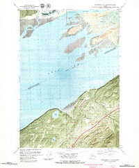
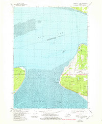
 1979 Tyonek A-1 NW1980 Print · USGSFire Island and the surrounding tidal reaches of the Cook Inlet are captured here during the late seventies. Researchers can locate infrastructure like the FAA Facility and Radio Facility, or trace the shoreline near Race Point and West Point.2 unique versions available
 - 1979 Map of Tyonek B-1 NE, 1980 Print
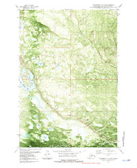
 1979 Tyonek B-1 NE1980 Print · USGSThe Matanuska-Susitna lowlands are shown in the late seventies as a landscape of glacial moraines and winding river channels. Researchers can trace remote routes like the Winter Crossing and Jeep Trail near Diamond Lake and the Little Susitna River.2 unique versions available
 - 1979 Map of Anchorage B-8 NW, 1980 Print
 1979 Anchorage B-8 NW1980 Print · USGSThe Matanuska-Susitna coastline comes into focus in the late seventies, centered on the strategic military outpost at Goose Bay Air Force Auxiliary Field. Researchers can trace early infrastructure along Goose Bay Road and identify numerous water bodies like Sevenmile Lake and Cranberry Lake.2 unique versions available
 - 1979 Map of Anchorage C-7 SE, 1980 Print
 1979 Anchorage C-7 SE1980 Print · USGSWasilla and the surrounding Matanuska-Susitna Valley are captured during a period of transition in the late seventies as local infrastructure expanded. Researchers can trace the development of the Alaska Railroad corridor, the Iditarod School, and the University of Alaska Experimental Farm.
 - 1979 Map of Anchorage C-8 SW, 1980 Print
 1979 Anchorage C-8 SW1980 Print · USGSBig Lake and the Houston boundary appear here during the late seventies as the region's recreational and transport hubs were taking shape. Researchers can trace the path of The Alaska RR and locate early aviation landmarks like the Big Lake No 2 Airport and several lakeside campgrounds.5 unique versions available
 - 1979 Map of Anchorage C-7 SW, 1980 Print
 1979 Anchorage C-7 SW1980 Print · USGSWasilla and the surrounding lake country were experiencing steady growth in the late seventies as transportation and local services expanded. Genealogists and historians can trace the early layout of Wasilla, the path of The Alaska Railroad, and the location of Iditarod Sch.
 - 1979 Map of Anchorage B-8 SW, 1980 Print
 1979 Anchorage B-8 SW1980 Print · USGSThe northern reaches of the Anchorage area and the Knik Arm are captured in the late seventies as military and recreational sites expanded. Local historians can trace the development of Elmendorf Air Force Base, the Hillberg Ski Area, and the settlement at Tuomi.2 unique versions available
 - 1979 Map of Anchorage C-8 SE, 1980 Print
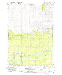
 1979 Anchorage C-8 SE1980 Print · USGSThe Meadow Lakes region of the Matanuska-Susitna Borough comes into focus during the late seventies as transportation and aviation infrastructure expanded. Researchers can trace the path of The Alaska Railroad past Pittman, locate the Big Lake No 2 Airport, and identify dozens of named water bodies like Bear Paw Lake and Visnaw Lake.
 - 1979 Map of Tyonek B-1 SE, 1980 Print
 1979 Tyonek B-1 SE1980 Print · USGSThe Matanuska-Susitna coastline appears here in the late seventies, showing the transition from the Elmendorf Moraine to the tidal Knik Arm. Trace the early transportation routes through the Susitna Flats including a remote Landing Strip and a northern Jeep Trail.2 unique versions available
 - 1979 Map of Tyonek C-1 SE, 1980 Print
 1979 Tyonek C-1 SE1980 Print · USGSMatanuska-Susitna's subarctic wetlands are captured in the late seventies, showing a maze of glacial lakes and river bends before major modern development. Trace the seasonal Winter Trail and identify remote access points like the Landing Strip and Nancy Lake State Recreation Area.2 unique versions available
 - 1979 Map of Anchorage C-6 SW, 1980 Print
 1979 Anchorage C-6 SW1980 Print · USGSThe Matanuska Valley comes into focus in the late 1970s, showcasing the civic growth of the region around Palmer. Researchers can trace old transportation routes like the Old Railroad Grade and explore local landmarks from the State Fairground to the Community College.2 unique versions available
 - 1979 Map of Tyonek A-1 NE, 1980 Print
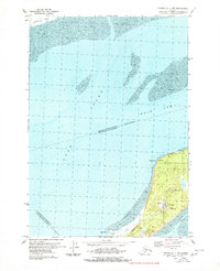
 1979 Tyonek A-1 NE1980 Print · USGSThe Anchorage coastline at the close of the 1970s reveals a strategic landscape of aviation and military infrastructure. Researchers can trace the boundaries of the Point Campbell Military Reservation and the early layout of Anchorage International Airport.2 unique versions available
 - 1979 Map of Anchorage C-8 NW, 1981 Print
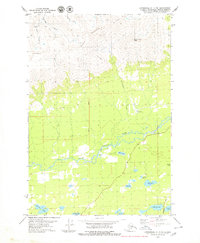
 1979 Anchorage C-8 NW1981 Print · USGSThe Matanuska-Susitna region shows a landscape of rail-connected wilderness and lakeside recreation in the late seventies. You can trace the path of The Alaska Railroad as it passes Nancy Lake, identifying local landmarks like the Seaplane Base and Houston Lake.2 unique versions available
Showing maps 1-25 of 28
Top cities of Matanuska-Susitna
- Wasilla historical maps
- Palmer historical maps
- Big Lake historical maps
- Willow historical maps
- Houston historical maps
- Talkeetna historical maps
See more
Frequently asked questions
- What are the different types of historical maps available for Matanuska-Susitna?
- What is the oldest map of Matanuska-Susitna?
- Where can I purchase historical maps of Matanuska-Susitna for my home or office?
- Where can I download high-res historical maps of Matanuska-Susitna?
- Are there historical topographic maps available for Matanuska-Susitna?
- Is there historical aerial imagery available for Matanuska-Susitna?
- Where are historical maps of Matanuska-Susitna sourced from?