Old Maps of Matanuska-Susitna, Alaska for Metal Detecting
Plan your next treasure hunt with 1,172 historic maps of Matanuska-Susitna. Find old homesites, ghost towns, trails, and gathering spots that may be lost to time — perfect for identifying promising metal detecting locations.
- Locate forgotten sites: Uncover places like long-lost settlements, abandoned rail lines, or gathering spots.
- Plan better hunts: Use map overlays combined with LiDAR or satellite views to narrow in on historically rich areas.
- Made for detectorists: Thousands of hobbyists use these maps to discover relics, coins, and hidden history.
Use these historic maps to boost your research and find new opportunities beneath the surface of Matanuska-Susitna.
Matanuska-Susitna, AK maps
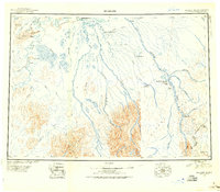
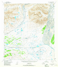
(1,172)- 1948 Map of Anchorage D-3, 1958 Print
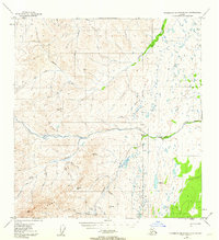
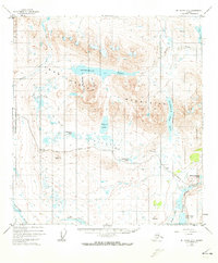
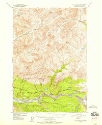 1948 Anchorage D-31958 Print · USGSThe Matanuska River valley in the late 1940s shows the vital Glenn Highway corridor at its post-war peak. You can trace the early hospitality of the Watchtower Inn, the settlement at Purin, and the proximity of the Matanuska Glacier.3 unique versions available
 - 1948 Map of Anchorage D-2, 1958 Print
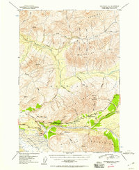 1948 Anchorage D-21958 Print · USGSThe Matanuska River valley in the late 1940s is shown here as a critical transportation corridor through the Alaskan interior. Researchers can trace the early path of the Glenn Highway and locate specific roadside landmarks like the Meeking Roadhouse and the Sheep Mountain Inn.4 unique versions available
 - 1948 Map of Anchorage D-4, 1962 Print
 1948 Anchorage D-41962 Print · USGSThe Matanuska River valley in the late 1940s shows a landscape of early highway development and mountain outposts. Trace the old Chickaloon Knik Nelchina Trail or locate remote landmarks like Eightmile Cabin and the Coal Mine (Aban'd).4 unique versions available
 - 1948 Map of Anchorage D-1, 1967 Print
 1948 Anchorage D-11967 Print · USGSThe Matanuska-Susitna region at the end of the 1940s reveals a wilderness being slowly opened by the Glenn Highway. Researchers can trace the early infrastructure of the Eureka Roadhouse and its Landing Strip alongside mountain crossings like Belanger Pass.4 unique versions available
 - 1949 Map of Tyonek, 1954 Print
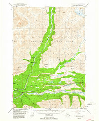
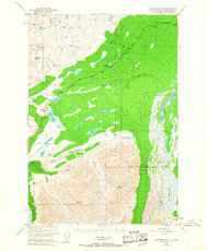
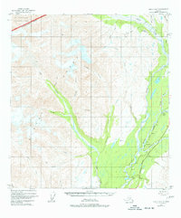
 1949 Tyonek1954 Print · USGSUpper Cook Inlet and the Alaska Range appear here in the mid-twentieth century as a landscape of massive glaciers and river-bound outposts. Researchers can trace the early rail corridor through Willow, locate the Moquawkie Indian Reservation, and find the site of McDougall.2 unique versions available
 - 1949 Map of McGrath, 1955 Print
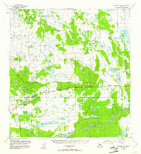
 1949 McGrath1955 Print · USGSThe Alaskan interior at mid-century comes to life through this survey of the river valleys and mountain passes near McGrath. Trace old-world wilderness routes via the Winter Trail and remote stops like the Big River Roadhouse or the Rohn Roadhouse.
 - 1949 Map of Talkeetna Mountains D-6, 1956 Print
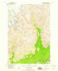
 1949 Talkeetna Mountains D-61956 Print · USGSThe Alaska interior at the close of the 1940s reveals a wilderness defined by the winding path of The Alaska Railroad. Map collectors and historians can trace remote rail stops like Hurricane, Gold Creek, and Canyon alongside the glacial waters of the Chulitna River.
 - 1949 Map of Healy B-4, 1958 Print
 1949 Healy B-41958 Print · USGSThe Interior of Alaska comes into focus during the late 1940s as the rail and road network began to expand near the park boundary. Trace the early alignment of the Alaska Railroad and search for local landmarks like the Cantwell Airstrip and Windy.4 unique versions available
 - 1949 Map of Anchorage D-5, 1959 Print
 1949 Anchorage D-51959 Print · USGSIn the Talkeetna Mountains during the late 1940s, the Matanuska River valley was just beginning to see modern transport and industry. Researchers can trace the early route of the Glenn Highway, locate an isolated Oil Well, and find remote Cabins near Thirtymile Lake.3 unique versions available
 - 1949 Map of Gulkana A-5, 1961 Print
 1949 Gulkana A-51961 Print · USGSThe interior of Alaska during the late 1940s is shown here as a wilderness of lakes and rivers centered around the remote Glenn Highway. Researchers can trace early roadside life at Atlasta House or locate the Indian Cem near the banks of Tazlina Lake.3 unique versions available
 - 1949 Map of Anchorage D-7, 1961 Print
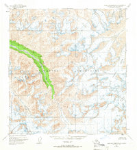
 1949 Anchorage D-71961 Print · USGSThe Talkeetna Mountains come alive in this post-war survey of Alaska's rich mining districts. Trace the high-altitude trails and operations of the Independence Mine, Gold Bullion Mine, and the route over Hatcher Pass.
 - 1949 Map of Talkeetna Mountains B-6, 1962 Print
 1949 Talkeetna Mountains B-61962 Print · USGSThe Matanuska-Susitna wilderness is captured in the late 1940s, showing the braided channels of the Talkeetna River before modern development. You can trace the remote drainage systems of Larson Lake, Sheep Creek, and the slopes of Bald Mountain.4 unique versions available
 - 1949 Map of Talkeetna Mountains A-1, 1962 Print
 1949 Talkeetna Mountains A-11962 Print · USGSThe Matanuska-Susitna region during the late 1940s reveals a wilderness shaped by river systems and early mining efforts. Researchers can locate the site of Nelchina (Aka'd) and trace remote waterways like the Little Nelchina River and Tyone Creek.4 unique versions available
 - 1949 Map of Gulkana A-6, 1964 Print
 1949 Gulkana A-61964 Print · USGSThe Matanuska-Susitna region as it appeared in the late 1940s reveals a wilderness being slowly bridged by the Glenn Highway. Researchers can trace early remote outposts like Mendeltna Lodge and identify strategic points like the Seaplane Base.2 unique versions available
 - 1949 Map of Talkeetna Mountains C-6, 1964 Print
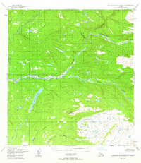
 1949 Talkeetna Mountains C-61964 Print · USGSThe interior of Alaska reached a pivotal moment in the late 1940s as rail transport dominated the Susitna Valley. Researchers can trace the path of the Alaska Railroad past the Sherman settlement and across the high ridges of the Talkeetna Mountains.3 unique versions available
 - 1949 Map of Valdez D-8, 1964 Print
 1949 Valdez D-81964 Print · USGSThe northern Alaskan wilderness near the Matanuska-Susitna border is documented here in the late 1940s as the Glenn Highway opened the interior. Researchers can locate remote outpost sites like a Cabin and trace the complex paths of the Nelchina River and Bottle Creek.3 unique versions available
 - 1949 Map of Healy B-2, 1965 Print
 1949 Healy B-21965 Print · USGSThe Alaskan interior during the late 1940s is revealed here through its complex glacial drainages and untouched peaks. Map collectors and researchers can trace the intricate braided channels of the Nenana River and the sweeping terrain of Monahan Flat.2 unique versions available
 - 1949 Map of Talkeetna Mountains A-4, 1966 Print
 1949 Talkeetna Mountains A-41966 Print · USGSThe Matanuska-Susitna wilderness remains largely untouched by roads or trails in this mid-century survey. Researchers can trace the massive ice fields of the Talkeetna Glacier and the high headwaters of Sheep Creek.2 unique versions available
 - 1949 Map of Anchorage D-8, 1967 Print
 1949 Anchorage D-81967 Print · USGSThe Alaskan wilderness north of Anchorage is revealed here just after the war, showing the early transportation network of the Susitna Valley. Trace the route of the Willow Creek Road and the Sled Road past Twelvemile Lake and a remote Cabin.3 unique versions available
 - 1949 Map of Healy A-1, 1968 Print
 1949 Healy A-11968 Print · USGSThe Matanuska-Susitna interior in the late 1940s was a landscape of remote mining camps and new roads. Researchers can trace the early path of the Denali Highway and locate the settlement at Denali near Valdez Creek and Lucky Hill.2 unique versions available
 - 1949 Map of Mount Hayes A-5, 1973 Print
 1949 Mount Hayes A-51973 Print · USGSThe Alaska Range wilderness at mid-century is captured here just as the road network began to penetrate the interior. Trace the early route of the Denali Highway as it passes Maclaren Summit and the waters of Sevenmile Lake.2 unique versions available
 - 1949 Map of Healy A-6, 1977 Print
 1949 Healy A-61977 Print · USGSUpper Matanuska-Susitna was a hub of mining and rail expansion in the late 1940s. Genealogists and historians can trace the paths of the Alaska Railroad and find remote sites like the Golden Zone Mine and Hurricane Gulch.5 unique versions available
 - 1950 Map of McGrath
 1950 McGrath1950 Print · USGSThe Kuskokwim River valley and the Alaska Range foothills appear here at the dawn of the fifties. Trace the old interior supply routes through McGrath and Nikolai, or locate remote landmarks like Farewell Mtn Roadhouse and Rainy Pass.
 - 1950 Map of Talkeetna Mountains
 1950 Talkeetna Mountains1950 Print · USGSThe Matanuska-Susitna region at mid-century was defined by its remote mountain peaks and the vital link of the Alaska Railroad. Researchers can trace early rail-side settlements like Gold Creek and Sherman or locate high-altitude landmarks such as Mt Watana 6320.2 unique versions available
 - 1950 Map of Talkeetna, 1954 Print
 1950 Talkeetna1954 Print · USGSThe Susitna Valley and the foothills of the Alaska Range appear in this mid-century survey as a frontier of remote lodges and rail-side outposts. You can trace the path of The Alaska Railroad through Talkeetna and locate vanished settlements like Sunflower.2 unique versions available
Showing maps 1-25 of 1,172
Top cities of Matanuska-Susitna
- Wasilla historical maps
- Palmer historical maps
- Big Lake historical maps
- Willow historical maps
- Houston historical maps
- Talkeetna historical maps
See more
Frequently asked questions
- What are the different types of historical maps available for Matanuska-Susitna?
- What is the oldest map of Matanuska-Susitna?
- Where can I purchase historical maps of Matanuska-Susitna for my home or office?
- Where can I download high-res historical maps of Matanuska-Susitna?
- Are there historical topographic maps available for Matanuska-Susitna?
- Is there historical aerial imagery available for Matanuska-Susitna?
- Where are historical maps of Matanuska-Susitna sourced from?