1950s Maps of Matanuska-Susitna, Alaska
Explore 195 historic maps of Matanuska-Susitna from the 1950s. These maps offer a rare glimpse into what life looked like during the 1950s — showing old roads, neighborhoods, homes, and landmarks that have changed or disappeared over time.
Whether you're researching your family's past, planning a metal detecting trip, or studying how Matanuska-Susitna's landscape evolved across the 1950s, these high-resolution maps are a powerful tool for exploring the history of this region.
- Focus on a specific era: All maps on this page are from the 1950s, giving you a focused view of this time period.
- See what’s changed: Compare century-old streets, trails, and buildings to today's modern landscape using overlays and satellite layers.
- Research with precision: Use these maps for genealogy, historical research, land use analysis, or educational projects.
- View, download, or print: Maps are fully viewable online in high resolution, and can be downloaded or printed for your own records.
Start exploring Matanuska-Susitna's history through authentic maps from the 1950s. This is your window into the past.
Matanuska-Susitna, AK maps
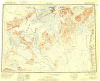
(195)- 1950 Map of McGrath
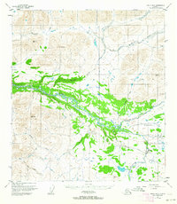
 1950 McGrath1950 Print · USGSThe Kuskokwim River valley and the Alaska Range foothills appear here at the dawn of the fifties. Trace the old interior supply routes through McGrath and Nikolai, or locate remote landmarks like Farewell Mtn Roadhouse and Rainy Pass.
 - 1950 Map of Talkeetna Mountains
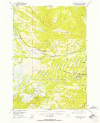
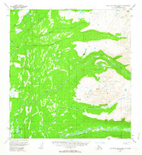
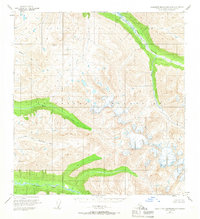
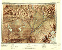
 1950 Talkeetna Mountains1950 Print · USGSThe Matanuska-Susitna region at mid-century was defined by its remote mountain peaks and the vital link of the Alaska Railroad. Researchers can trace early rail-side settlements like Gold Creek and Sherman or locate high-altitude landmarks such as Mt Watana 6320.2 unique versions available
 - 1950 Map of Talkeetna, 1954 Print
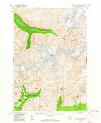
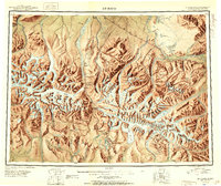
 1950 Talkeetna1954 Print · USGSThe Susitna Valley and the foothills of the Alaska Range appear in this mid-century survey as a frontier of remote lodges and rail-side outposts. You can trace the path of The Alaska Railroad through Talkeetna and locate vanished settlements like Sunflower.2 unique versions available
 - 1950 Map of Mount Hayes, 1955 Print
 1950 Mount Hayes1955 Print · USGSThe Alaska Interior in the early fifties shows a landscape of high peaks and essential roadhouse stops along the primitive highway system. Genealogists and historians can trace old travel routes and outposts like Rapids Roadhouse, Donnelly, and Paxson.2 unique versions available
 - 1950 Map of Anchorage C-8, 1958 Print
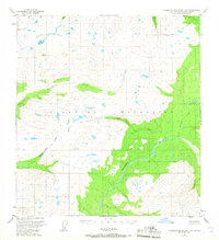
 1950 Anchorage C-81958 Print · USGSThe Matanuska-Susitna valley comes alive in the early statehood era as a hub of rail-side industry and wilderness settlement. Genealogists and historians can trace early residents near Houston and Pittman, or locate industrial landmarks like the Coal Mine and Alaska Railroad.3 unique versions available
 - 1950 Map of Talkeetna Mountains B-5, 1959 Print
 1950 Talkeetna Mountains B-51959 Print · USGSThe Matanuska-Susitna wilderness appears in the early statehood era as a network of drainages and high peaks. Explorers and researchers can locate remote cabins and landmarks like Rainbow Lake and Wells Mountain along the river valleys.3 unique versions available
 - 1950 Map of Talkeetna Mountains B-4, 1959 Print
 1950 Talkeetna Mountains B-41959 Print · USGSThe high peaks of the Matanuska-Susitna region appear here in the decade following the war, showcasing a wilderness area defined by its complex river systems. Local historians and surveyors can trace the course of the Talkeetna River and its alpine tributaries like Iron Creek and Yellowjacket Creek.3 unique versions available
 - 1950 Map of Talkeetna Mountains D-5, 1962 Print
 1950 Talkeetna Mountains D-51962 Print · USGSIn the early 1950s, this remote reach of the Alaskan interior was defined by the massive Susitna River and a network of seasonal routes. Researchers can trace the path of the Winter Trail and locate isolated Cabins along Indian River and Devil Creek.3 unique versions available
 - 1950 Map of Anchorage D-6, 1962 Print
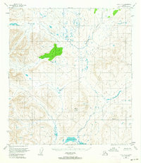
 1950 Anchorage D-61962 Print · USGSThe northern Talkeetna Mountains appear here as a bustling center for mining during the mid-twentieth century. Researchers can trace the legacy of early prospectors through named claims like the Rae-Wallace Mine and Lonesome Mine, or locate the historic Little Susitna Roadhouse.5 unique versions available
 - 1950 Map of Anchorage C-7, 1963 Print
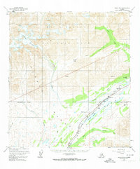
 1950 Anchorage C-71963 Print · USGSWasilla and the surrounding lake country are captured here at the start of the 1950s as the rail-and-road network expanded through the Matanuska Valley. Local researchers can trace the early layout of the Alaska Railroad and find landmarks like the Thorpe Mine and Wasilla Lake.2 unique versions available
 - 1950 Map of Talkeetna Mountains A-6, 1963 Print
 1950 Talkeetna Mountains A-61963 Print · USGSThe wilderness of the Susitna Valley is captured here just after the war, showing the intricate drainage of the Kashwitna River. Researchers can trace the paths of Montana Creek and Sheep Creek below high peaks like VABM Wolverine 4157.4 unique versions available
 - 1950 Map of Healy A-3, 1964 Print
 1950 Healy A-31964 Print · USGSInterior Alaska at the dawn of the 1950s shows a landscape of high-altitude drainages and mineral potential. Trace the course of Deadman Creek past Deadman Mountain or locate the site simply marked Gold.3 unique versions available
 - 1950 Map of Healy B-3, 1964 Print
 1950 Healy B-31964 Print · USGSThe Denali Highway corridor in the early fifties shows a rugged interior landscape shaped by the Nenana River and the high peaks of the Alaska Range. Researchers can locate remote backcountry sites like the Landing Strip, Brushkana Campground, and isolated cabins.2 unique versions available
 - 1950 Map of Healy A-4, 1965 Print
 1950 Healy A-41965 Print · USGSThe Matanuska-Susitna wilderness of the mid-twentieth century is captured here in its wild, unsurveyed state. Researchers can trace the high-altitude routes through Caribou Pass and follow the distinct drainage patterns of the Jack River and Tsusena Creek.3 unique versions available
 - 1950 Map of Healy B-1, 1965 Print
 1950 Healy B-11965 Print · USGSThe braided river valleys and massive ice fields of the Alaskan interior are captured here in the mid-twentieth century. Researchers can trace the shifting courses of the Susitna River and Boulder Creek beneath the Clearwater Mountains.4 unique versions available
 - 1950 Map of Healy A-5, 1965 Print
 1950 Healy A-51965 Print · USGSThe Alaska interior at mid-century is defined by the vital Alaska Railroad corridor through the Chulitna River valley. Researchers can trace remote mountain infrastructure and early settlements like Colorado, Broad Pass, and the transit points around Honolulu Pass.4 unique versions available
 - 1950 Map of Talkeetna Mountains A-5, 1966 Print
 1950 Talkeetna Mountains A-51966 Print · USGSThe Matanuska-Susitna backcountry was still largely being mapped by aerial photography in the mid-century. Researchers can trace the wild courses of the Kashwitna River and Sheep River or locate survey markers like VABM 5666 Honey.3 unique versions available
 - 1950 Map of Talkeetna Mountains C-5, 1967 Print
 1950 Talkeetna Mountains C-51967 Print · USGSIn the Matanuska-Susitna region during the mid-twentieth century, this survey documents a roadless wilderness dominated by the high peaks and river valleys of the Alaskan interior. Researchers can trace the wild courses of the Talkeetna River, Chunilna Creek, and the aptly named Disappointment Creek.2 unique versions available
 - 1950 Map of Gulkana B-6, 1972 Print
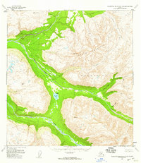
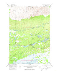
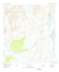
 1950 Gulkana B-61972 Print · USGSThe Matanuska-Susitna region at mid-century reveals a landscape of interconnected waterways and early bush-pilot access points. Researchers can trace the development of lakeside retreats like Twin Spruce Lodge or Kadok Landing and identify isolated features like Little Lake Louise and the nearby Landing Strip.
 - 1950 Map of Mount Hayes A-6, 1974 Print
 1950 Mount Hayes A-61974 Print · USGSThe Clearwater Mountains and upper Maclaren River valley are shown here in the mid-twentieth century as new roads began to pierce the interior. Researchers can trace early wilderness infrastructure like the Denali Highway, the remote Lodge, and a Sled Road.2 unique versions available
 - 1950 Map of Healy B-5, 1974 Print
 1950 Healy B-51974 Print · USGSThe Alaska Range in the early 1950s served as a vital transit corridor for the interior's developing infrastructure. Researchers can trace the high-altitude route of the Alaska Railroad as it passes through Summit and the CAA Station near Summit Lake.3 unique versions available
 - 1951 Map of Talkeetna
 1951 Talkeetna1951 Print · USGSInterior Alaska in the early fifties shows a wilderness being opened by the Alaska Railroad and bush aviation. You can trace early backcountry outposts like Chelatna Lodge, the riverside community of Talkeetna, and the high peaks of Mount Mc Kinley National Park.
 - 1951 Map of Healy
 1951 Healy1951 Print · USGSThe Alaska interior during the early fifties reveals a landscape shaped by the Alaska Railroad and the mining of the Alaska Range. Trace early settlements and infrastructure like Suntrana, the Dunkle Coal Mine, and the McKinley Park Airstrip at the edge of the wilderness.5 unique versions available
 - 1951 Map of Gulkana
 1951 Gulkana1951 Print · USGSThe Copper River basin comes alive in the early fifties as the highway system begins to reshape the Alaskan interior. Genealogists and historians can trace pioneer outposts from Ryans Roadhouse to Sourdough, alongside major landmarks like Lake Louise.4 unique versions available
 - 1951 Map of Mount Hayes
 1951 Mount Hayes1951 Print · USGSIn the Alaska Range during the early fifties, the interior road network relied on isolated outposts and high-mountain passes. Researchers can trace the path of the Richardson Highway through Isabel Pass and find historic stops like Rapids Roadhouse and Millers Roadhouse.2 unique versions available
Showing maps 1-25 of 195
Top cities of Matanuska-Susitna
- Wasilla historical maps
- Palmer historical maps
- Big Lake historical maps
- Willow historical maps
- Houston historical maps
- Talkeetna historical maps
See more
Frequently asked questions
- What are the different types of historical maps available for Matanuska-Susitna?
- What is the oldest map of Matanuska-Susitna?
- Where can I purchase historical maps of Matanuska-Susitna for my home or office?
- Where can I download high-res historical maps of Matanuska-Susitna?
- Are there historical topographic maps available for Matanuska-Susitna?
- Is there historical aerial imagery available for Matanuska-Susitna?
- Where are historical maps of Matanuska-Susitna sourced from?