1940s Maps of Pima County, Arizona
Explore 49 historic maps of Pima County from the 1940s. These maps offer a rare glimpse into what life looked like during the 1940s — showing old roads, neighborhoods, homes, and landmarks that have changed or disappeared over time.
Whether you're researching your family's past, planning a metal detecting trip, or studying how Pima County's landscape evolved across the 1940s, these high-resolution maps are a powerful tool for exploring the history of this region.
- Focus on a specific era: All maps on this page are from the 1940s, giving you a focused view of this time period.
- See what’s changed: Compare century-old streets, trails, and buildings to today's modern landscape using overlays and satellite layers.
- Research with precision: Use these maps for genealogy, historical research, land use analysis, or educational projects.
- View, download, or print: Maps are fully viewable online in high resolution, and can be downloaded or printed for your own records.
Start exploring Pima County's history through authentic maps from the 1940s. This is your window into the past.
Pima County, AZ maps
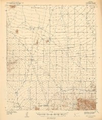
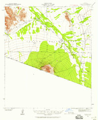
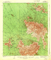
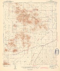
(49)- 1940 Map of Elgin
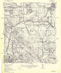 1940 Elgin1940 Print · USGSSoutheastern Arizona ranching country is shown here just before the mid-century, where the Southern Pacific railroad connects remote desert outposts. Researchers can locate early family homesteads like Gardner's Ranch and Rodgers Ranch alongside the historic site of Old Ft. Crittenden.
 - 1940 Map of Palo Alto Ranch, 1956 Print
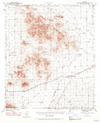
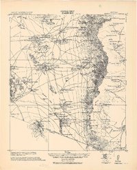
 1940 Palo Alto Ranch1956 Print · USGSThe Pima County desert landscape in the 1940s is shown here as a network of cattle outposts and dormant mineral claims. Genealogists and historians can locate family holdings like Anvil Ranch and trace the history of mining at the Banner Mine or Aguinaldo Mine.3 unique versions available
 - 1941 Map of Presumido Peak
 1941 Presumido Peak1941 Print · USGSThe Arizona borderlands in the early 1940s are defined here by cattle ranching and tribal lands along the international line. Researchers can trace historic properties like Rancho de la Osa and Buenos Aires Ranch or locate the Site of Old Indian Fort near Sasabe.2 unique versions available
 - 1941 Map of Twin Buttes
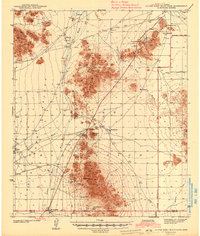
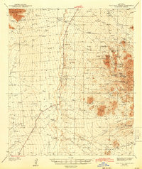
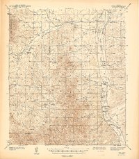
 1941 Twin Buttes1941 Print · USGSSouthern Arizona ranching and mining culture is well-documented in this late-1930s survey of the Sierrita foothills. Researchers can locate the McGee Sch, the rails of the Southern Pacific RR, and family-named landmarks like Canoa Ranch and Harris Ranch.
 - 1941 Map of Vekol Mountains
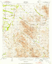
 1941 Vekol Mountains1941 Print · USGSMining activity and tribal settlements characterize this desert region in the late 1930s. Genealogists and historians can trace indigenous communities at Sif Vaya and Kohatk alongside early mineral prospects like the Vekol Mine and Reward Mine.
 - 1941 Map of San Vicente
 1941 San Vicente1941 Print · USGSPima County ranching and tribal lands are captured in the late 1930s before modern development altered this desert landscape. Genealogists and historians can trace family-named sites like San Ignacio Ranch and settlements including San Vicente and Haivana Nakya.
 - 1941 Map of Cocoraque Butte, 1942 Print
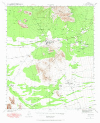
 1941 Cocoraque Butte1942 Print · USGSPima County ranching and reservation life are captured here in the early 1940s, just as the local road network began to stabilize. Researchers can trace historic property boundaries and desert outposts like Cocoraque Ranch, Robles Junction, and the indigenous settlement of Viopuli.2 unique versions available
 - 1941 Map of Baboquivari Peak, 1955 Print
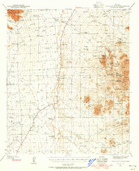
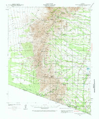
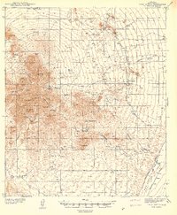
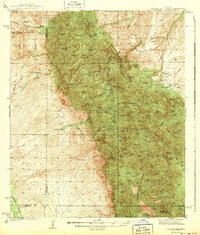
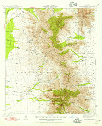 1941 Baboquivari Peak1955 Print · USGSArizona's Tohono O'odham lands come alive in this wartime survey, showing the deep connection between ranching families and the desert landscape. Genealogists and historians can trace the locations of the Allison Mine, Fresnal Canyon School, and numerous holdings like Otero Ranch.3 unique versions available
 - 1941 Map of Arivaca, 1956 Print
 1941 Arivaca1956 Print · USGSIn the early 1940s, this southern Arizona cattle and mining district centered around Arivaca and its surrounding family ranches. Trace the legacy of desert prospecting at the Las Guijas Mine or locate historic homesteads like Canoa Ranch and Montana Ranch.2 unique versions available
 - 1941 Map of Vamori, 1958 Print
 1941 Vamori1958 Print · USGSTraditional O'odham life in the early 1940s is mapped here across the desert expanses of the Papago Indian Reservation. Genealogists and historians can locate remote settlements and family landmarks including San Miguel, Ak Chut Vaya, and San Agustin Ranch.3 unique versions available
 - 1941 Map of Sells, 1969 Print
 1941 Sells1969 Print · USGSThe Papago Indian Reservation in the early 1940s reveals a desert landscape of ancestral villages and active mining. Trace family roots and desert trails through Sells, Topawa, and the historic San Solano Mission.
 - 1942 Map of Silver Reef Mountains
 1942 Silver Reef Mountains1942 Print · USGSPinal County's desert mining and indigenous heritage are recorded here in the early 1940s, just as these remote districts were being systematically surveyed. Genealogists and historians can trace the locations of traditional settlements like Vaiva Vo and Kohatk alongside numerous mining claims including the Silver Reef Mine and Jackrabbit Mine.2 unique versions available
 - 1942 Map of Vekol Mountains
 1942 Vekol Mountains1942 Print · USGSThe high desert of southern Arizona comes into focus during the late 1930s as a hub for mineral exploration and tribal settlement. Miners and genealogists can trace the locations of the Vekol Mine, Copperosity Mine, and the settlement of Sif Vaya.
 - 1942 Map of San Vicente
 1942 San Vicente1942 Print · USGSThe Sonoran desert landscape of Pima County is captured here in the late 1930s, showing the early ranching and mining infrastructure of the Papago Indian Reservation. Genealogists and historians can locate remote outposts like San Ignacio Ranch, Wattle Hut, and the Roadside Mine.
 - 1942 Map of Comobabi
 1942 Comobabi1942 Print · USGSThe Papago Indian Reservation comes into focus during the late 1930s, showing a network of remote desert settlements and scattered mountain mines. Genealogists and historians can trace the foundations of Sil Nakya, Ko Vaya, and mining sites like the Picacho Mine.2 unique versions available
 - 1942 Map of Oro Blanco, 1961 Print
 1942 Oro Blanco1961 Print · USGSThe Arizona-Mexico borderlands come to life in this early 1940s survey of Santa Cruz County. Genealogists and historians can trace the legacy of the local mining boom through sites like Oro Blanco and the Old Glory Mine, alongside working spreads such as Garcia Ranch.3 unique versions available
 - 1943 Map of Sells
 1943 Sells1943 Print · USGSThe Papago Indian Reservation in the early 1940s reveals a desert landscape of traditional settlements and active mining. Genealogists and historians can trace family roots through the San Solano Mission, Topawa P O, and villages like Artesa or Ali Chuk Son.4 unique versions available
 - 1943 Map of Benson
 1943 Benson1943 Print · USGSCochise County during the wartime 1940s reveals a landscape defined by the San Pedro River and the legendary town of Tombstone. Genealogists and historians can trace the foundations of Fort Huachuca and locate rural landmarks like St David, Fairbank, and Huachuca Turner PO.
 - 1943 Map of Cocoraque Butte
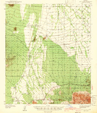
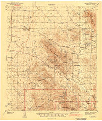
 1943 Cocoraque Butte1943 Print · USGSThe Papago Indian Reservation and Pima County ranchlands are documented here in the early 1940s during a period of transition for desert travel. Researchers can trace historic family holdings like Dill Ranch and Cocoraque Ranch or locate the old Three Points Sch.3 unique versions available
 - 1943 Map of Fresnal
 1943 Fresnal1943 Print · USGSSouthern Arizona’s borderlands and tribal territories are captured here in the 1940s, shortly after the height of early mining efforts. Researchers can trace ancestral connections in villages like Indian Oasis or locate vanished industrial sites like the Golden Age Mine & Mill.
 - 1943 Map of Arivaca
 1943 Arivaca1943 Print · USGSIn the early 1940s, this pocket of Pima County was a hub of hard-rock mining and cattle ranching. Researchers can trace family history through sites like Arivaca Ranch, find a lonely Cemetery, or locate dozens of mines including the Las Guijas Mine and Ajax Mine.3 unique versions available
 - 1943 Map of Palo Alto Ranch
 1943 Palo Alto Ranch1943 Print · USGSPima County ranching and mining culture is preserved here as it stood in the early 1940s. Genealogists and historians can trace family-named lands like Peyron Ranch and Anvil Ranch or locate several mining sites such as the Banner Mine.
 - 1943 Map of Galiuro Mts
 1943 Galiuro Mts1943 Print · USGSThe high desert of the Galiuro Mountains comes into focus in the late 1930s, showing a rugged landscape defined by cattle ranching and mining. You can trace the locations of family holdings like Mercer Ranch and Daley Ranch or search for remote mine sites like the Bunker Hill Mine.2 unique versions available
 - 1943 Map of Old Glory
 1943 Old Glory1943 Print · USGSThe Arizona-Mexico borderlands come into focus in this mid-century reconnaissance, capturing the mining and ranching life of the high desert. Researchers can trace the locations of Old Glory Mine, Ruby P.O. (Montana), and historic outposts like Tres Bellotas.
 - 1943 Map of Tubac
 1943 Tubac1943 Print · USGSThe Santa Cruz River valley comes alive in the late 1930s, documenting the vital transport corridor through Tubac and Amado. Genealogists and historians can trace family-run operations like Moyza Ranch or locate the Sopori Sch and Tumacacori National Monument.3 unique versions available
Showing maps 1-25 of 49
Top cities of Pima County
- Tucson historical maps
- Marana historical maps
- Oro Valley historical maps
- Sahuarita historical maps
- Vail historical maps
- Picture Rocks historical maps
See more
Frequently asked questions
- What are the different types of historical maps available for Pima County?
- What is the oldest map of Pima County?
- Where can I purchase historical maps of Pima County for my home or office?
- Where can I download high-res historical maps of Pima County?
- Are there historical topographic maps available for Pima County?
- Is there historical aerial imagery available for Pima County?
- Where are historical maps of Pima County sourced from?