Old Maps of Pima County, Arizona for Hiking & Exploration
Hike through history with 1,318 historic maps of Pima County. Explore old trails, ghost towns, and forgotten backroads — perfect for outdoor adventurers and local explorers.
- Rediscover forgotten places: Map out old mining camps, roads, and footpaths that no longer exist on modern maps.
- Layer with modern tools: Combine with LiDAR or satellite views to plan hikes through historical terrain.
- Made for exploration: Popular among hikers, overlanders, and local history lovers.
Use these maps to find adventure and explore the hidden past of Pima County.
Pima County, AZ maps
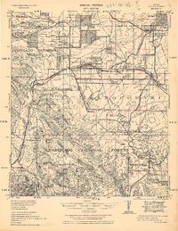
(1,318)- 1904 Map of Patagonia, 1955 Print
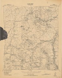
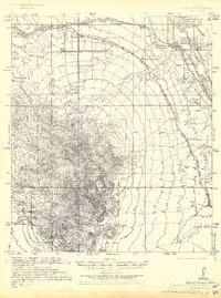
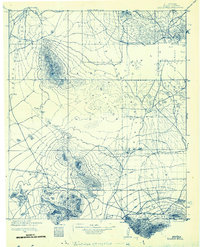
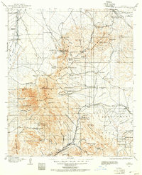 1904 Patagonia1955 Print · USGSArizona's mining and ranching frontiers are at their peak in this early century survey of the Santa Rita Mountains. Genealogists and historians can trace family operations at the Empire Ranch or the Total Wreck Mine, and locate the site of Old Ft Crittenden.
 - 1904 Map of Tucson, 1957 Print
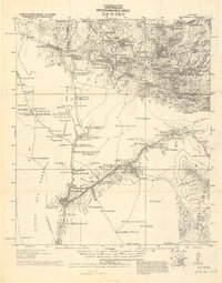
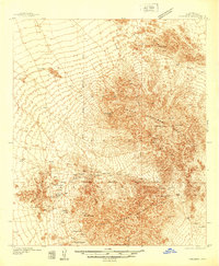
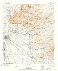 1904 Tucson1957 Print · USGSTucson and its surrounding desert basins are captured here at the turn of the century as the railroad transformed this Pima County landscape. Genealogists and historians can locate early family holdings like Carrillos Ranch, the site of Old Fort Lowell, and the remote Loma Verde Mines.
 - 1905 Map of Patagonia
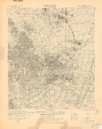
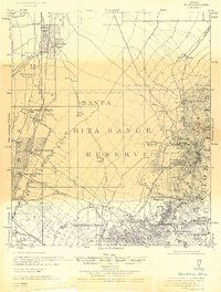
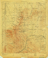 1905 Patagonia1905 Print · USGSSouthern Arizona’s mining and ranching frontier is captured here at the start of the twentieth century. Genealogists and historians can trace numerous family homesteads and active mining sites, from Empire Ranch and Helvetia to the curiously named Total Wreck Mine.4 unique versions available
 - 1905 Map of Tucson
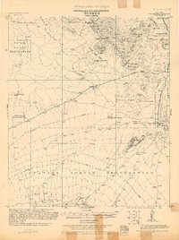
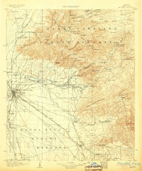 1905 Tucson1905 Print · USGSEarly 1900s Tucson is shown here as a railway hub at the base of the Rincon and Santa Catalina mountains. Genealogists and historians can trace numerous family homesteads like Pusch's Ranch, explore Old Fort Lowell, or locate the Loma Verde Mines.5 unique versions available
 - 1911 Map of Winkelman, 1957 Print
 1911 Winkelman1957 Print · USGSThe Pinal and Pima County line comes alive in the 1910s, showing a landscape of mining camps and early ranching. Genealogists and historians can trace the foundations of Mammoth and find long-lost sites like the Finch School, Campo Bonito, and the MAMMOTH MINE.
 - 1913 Map of Winkelman
 1913 Winkelman1913 Print · USGSThe confluence of the Gila and San Pedro rivers in the 1910s reveals a landscape of mining camps and remote ranching outposts. Trace the early industrial footprint of the Mammoth Mine and Oracle or find family landmarks like Finch School and Biddicks Cabin.4 unique versions available
 - 1915 Map of Benson
 1915 Benson1915 Print · USGSSouthern Arizona was a landscape of rail junctions and mining claims just before the Great War. Genealogists and historians can trace the reach of Tombstone, find the Panama Mine, and locate vanished rail stops like Fairbank and Boquillas.4 unique versions available
 - 1920 Map of Arivaca
 1920 Arivaca1920 Print · USGSSouthern Arizona ranching and mining country comes into focus in this post-World War I survey of the Santa Cruz Valley. Trace family roots and early industry near the Tumacacori Mission, Oceanic Mine, and the village of Arivaca.
 - 1921 Map of Old Glory
 1921 Old Glory1921 Print · USGSThe Arizona borderlands appear as a network of cattle ranches and mining outposts in this early twentieth-century military reconnaissance. Genealogists and historians can trace family operations like Lopez, Alamito Ranch, and the Old Glory Mine.2 unique versions available
 - 1922 Map of Agus Caliente
 1922 Agus Caliente1922 Print · USGSThe Santa Rita Mountains of Southern Arizona appear here in the early twenties during a period of active mountain mining and ranching. Genealogists and historians can trace family sites like Wise's Ranch or find old operations at the Mansfield Mines and Montosa Mill.
 - 1925 Map of Samaniego Peak
 1925 Samaniego Peak1925 Print · USGSIn the mid-twenties, this Pima County landscape was a mix of isolated desert homesteads and active mining operations. Genealogists and historians can trace family-named locations like Perones Ranch and Mendoza Ranch or explore the rail-and-ore history of the Southern Pacific Railroad.
 - 1925 Map of San Xavier
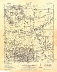
 1925 San Xavier1925 Print · USGSThe Tucson area and the Papago Indian Reservation come to life in this mid-1920s survey. Researchers can trace family-named homesteads such as Kubils Ranch and Coronado Ranch alongside industrial sites like the Arizona Group Mines.
 - 1926 Map of Whetstone
 1926 Whetstone1926 Print · USGSThe San Pedro River valley and the railroad hub of Benson are captured here in the mid-1920s. Genealogists and historians can trace the early footprints of Wakefield Ranch, locate the Taylor School, and follow the junction of the Southern Pacific and El Paso and Southwestern lines.
 - 1926 Map of Helvetia
 1926 Helvetia1926 Print · USGSSouthern Arizona in the mid-twenties shows a landscape of cattle ranches and high-desert outposts. Researchers can trace family-named sites like Stone's Ranch and Mc Cleary's Ranch or explore early settlements such as Helvetia and Greaterville.
 - 1927 Map of Aguila Mountains
 1927 Aguila Mountains1927 Print · USGSThe desert of Yuma County is captured in the late twenties, showing the region as a wide-open basin organized by early township surveys. Researchers can trace the original path of Yager Road as it cuts across the San Cristobal Valley.2 unique versions available
 - 1930 Map of Aguila Mountains
 1930 Aguila Mountains1930 Print · USGSIn the Yuma County desert during the late 1920s, this survey captures a landscape of extreme verticality and open space. Researchers can trace early desert transit along the Yager Road or study the terrain surrounding the Aguila Mountains and Aztec Hills.3 unique versions available
 - 1932 Map of Elgin
 1932 Elgin1932 Print · USGSSanta Cruz County ranching culture is on full display in the early 1930s as the Southern Pacific rail line winds through the high desert. Genealogists can trace family landmarks like Gardner's Ranch and Turner-Bower Ranch or locate the site of Old Ft Crittenden.
 - 1932 Map of Ajo, 1958 Print
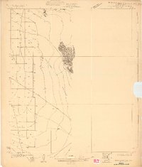
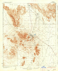
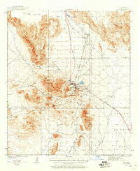 1932 Ajo1958 Print · USGSThe copper-rich Arizona desert comes alive in the early 1930s, centered on the massive pit and surrounding worker communities. Trace the rail lines of the Tucson Cornelia and Gila Bend RR or locate the historic Indian Cem and New Cornelia Mines.
 - 1934 Map of Tucson Mountains
 1934 Tucson Mountains1934 Print · USGSThe desert northwest of Tucson comes into focus during the mid-1930s, showing the early footprints of the Papago Indian Reservation and the railroad corridor. Genealogists and historians can trace family-named sites and ranching outposts like Maisi Ayra Ranch, Rodriguez, and the Maish Roadside Mine.
 - 1934 Map of Ajo
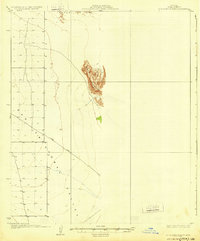
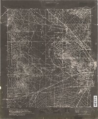
 1934 Ajo1934 Print · USGSArizona's copper mining heartland comes into focus in the 1930s as industrial development expands across the desert. Genealogists and historians can trace local life at Mexican Town, locate the Indian Cem, or follow the Old Sonoita Road past remote sites like Bates Well.2 unique versions available
 - 1934 Map of Silver Bell
 1934 Silver Bell1934 Print · USGSPima County at the height of the New Deal era reveals a sparse network of desert settlements and remote mines. Genealogists and historians can trace the footprint of the Papago Indian Reservation through its small villages like Santa Cruz and industrial sites like the Roadside Mine.
 - 1934 Map of Newman Peak
 1934 Newman Peak1934 Print · USGSThe Pinal and Pima County line area is captured here in the mid-1930s, showing a desert landscape shaped by mining and the railroad. Researchers can trace the Southern Pacific line through Redrock or locate the Sasco Mine and 96 Ranch.
 - 1937 Map of Comobabi
 1937 Comobabi1937 Print · USGSPima County's high-desert mining and tribal lands are captured in the late 1930s, showing the early infrastructure of the Papago Indian Reservation. Trace the locations of isolated mining operations like the Cobabi Mine and settlements at San Luis and Nolic.4 unique versions available
 - 1938 Map of Galiuro Mts
 1938 Galiuro Mts1938 Print · USGSThe high desert of Graham and Pinal Counties comes alive in this pre-war survey of the Galiuro Mountains. Local history researchers can trace old ranching boundaries and mining claims like Sixteen To One Mine, Y L Ranch, and the Gerónimo Camp outpost.5 unique versions available
 - 1938 Map of Huachuca
 1938 Huachuca1938 Print · USGSSoutheastern Arizona's military and ranching landscape is captured here in the late thirties, centered on the historic Fort Huachuca. Genealogists and historians can trace early family holdings like Pyeatt Ranch and Mc Beanes, or locate the Manua Panama Mine and the Evans School.
Showing maps 1-25 of 1,318
Top cities of Pima County
- Tucson historical maps
- Marana historical maps
- Oro Valley historical maps
- Sahuarita historical maps
- Vail historical maps
- Picture Rocks historical maps
See more
Frequently asked questions
- What are the different types of historical maps available for Pima County?
- What is the oldest map of Pima County?
- Where can I purchase historical maps of Pima County for my home or office?
- Where can I download high-res historical maps of Pima County?
- Are there historical topographic maps available for Pima County?
- Is there historical aerial imagery available for Pima County?
- Where are historical maps of Pima County sourced from?