1960s Maps of Pima County, Arizona
Explore 41 historic maps of Pima County from the 1960s. These maps offer a rare glimpse into what life looked like during the 1960s — showing old roads, neighborhoods, homes, and landmarks that have changed or disappeared over time.
Whether you're researching your family's past, planning a metal detecting trip, or studying how Pima County's landscape evolved across the 1960s, these high-resolution maps are a powerful tool for exploring the history of this region.
- Focus on a specific era: All maps on this page are from the 1960s, giving you a focused view of this time period.
- See what’s changed: Compare century-old streets, trails, and buildings to today's modern landscape using overlays and satellite layers.
- Research with precision: Use these maps for genealogy, historical research, land use analysis, or educational projects.
- View, download, or print: Maps are fully viewable online in high resolution, and can be downloaded or printed for your own records.
Start exploring Pima County's history through authentic maps from the 1960s. This is your window into the past.
Pima County, AZ maps
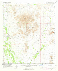
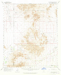
(41)- 1962 Map of Ajo
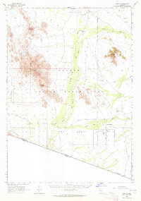
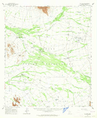
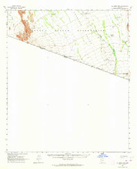
 1962 Ajo1962 Print · USGSSouthern Arizona in the early sixties was a landscape of deep-desert mining, military airfields, and tribal lands. Researchers can trace the Cornelia Mine near Ajo, remote outposts like Trays Trading Post, and the path of the Devils Highway.
 - 1962 Map of Tucson
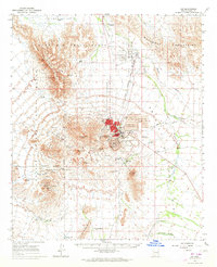
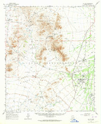
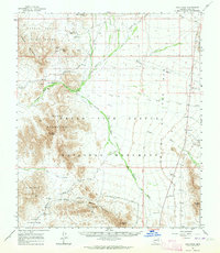
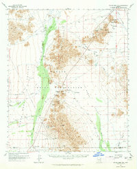
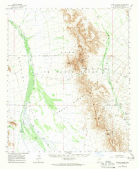
 1962 Tucson1962 Print · USGSSouthern Arizona in the early sixties showcases a landscape defined by burgeoning desert cities and massive military installations. Researchers can trace tribal settlements like Schuchk, legacy mining sites at Silver Bell Mine, and the early footprint of Davis-Monthan Air Force Base.
 - 1963 Map of Ajo
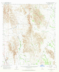
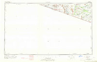
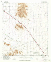
 1963 Ajo1963 Print · USGSSouthwestern Arizona in the early sixties reveals a landscape of desert ranches and remote mining outposts. Trace the historic Southern Pacific line or locate isolated landmarks like O'Neils Grave and Tracy's Trading Post.
 - 1963 Map of Kom Vo, 1964 Print
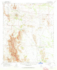
 1963 Kom Vo1964 Print · USGSThe southern border of the Papago Indian Reservation is captured in the early 1960s, showing a land shaped by isolated wells and ancient paths. Genealogists and historians can trace the residents of Kom Vo and Vamori, or locate specific sites like Petroglyphs and Papago Farms.2 unique versions available
 - 1963 Map of Ajo, 1964 Print
 1963 Ajo1964 Print · USGSMid-century copper mining and desert railroading are captured here as the industrial footprint of Ajo reached its peak. Researchers can trace the layout of Mexican Town, the massive New Cornelia Mine works, and the Tucson Cornelia and Gila Bend Railroad line.2 unique versions available
 - 1963 Map of Sikort Chuapo Mts, 1964 Print
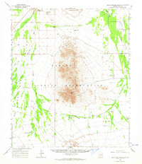
 1963 Sikort Chuapo Mts1964 Print · USGSThe Papago Indian Reservation and its surrounding mountain ranges are captured here in the early sixties, showing a landscape defined by desert water sources. Researchers can trace the locations of Sikort Chuapo Well, Hoa Murk, and scattered prospects near Rocky Point Junction.2 unique versions available
 - 1963 Map of Mt. Ajo, 1964 Print
 1963 Mt. Ajo1964 Print · USGSSouthern Arizona in the early sixties reveals a landscape of tribal villages and desert monuments shaped by the Ajo Range. Genealogists and historians can locate remote settlements like Schuchuli and Gu Vo, or trace landmarks like the Surprise Mine and Kerwo Day Sch.2 unique versions available
 - 1963 Map of Gu Oidak, 1964 Print
 1963 Gu Oidak1964 Print · USGSThe Papago Indian Reservation comes into focus during the early sixties, showing a landscape of traditional settlements and desert missions. Researchers can trace the layout of Gu Oidak, locate the St Francis Mission near Vamori, or find the Petroglyphs in the southern hills.2 unique versions available
 - 1963 Map of Lukeville, 1964 Print
 1963 Lukeville1964 Print · USGSThe Arizona borderlands in the early sixties reveal a landscape of remote mining claims and international checkpoints. Researchers can trace the desert infrastructure of Lukeville and locate historic workings such as the Victoria Mine and Lost Cabin Mine.2 unique versions available
 - 1963 Map of Gu Achi, 1964 Print
 1963 Gu Achi1964 Print · USGSIn the early 1960s, the heart of the Papago Indian Reservation was a landscape of remote desert villages and high-mountain mines. Researchers can trace traditional settlements like Anegam and Ali Oidak, or locate mining sites such as the Oro Grande Mine and Montezona Mine.2 unique versions available
 - 1963 Map of Quijotoa Mts, 1964 Print
 1963 Quijotoa Mts1964 Print · USGSThe Papago Indian Reservation comes into focus during the early sixties, showing a landscape defined by desert mining and traditional settlements. Researchers can locate remote sites like Stoa Vaya, the Quijotoa Trading Post, and numerous workings like the Black Prince Mine.2 unique versions available
 - 1963 Map of Cimarron Peak, 1964 Print
 1963 Cimarron Peak1964 Print · USGSThe Papago Indian Reservation in the early sixties remains a landscape of isolated peaks and desert washes. Genealogists and researchers can trace local landmarks like Hickiwan, the Cem at Tatria Toak, and the remote Window Mtn Well.
 - 1963 Map of Quitobaquito Springs, 1964 Print
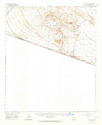
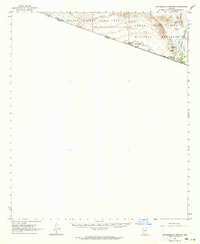 1963 Quitobaquito Springs1964 Print · USGSThe Arizona-Sonora borderlands come into focus in the early sixties, showing the critical water sources and desert tracks of Pima County. Researchers can trace the remote Quitobaquito Springs, find the isolated Airstrip, and locate named landmarks like Hocker Well.2 unique versions available
 - 1963 Map of Santa Rosa Mountains, 1964 Print
 1963 Santa Rosa Mountains1964 Print · USGSThe Papago Indian Reservation is captured in the early sixties, showing a landscape defined by isolated wells and mountain peaks. Researchers can locate remote desert outposts such as Komelik and Hot Oidak or trace historic routes along Tat Momoli Wash.2 unique versions available
 - 1963 Map of Pisinimo, 1964 Print
 1963 Pisinimo1964 Print · USGSThe Papago Indian Reservation in the early sixties is captured here as a landscape of desert washes and remote O'odham villages. Genealogists and historians can trace traditional settlements and vital water sources like Pisinimo, Wahak Hotrontk, and Schuk Cowlik.2 unique versions available
 - 1963 Map of La Lesna Mts., 1964 Print
 1963 La Lesna Mts.1964 Print · USGSThe Sonoran Desert borderlands are captured here in the early sixties, showing the remote ranching and indigenous life within the Papago Indian Reservation. Researchers can locate historic cattle stations like Toros Ranch and unique sites such as the San Rafael Ruins and Sivili Chuchg.2 unique versions available
 - 1963 Map of Kino Peak, 1964 Print
 1963 Kino Peak1964 Print · USGSIn the early 1960s, this remote corner of the Sonoran Desert remained a landscape of isolated outposts and rugged mountain ranges. Researchers can trace historic desert water sources and travel routes, including Armenta Well, Bluebird Mine, and the Growler Pass.2 unique versions available
 - 1963 Map of Lukeville, 1964 Print
 1963 Lukeville1964 Print · USGSThe Arizona-Mexico borderlands come into focus in this early 1960s survey, detailing the desert infrastructure of the Papago Indian Reservation. Researchers can locate remote sites like the Milton Mine, San Rafael Ruins, and the border crossing at Lukeville.2 unique versions available
 - 1963 Map of Eloy, 1965 Print
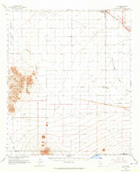 1963 Eloy1965 Print · USGSThe Santa Cruz Flats are captured here in the early 1960s, showing a landscape of desert irrigation and rail-side growth. Trace the development of Arizona City, the Southern Pacific rail line, and remote outposts like Friendly Corners.2 unique versions available
 - 1963 Map of Vekol Mountains, 1965 Print
 1963 Vekol Mountains1965 Print · USGSThe Papago Indian Reservation comes into focus during the early sixties, revealing a desert landscape where mining history and indigenous settlements overlap. Researchers can trace historic extraction at the Vekol Mine (Ruins) and Reward Mine, or locate small communities like Kohatk and Sif Vaya.2 unique versions available
 - 1963 Map of Red Rock, 1965 Print
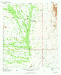
 1963 Red Rock1965 Print · USGSArizona's Sonoran Desert landscape comes into focus during the early sixties, showing a corridor of growth along the railroad. Genealogists and historians can trace family-named sites like La Osa Ranch, Meeks Ranch, and the Aguirre Ranch.3 unique versions available
 - 1963 Map of Silver Reef Mts, 1965 Print
 1963 Silver Reef Mts1965 Print · USGSThe Arizona desert of the early 1960s is captured here, showcasing the mining districts and tribal lands of Pinal County. Trace the historical footprints of the Magnesium Queen Mines, the remote settlement of Tat Momoli, and the Santa Rosa Trail through the Slate Mountains.2 unique versions available
 - 1963 Map of Diaz Peak, 1965 Print
 1963 Diaz Peak1965 Print · USGSSouthern Arizona’s borderlands and the tribal lands of the O'odham people are captured in the 1960s. Trace the remote desert outposts and water sources of the era, from the village of Ali Chuk and Menagers Lake to the rugged heights of Diaz Peak.2 unique versions available
 - 1964 Map of Tucson
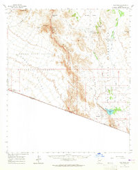
 1964 Tucson1964 Print · USGSSouthern Arizona in the mid-1960s shows a landscape of burgeoning desert cities and industrial-scale copper mining. Researchers can trace the development of Tucson and its outlying mining districts, including the Silver Bell Mine and San Manuel Mine.
 - 1964 Map of Growler Peak, 1965 Print
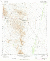
 1964 Growler Peak1965 Print · USGSThe Pima County desert during the mid-sixties is captured here as a strictly managed landscape of military ranges and game preserves. Researchers can trace remote water sources and passage points like Charlie Bell Wells, Saguaro Gap Well, and Charlie Bell Pass.3 unique versions available
Showing maps 1-25 of 41
Top cities of Pima County
- Tucson historical maps
- Marana historical maps
- Oro Valley historical maps
- Sahuarita historical maps
- Vail historical maps
- Picture Rocks historical maps
See more
Frequently asked questions
- What are the different types of historical maps available for Pima County?
- What is the oldest map of Pima County?
- Where can I purchase historical maps of Pima County for my home or office?
- Where can I download high-res historical maps of Pima County?
- Are there historical topographic maps available for Pima County?
- Is there historical aerial imagery available for Pima County?
- Where are historical maps of Pima County sourced from?