1980s Maps of Pima County, Arizona
Explore 92 historic maps of Pima County from the 1980s. These maps offer a rare glimpse into what life looked like during the 1980s — showing old roads, neighborhoods, homes, and landmarks that have changed or disappeared over time.
Whether you're researching your family's past, planning a metal detecting trip, or studying how Pima County's landscape evolved across the 1980s, these high-resolution maps are a powerful tool for exploring the history of this region.
- Focus on a specific era: All maps on this page are from the 1980s, giving you a focused view of this time period.
- See what’s changed: Compare century-old streets, trails, and buildings to today's modern landscape using overlays and satellite layers.
- Research with precision: Use these maps for genealogy, historical research, land use analysis, or educational projects.
- View, download, or print: Maps are fully viewable online in high resolution, and can be downloaded or printed for your own records.
Start exploring Pima County's history through authentic maps from the 1980s. This is your window into the past.
Pima County, AZ maps
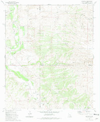
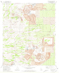
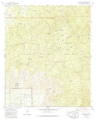
(92)- 1980 Map of Wilbur Canyon
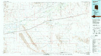
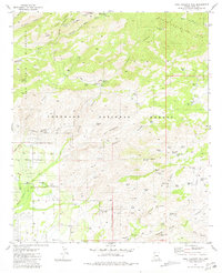
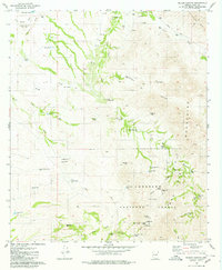 1980 Wilbur Canyon1980 Print · USGSIn the high desert of Pima County during the late seventies, this survey traces the mining and ranching legacies of the Las Guijas Mountains. Genealogists and historians can locate the San Luis Mine, the Ruins near Carpenter Well, and a secluded Cem.3 unique versions available
 - 1980 Map of Red Rock, 1981 Print
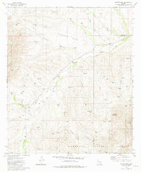
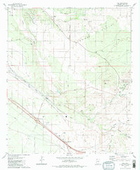
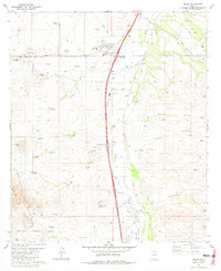
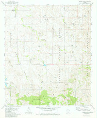
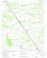 1980 Red Rock1981 Print · USGSThe Pinal and Pima county line in the early 1980s shows a landscape of desert ranching and industrial growth. Genealogists and historians can trace the Southern Pacific line through Red Rock and the extensive Marana Air Park near Meeks Ranch.2 unique versions available
 - 1980 Map of Ajo, 1996 Print
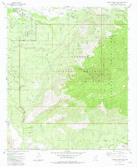
 1980 Ajo1996 Print · USGSIn the Sonoran Desert during the early 1980s, mining operations and tribal lands shaped the landscape of Pima County. Researchers can trace the development of Ajo and Why, locate desert outposts like San Simon Well, and identify old workings at the Bluebird Mine.
 - 1980 Map of Cabeza Prieta Mts, 1996 Print
 1980 Cabeza Prieta Mts1996 Print · USGSThe Arizona-Sonora borderlands come into focus in the 1980s, showcasing a vast landscape of protected wilderness and military ranges. Researchers can trace remote desert water sources like Tule Well and Papago Well or locate prominent landmarks such as Cabeza Prieta Peak.2 unique versions available
 - 1980 Map of Dateland, 1996 Print
 1980 Dateland1996 Print · USGSThe Yuma County desert during the late twentieth century is defined by the vital transit corridor along the Gila River. Researchers can trace the Southern Pacific rail line through remote stops like Sentinel and Aztec or locate the Sheep Mine in the rugged backcountry.
 - 1981 Map of Saucito Mtn.
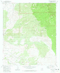
 1981 Saucito Mtn.1981 Print · USGSSouthern Arizona ranching and forest lands are documented here in the early eighties as they straddle the Pima and Santa Cruz county lines. Researchers can locate the Old Sopori School, trace the Arivaca Road, and find family-named sites like Santa Lucia Ranch.2 unique versions available
 - 1981 Map of Mount Bigelow
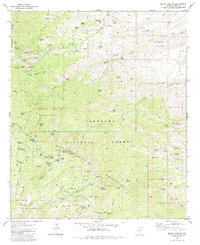 1981 Mount Bigelow1981 Print · USGSThe Santa Catalina Mountains in the early eighties were a mix of active forest management and historical mining claims. Researchers can trace the layout of the Daily Mine Group, the seasonal settlement at Soldier Camp, and high-altitude landmarks like Mount Bigelow.3 unique versions available
 - 1981 Map of Piety Hill
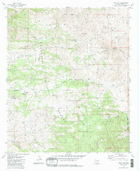 1981 Piety Hill1981 Print · USGSThe Rincon Mountains and Coronado National Forest are shown in the early 1980s as a landscape of isolated ranching and rugged canyons. Researchers can trace the water-management infrastructure of the era through sites like Bullock Corrals, Youtcy Ranch, and Chiva Falls.2 unique versions available
 - 1981 Map of Agua Caliente Hill
 1981 Agua Caliente Hill1981 Print · USGSThe Santa Catalina foothills in the early eighties were a mix of ranching land and mountain recreation. Locate family-owned outposts like the Agua Caliente Ranch and Bellota Ranch or trace the route to Tanque Verde Falls and the Seven Cataracts.3 unique versions available
 - 1981 Map of Vail
 1981 Vail1981 Print · USGSThe Rincon Valley in the early eighties shows a landscape of historic cattle ranches beginning to meet modern infrastructure. Researchers can trace the legacy of the Southern Pacific line past the Santa Rita Shrine and into the foothills near Pistol Hill.2 unique versions available
 - 1981 Map of Rincon Peak
 1981 Rincon Peak1981 Print · USGSThe Rincon Mountains and high desert of Pima County are captured here in the early eighties, showing a landscape defined by ranching and conservation. Trace the Southern Pacific rail line and discover remote water sources like Lion Spring and Charlies Well.3 unique versions available
 - 1981 Map of Mt. Wrightson
 1981 Mt. Wrightson1981 Print · USGSThe Santa Rita Mountains of the early eighties are mapped here in detail, showcasing a rugged mining and recreation landscape. Researchers can trace the legacy of mineral claims at the Florida Mine, explore the heights of Mt Wrightson, or locate subterranean features like Onyx Cave.2 unique versions available
 - 1981 Map of The Narrows
 1981 The Narrows1981 Print · USGSPima County ranching and mining operations are captured here in the early eighties. Researchers can trace the rail corridor of the Southern Pacific or locate high-desert landmarks like the Total Wreck Mine and Bobo Spring Ranch.2 unique versions available
 - 1981 Map of Amado
 1981 Amado1981 Print · USGSIn the Santa Cruz River valley during the early eighties, ranching and desert travel defined the landscape. Genealogists and historians can trace family operations at Sopori Ranch, the rural Sopori Sch, and the rail stops of the Southern Pacific.2 unique versions available
 - 1981 Map of Redington
 1981 Redington1981 Print · USGSThe San Pedro River valley comes into focus during the early 1980s, documenting a landscape of remote ranches and desert canyons. Genealogists and researchers can trace family-named sites like Bingham Ranch and Bayless Ranch or locate the local Cem and Redington settlement.2 unique versions available
 - 1981 Map of Batamote Hills
 1981 Batamote Hills1981 Print · USGSThe Sierrita Mountains and Batamote Hills define this Pima County landscape in the early eighties. Researchers can trace ranching and mining roots through features like the Blackhawk Mine, Batamote Well, and the solitary Grave near Lobo Peak.2 unique versions available
 - 1981 Map of Samaniego Peak
 1981 Samaniego Peak1981 Print · USGSThe Sierrita Mountains of Pima County are shown here in the early 1980s, an era when mining and ranching shaped the high desert landscape. Genealogists and historians can trace family-named sites like Mc Gees Settlement, Mickey Rye Well, and the Fortuna Mine.2 unique versions available
 - 1981 Map of Twin Buttes
 1981 Twin Buttes1981 Print · USGSArizona's copper industry was at its peak in the early 1980s, defining the landscape south of Tucson through massive open-pit operations. Researchers can trace the industrial layout of the Mission Mine and locate local landmarks like the Twin Buttes Cem and Demetrie.2 unique versions available
 - 1981 Map of Mt. Hopkins
 1981 Mt. Hopkins1981 Print · USGSThe Santa Rita Mountains of Southern Arizona are captured in the early eighties as a hub of both scientific research and historic mining operations. Researchers can trace dozens of prospect sites and established mines like the Montosa Mine or locate the Agua Caliente Caves and Proctor Ranch.3 unique versions available
 - 1981 Map of Samaniego Hills
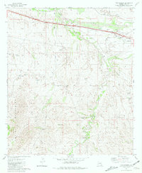
 1981 Samaniego Hills1981 Print · USGSThe Arizona desert south of Picacho Peak reveals a landscape of industrial memory and ranching life in the early eighties. Genealogists and historians can locate the Sasco Cem, trace the Old Railroad Grade, and explore the site of the Sasco Ruins.3 unique versions available
 - 1981 Map of Soza Canyon
 1981 Soza Canyon1981 Print · USGSIn the early eighties, the San Pedro River valley remained a landscape of remote family ranches and small desert outposts. Researchers can trace the legacy of early settlers through landmarks like Cascabel, the Spear Ranch, and the Cascabel School (Site).2 unique versions available
 - 1981 Map of Mica Mountain
 1981 Mica Mountain1981 Print · USGSThe high Rincon Mountains of Pima County are shown here in the early 1980s, revealing a landscape of national forest and monument lands. Researchers can trace remote sites like Manning Camp, the Madrona Ranger Sta, and a lone Grave near Rincon Creek.3 unique versions available
 - 1981 Map of Murphy Peak
 1981 Murphy Peak1981 Print · USGSArizona's high desert ranching country is captured here in the early 1980s, where the Pima and Santa Cruz county lines meet. Researchers can trace land use through named water improvements and topographical features like Arivaca Lake, Murphy Peak, and Red Spring Pass.2 unique versions available
 - 1981 Map of Buehman Canyon
 1981 Buehman Canyon1981 Print · USGSArizona's high desert during the early eighties reveals a landscape of ranching waterworks and remote forest tracks. Genealogists and historians can trace family-named landmarks like Burleson Well, Pearsons Spring, and Georges Spring across the Davis Mesa.2 unique versions available
 - 1981 Map of Tanque Verde Peak
 1981 Tanque Verde Peak1981 Print · USGSThe Rincon Mountains and Saguaro National Monument come alive in this early 1980s survey of the Arizona desert. Trace the historic Old Military Reservation Boundary or locate remote sites like Thunderhead Ranch and Hope Camp.4 unique versions available
Showing maps 1-25 of 92
Top cities of Pima County
- Tucson historical maps
- Marana historical maps
- Oro Valley historical maps
- Sahuarita historical maps
- Vail historical maps
- Picture Rocks historical maps
See more
Frequently asked questions
- What are the different types of historical maps available for Pima County?
- What is the oldest map of Pima County?
- Where can I purchase historical maps of Pima County for my home or office?
- Where can I download high-res historical maps of Pima County?
- Are there historical topographic maps available for Pima County?
- Is there historical aerial imagery available for Pima County?
- Where are historical maps of Pima County sourced from?