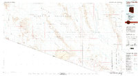
1980 Map of Cabeza Prieta Mts
USGS Topo · Published 1996About this map
The Cabeza Prieta National Wildlife Refuge dominates this desert landscape along the Arizona-Sonora border, illustrating a vast conservation and military territory during the late twentieth century. This survey details the intersection of the Barry M Goldwater Air Force Range with the protected wilderness of the Organ Pipe Cactus National Monument. The terrain is defined by dramatic volcanic and aeolian features, such as the Pinacate Lava Flow and the shifting Pinta Sands, which surround the Cabeza Prieta Mountains.
Find a feature on this map
58 named features on this map. Tap any name to fly to it.
Don’t see what you’re looking for? This feature index may not catch every label — zoom into the map to look around manually.
Map Details
Editions of this 1980 Cabeza Prieta Mts Map
2 editions found
Other maps of this area

1926 · Wellton
USGS Topo · 1:62,500

1926 · Mohawk
USGS Topo · 1:62,500

1927 · Aguila Mountains
USGS Topo · 1:48,000

1927 · Kim
USGS Topo · 1:62,500

1928 · Mohawk
USGS Topo · 1:62,500

1929 · Wellton
USGS Topo · 1:62,500

1930 · Aguila Mountains
USGS Topo · 1:62,500

1931 · Kim
USGS Topo · 1:62,500

1932 · Ajo
USGS Topo · 1:62,500

1934 · Ajo
USGS Topo · 1:62,500