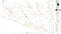
1980 Map of Cabeza Prieta Mts
USGS Topo · Published 1996About this map
The Barry M Goldwater Air Force Range dominates the northern reaches of this Southwestern landscape, where the vast Lechuguilla Desert meets the rugged volcanic terrain of the Pinacate Lava Flow. This 1980 survey reveals a land defined by its extremes, from the shifting Pinta Sands to the stark peaks of the Cabeza Prieta Mountains. Life in this arid region was historically anchored to rare water sources like Tule Well and Papago Well, which served as vital stopovers for travelers and miners.
Find a feature on this map
46 named features on this map. Tap any name to fly to it.
Don’t see what you’re looking for? This feature index may not catch every label — zoom into the map to look around manually.
Map Details
Editions of this 1980 Cabeza Prieta Mts Map
2 editions found
Other maps of this area

1926 · Wellton
USGS Topo · 1:62,500

1926 · Mohawk
USGS Topo · 1:62,500

1927 · Aguila Mountains
USGS Topo · 1:48,000

1927 · Kim
USGS Topo · 1:62,500

1928 · Mohawk
USGS Topo · 1:62,500

1929 · Wellton
USGS Topo · 1:62,500

1930 · Aguila Mountains
USGS Topo · 1:62,500

1931 · Kim
USGS Topo · 1:62,500

1932 · Ajo
USGS Topo · 1:62,500

1934 · Ajo
USGS Topo · 1:62,500