Old Maps of Sahuarita, Arizona for Metal Detecting
Plan your next treasure hunt with 50 historic maps of Sahuarita. Find old homesites, ghost towns, trails, and gathering spots that may be lost to time — perfect for identifying promising metal detecting locations.
- Locate forgotten sites: Uncover places like long-lost settlements, abandoned rail lines, or gathering spots.
- Plan better hunts: Use map overlays combined with LiDAR or satellite views to narrow in on historically rich areas.
- Made for detectorists: Thousands of hobbyists use these maps to discover relics, coins, and hidden history.
Use these historic maps to boost your research and find new opportunities beneath the surface of Sahuarita.
Sahuarita, AZ maps
(50)- 1904 Map of Patagonia, 1955 Print
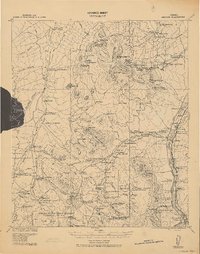
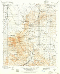 1904 Patagonia1955 Print · USGSArizona's mining and ranching frontiers are at their peak in this early century survey of the Santa Rita Mountains. Genealogists and historians can trace family operations at the Empire Ranch or the Total Wreck Mine, and locate the site of Old Ft Crittenden.
 - 1904 Map of Tucson, 1957 Print
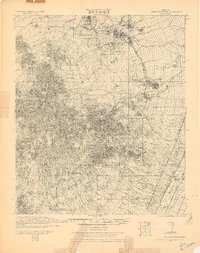
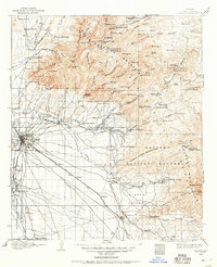 1904 Tucson1957 Print · USGSTucson and its surrounding desert basins are captured here at the turn of the century as the railroad transformed this Pima County landscape. Genealogists and historians can locate early family holdings like Carrillos Ranch, the site of Old Fort Lowell, and the remote Loma Verde Mines.
 - 1905 Map of Patagonia
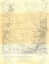
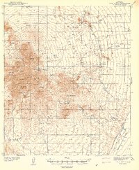
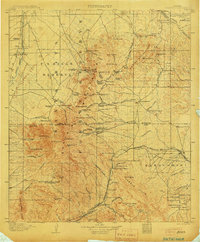 1905 Patagonia1905 Print · USGSSouthern Arizona’s mining and ranching frontier is captured here at the start of the twentieth century. Genealogists and historians can trace numerous family homesteads and active mining sites, from Empire Ranch and Helvetia to the curiously named Total Wreck Mine.4 unique versions available
 - 1905 Map of Tucson
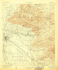 1905 Tucson1905 Print · USGSEarly 1900s Tucson is shown here as a railway hub at the base of the Rincon and Santa Catalina mountains. Genealogists and historians can trace numerous family homesteads like Pusch's Ranch, explore Old Fort Lowell, or locate the Loma Verde Mines.5 unique versions available
 - 1920 Map of Arivaca
 1920 Arivaca1920 Print · USGSSouthern Arizona ranching and mining country comes into focus in this post-World War I survey of the Santa Cruz Valley. Trace family roots and early industry near the Tumacacori Mission, Oceanic Mine, and the village of Arivaca.
 - 1925 Map of Samaniego Peak
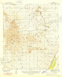
 1925 Samaniego Peak1925 Print · USGSIn the mid-twenties, this Pima County landscape was a mix of isolated desert homesteads and active mining operations. Genealogists and historians can trace family-named locations like Perones Ranch and Mendoza Ranch or explore the rail-and-ore history of the Southern Pacific Railroad.
 - 1926 Map of Helvetia
 1926 Helvetia1926 Print · USGSSouthern Arizona in the mid-twenties shows a landscape of cattle ranches and high-desert outposts. Researchers can trace family-named sites like Stone's Ranch and Mc Cleary's Ranch or explore early settlements such as Helvetia and Greaterville.
 - 1939 Map of Twin Buttes
 1939 Twin Buttes1939 Print · USGSPima County ranching and mining life are captured in the late 1930s as family outposts spread across the Sierrita foothills. Genealogists and historians can trace legacy holdings from Pino Blanco Ranch to Canoa Ranch, alongside the isolated McGee Sch and the San Xavier mine.2 unique versions available
 - 1941 Map of Twin Buttes
 1941 Twin Buttes1941 Print · USGSSouthern Arizona ranching and mining culture is well-documented in this late-1930s survey of the Sierrita foothills. Researchers can locate the McGee Sch, the rails of the Southern Pacific RR, and family-named landmarks like Canoa Ranch and Harris Ranch.
 - 1948 Map of Twin Buttes
 1948 Twin Buttes1948 Print · USGSPima County's ranching and mining heart is captured here in the late 1930s, showing the high desert before modern development. Trace family landholdings and rural hubs like Soto Ranch, McGee Sch, and the riverside rail stop at Canoa.2 unique versions available
 - 1948 Map of Tucson
 1948 Tucson1948 Print · USGSTucson and its desert surroundings are seen here in the late 1940s as the city began expanding toward its major military and aviation hubs. Genealogists and local historians can trace legacy sites like Yaqui Village, Davis-Monthan Field, and the Benedictine Convent before urban growth transformed the valley.
 - 1956 Map of Nogales, 1963 Print
 1956 Nogales1963 Print · USGSSouthern Arizona in the mid-fifties is captured here from the Papago tribal lands to the San Pedro valley. Genealogists and historians can trace border settlements like Sasabe, the legacy of Tombstone, and old mining sites including the Mary G Mine.4 unique versions available
 - 1956 Map of Tucson, 1967 Print
 1956 Tucson1967 Print · USGSPost-war Southern Arizona comes into focus as the copper and aviation industries expand around Tucson. Trace family roots in South Tucson or locate early mining sites like the San Manuel Mine and Silver Bell Mine near the Santa Cruz River.3 unique versions available
 - 1957 Map of Twin Buttes, 1958 Print
 1957 Twin Buttes1958 Print · USGSSouthern Arizona in the late fifties shows a landscape of expansive cattle ranches and growing industrial copper mines. Genealogists and historians can trace family-named holdings like McGee Ranch or explore the operations at Banner Mine and San Xavier.4 unique versions available
 - 1957 Map of Tucson, 1958 Print
 1957 Tucson1958 Print · USGSMid-century Tucson is shown during a period of rapid desert expansion and military growth. Genealogists and historians can trace family-named sites like Franco Ranch, local landmarks such as Sentinel Peak, and the development of Vandenberg Village.2 unique versions available
 - 1958 Map of Nogales
 1958 Nogales1958 Print · USGSSouthern Arizona in the late fifties was a landscape of international borders and high-desert outposts, dominated by the Huachuca Mountains and the Papago Indian Reservation. Local historians can trace old mining camps like Ruby and Greaterville or locate historic military grounds at the Fort Huachuca Military Reservation.
 - 1958 Map of Tucson
 1958 Tucson1958 Print · USGSSouthern Arizona in the late fifties reveals a landscape of desert agriculture and rising military aviation. Trace the rail lines of the Southern Pacific or locate the historic San Xavier Del Bac Mission and the Casa Grande Natl Mon.
 - 1958 Map of Sahuarita, 1959 Print
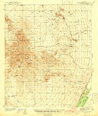
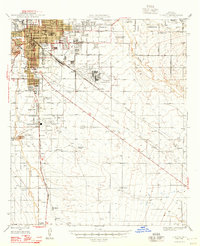
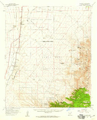 1958 Sahuarita1959 Print · USGSThe Pima County desert and mountain foothills come into focus in the late fifties, showing the expanding reach of federal land use. Researchers can locate family ranches like Johnson Ranch and historic mining sites near Helvetia or the settlement of Greaterville.3 unique versions available
 - 1959 Map of Tucson
 1959 Tucson1959 Print · USGSSouthern Arizona in the late fifties shows a landscape of military growth and desert industry. Genealogists and historians can trace the footprint of Davis-Monthan Air Force Base and old mining sites like the San Manuel Mine near Mammoth.2 unique versions available
 - 1959 Map of Nogales
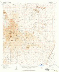
 1959 Nogales1959 Print · USGSThe Southern Arizona borderlands appear in the late fifties as a complex landscape of military ranges, tribal lands, and high-desert mining towns. Local historians can trace the Southern Pacific rail lines connecting Tombstone and Benson or locate family ranches such as Canoa Ranch.
 - 1962 Map of Tucson
 1962 Tucson1962 Print · USGSSouthern Arizona in the early sixties showcases a landscape defined by burgeoning desert cities and massive military installations. Researchers can trace tribal settlements like Schuchk, legacy mining sites at Silver Bell Mine, and the early footprint of Davis-Monthan Air Force Base.
 - 1964 Map of Tucson
 1964 Tucson1964 Print · USGSSouthern Arizona in the mid-1960s shows a landscape of burgeoning desert cities and industrial-scale copper mining. Researchers can trace the development of Tucson and its outlying mining districts, including the Silver Bell Mine and San Manuel Mine.
 - 1968 Map of Tucson SW, 1969 Print
 1968 Tucson SW1969 Print · USGSSouth of the Tucson city limits in the late sixties, this aerial survey captures the desert valley as it transitioned between traditional ranching and modern aviation. Genealogists and researchers can trace the limits of the San Xavier Indian Reservation and locate landmarks like Martinez Hill and the Tucson International Airport.3 unique versions available
 - 1981 Map of Twin Buttes
 1981 Twin Buttes1981 Print · USGSArizona's copper industry was at its peak in the early 1980s, defining the landscape south of Tucson through massive open-pit operations. Researchers can trace the industrial layout of the Mission Mine and locate local landmarks like the Twin Buttes Cem and Demetrie.2 unique versions available
 - 1981 Map of Sahuarita, 1982 Print
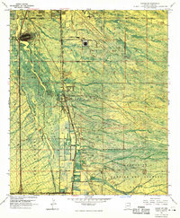
 1981 Sahuarita1982 Print · USGSThe Santa Cruz Valley in the early eighties reveals a desert landscape transitioning from ranching to mining and suburban development. Genealogists and historians can trace the growth of Sahuarita and Green Valley alongside the Southern Pacific rails.2 unique versions available
Showing maps 1-25 of 50
Top cities near Sahuarita
Top neighborhoods of Sahuarita
Frequently asked questions
- What are the different types of historical maps available for Sahuarita?
- What is the oldest map of Sahuarita?
- Where can I purchase historical maps of Sahuarita for my home or office?
- Where can I download high-res historical maps of Sahuarita?
- Are there historical topographic maps available for Sahuarita?
- Is there historical aerial imagery available for Sahuarita?
- Where are historical maps of Sahuarita sourced from?