1960s Maps of Schuk Toak District, Arizona
Explore 4 historic maps of Schuk Toak District from the 1960s. These maps offer a rare glimpse into what life looked like during the 1960s — showing old roads, neighborhoods, homes, and landmarks that have changed or disappeared over time.
Whether you're researching your family's past, planning a metal detecting trip, or studying how Schuk Toak District's landscape evolved across the 1960s, these high-resolution maps are a powerful tool for exploring the history of this region.
- Focus on a specific era: All maps on this page are from the 1960s, giving you a focused view of this time period.
- See what’s changed: Compare century-old streets, trails, and buildings to today's modern landscape using overlays and satellite layers.
- Research with precision: Use these maps for genealogy, historical research, land use analysis, or educational projects.
- View, download, or print: Maps are fully viewable online in high resolution, and can be downloaded or printed for your own records.
Start exploring Schuk Toak District's history through authentic maps from the 1960s. This is your window into the past.
Schuk Toak District, AZ maps
(4)- 1962 Map of Tucson
 1962 Tucson1962 Print · USGSSouthern Arizona in the early sixties showcases a landscape defined by burgeoning desert cities and massive military installations. Researchers can trace tribal settlements like Schuchk, legacy mining sites at Silver Bell Mine, and the early footprint of Davis-Monthan Air Force Base.
 - 1963 Map of Santa Rosa Mountains, 1964 Print
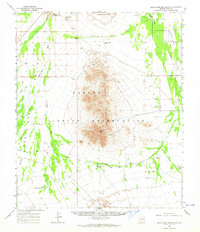 1963 Santa Rosa Mountains1964 Print · USGSThe Papago Indian Reservation is captured in the early sixties, showing a landscape defined by isolated wells and mountain peaks. Researchers can locate remote desert outposts such as Komelik and Hot Oidak or trace historic routes along Tat Momoli Wash.2 unique versions available
 - 1964 Map of Tucson
 1964 Tucson1964 Print · USGSSouthern Arizona in the mid-1960s shows a landscape of burgeoning desert cities and industrial-scale copper mining. Researchers can trace the development of Tucson and its outlying mining districts, including the Silver Bell Mine and San Manuel Mine.
 - 1968 Map of Brown Mountain, 1969 Print
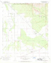 1968 Brown Mountain1969 Print · USGSThe Tucson Mountains and Avra Valley come alive in this late-sixties survey of the Pima County desert. Genealogists and historians can trace desert settlements and landmarks like Old Tucson, the historic Phillips Ranch, and the airfield at Ryan Field.3 unique versions available
End of results
Showing maps 1-4 of 4
Top neighborhoods of Schuk Toak District
- Quinlin historical maps
- Nawt Vaya historical maps
- San Pedro historical maps
- Uhs Kug historical maps
- San Vicente historical maps
- Queens Well historical maps
See more
Frequently asked questions
- What are the different types of historical maps available for Schuk Toak District?
- What is the oldest map of Schuk Toak District?
- Where can I purchase historical maps of Schuk Toak District for my home or office?
- Where can I download high-res historical maps of Schuk Toak District?
- Are there historical topographic maps available for Schuk Toak District?
- Is there historical aerial imagery available for Schuk Toak District?
- Where are historical maps of Schuk Toak District sourced from?