1970s Maps of Schuk Toak District, Arizona
Explore 15 historic maps of Schuk Toak District from the 1970s. These maps offer a rare glimpse into what life looked like during the 1970s — showing old roads, neighborhoods, homes, and landmarks that have changed or disappeared over time.
Whether you're researching your family's past, planning a metal detecting trip, or studying how Schuk Toak District's landscape evolved across the 1970s, these high-resolution maps are a powerful tool for exploring the history of this region.
- Focus on a specific era: All maps on this page are from the 1970s, giving you a focused view of this time period.
- See what’s changed: Compare century-old streets, trails, and buildings to today's modern landscape using overlays and satellite layers.
- Research with precision: Use these maps for genealogy, historical research, land use analysis, or educational projects.
- View, download, or print: Maps are fully viewable online in high resolution, and can be downloaded or printed for your own records.
Start exploring Schuk Toak District's history through authentic maps from the 1970s. This is your window into the past.
Schuk Toak District, AZ maps
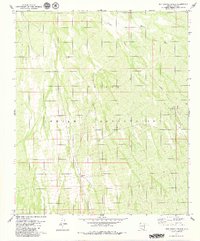
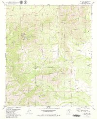
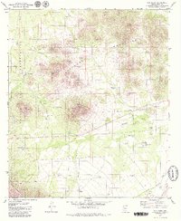
(15)- 1978 Map of Sil Nakya
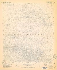 1978 Sil Nakya1978 Print · USGSThe Papago Indian Reservation in the late 1970s showcases a landscape of isolated desert settlements and vital water sources. Genealogists and historians can trace the foundations of the community through the St Agatha Mission, the local Cem, and rural outposts like Sil Nakya.
 - 1978 Map of San Ignacio Ranch, 1979 Print
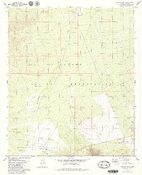
 1978 San Ignacio Ranch1979 Print · USGSThe Pima County desert in the late seventies is shown here as a landscape of remote ranching and tribal lands. Researchers can locate the San Ignacio Ranch and its associated Corrals, alongside a small Cem near the banks of Aguirre Wash.
 - 1978 Map of San Juan Spring, 1979 Print
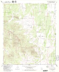
 1978 San Juan Spring1979 Print · USGSThe Baboquivari Mountains and the desert plains of the Papago Indian Reservation come to life in the late seventies. Genealogists and historians can trace desert settlements like Gu Chuapo, locate the Pavo Kug (Ruins), and find remote landmarks like San Juan Spring.
 - 1979 Map of Sells East
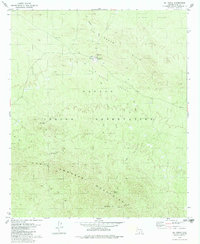
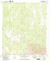
 1979 Sells East1979 Print · USGSThe Papago Indian Reservation in the late seventies reveals a desert landscape organized around essential water sources and mountain foothills. Researchers can trace community development from the hub of Sells to Our Lady of Lourdes Mission and find old mining sites like the Jaeger Mine.2 unique versions available
 - 1979 Map of San Ignacio Ranch
 1979 San Ignacio Ranch1979 Print · USGSPima County ranching and reservation lands are captured in the mid-1970s, showing a landscape defined by seasonal water and remote outposts. Genealogists and historians can locate the San Ignacio Ranch and trace vital water sources like the Well and Viopuli Wash.
 - 1979 Map of Black Hills
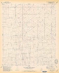
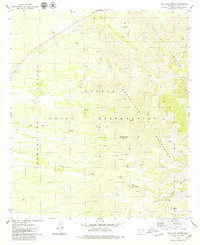
 1979 Black Hills1979 Print · USGSThe Papago Indian Reservation in the late seventies reveals a high-desert terrain shaped by seasonal water and ranching. Researchers can trace land markers like Coyote Field, the winding Anegan Wash, and the distinct elevations of Proctor Hill.
 - 1979 Map of Sil Nakya
 1979 Sil Nakya1979 Print · USGSThe Papago Indian Reservation is captured here in the late 1970s, focused on the high-desert terrain of the North Comobabi Mountains. Genealogists and historians can locate the St Agatha Mission, burial grounds at Cem, and desert water sources like Frog Well.
 - 1979 Map of Comobabi
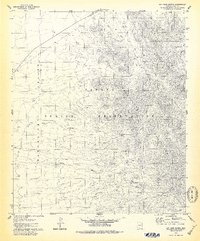
 1979 Comobabi1979 Print · USGSThe Papago Indian Reservation comes into focus during the late 1970s, showcasing a landscape of desert mountains and isolated settlements. Researchers can trace the trails around Ko Vaya or locate the Emperor and Duchess Mine and local Cem.
 - 1979 Map of Kitt Peak
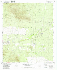
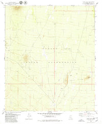
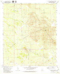
 1979 Kitt Peak1979 Print · USGSThe high desert of Pima County comes into focus in the late 1970s, centered on the specialized scientific community atop the Quinlan Mountains. Researchers can locate specialized sites like the Kitt Peak National Observatory, the Uhs Kug (Site), and the remote Hay Hook Ranch.3 unique versions available
 - 1979 Map of La Tortuga Butte
 1979 La Tortuga Butte1979 Print · USGSThe Roskruge Mountains and the Papago Indian Reservation are captured here in the late seventies. Researchers can trace remote desert water sources like La Tortuga Well, locate the Graves site, and follow old Pack Trails through Aguirre Pass.2 unique versions available
 - 1979 Map of Pan Tak
 1979 Pan Tak1979 Print · USGSMid-century desert life in Pima County is centered here on the Papago Indian Reservation during the late seventies. Genealogists and historians can trace the settlement of Pan Tak, locate isolated water sources like Dobbs Well, and identify mining sites such as the Roadside Mine.2 unique versions available
 - 1979 Map of San Juan Spring
 1979 San Juan Spring1979 Print · USGSThe Papago Indian Reservation comes into focus during the late 1970s, showcasing a landscape of high desert basins and mountain canyons. Researchers can locate remote water sources and historical sites like Pavo Kug (Ruins), San Juan Spring, and Chuapo.
 - 1979 Map of San Pedro
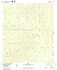
 1979 San Pedro1979 Print · USGSPima County ranching and desert life are documented here during the late seventies within the Papago Indian Reservation. Local historians can trace family sites at San Pedro, U-Diamond Ranch, and the Cem near the Roskruge Mountains.3 unique versions available
 - 1979 Map of Haivana Nakya
 1979 Haivana Nakya1979 Print · USGSThe Papago Indian Reservation comes into focus during the late 1970s, showcasing a landscape defined by desert ranching and mountain foothills. Researchers can trace remote settlements like Haivana Nakya, old ranch sites at Santa Rosa Ranch, and the complex drainage of Anegan Wash.2 unique versions available
 - 1979 Map of Cocoraque Butte, 1980 Print
 1979 Cocoraque Butte1980 Print · USGSThe Pima County desert landscape of the late 1970s centers on the Papago Indian Reservation and the rising slopes of the Roskruge Mountains. Genealogists and local historians can trace family-named sites like Santa Rita Ranch and Donaldson Ranch alongside an old desert Cem.
End of results
Showing maps 1-15 of 15
Top neighborhoods of Schuk Toak District
- Quinlin historical maps
- Nawt Vaya historical maps
- San Pedro historical maps
- Uhs Kug historical maps
- San Vicente historical maps
- Queens Well historical maps
See more
Frequently asked questions
- What are the different types of historical maps available for Schuk Toak District?
- What is the oldest map of Schuk Toak District?
- Where can I purchase historical maps of Schuk Toak District for my home or office?
- Where can I download high-res historical maps of Schuk Toak District?
- Are there historical topographic maps available for Schuk Toak District?
- Is there historical aerial imagery available for Schuk Toak District?
- Where are historical maps of Schuk Toak District sourced from?