Old Maps of Schuk Toak District, Arizona for Hiking & Exploration
Hike through history with 158 historic maps of Schuk Toak District. Explore old trails, ghost towns, and forgotten backroads — perfect for outdoor adventurers and local explorers.
- Rediscover forgotten places: Map out old mining camps, roads, and footpaths that no longer exist on modern maps.
- Layer with modern tools: Combine with LiDAR or satellite views to plan hikes through historical terrain.
- Made for exploration: Popular among hikers, overlanders, and local history lovers.
Use these maps to find adventure and explore the hidden past of Schuk Toak District.
Schuk Toak District, AZ maps
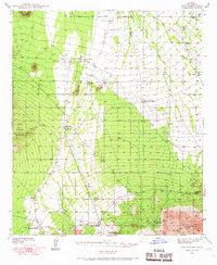
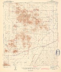
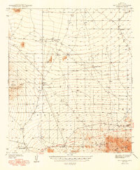
(158)- 1925 Map of San Xavier
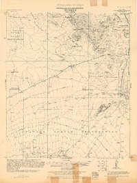 1925 San Xavier1925 Print · USGSThe Tucson area and the Papago Indian Reservation come to life in this mid-1920s survey. Researchers can trace family-named homesteads such as Kubils Ranch and Coronado Ranch alongside industrial sites like the Arizona Group Mines.
 - 1934 Map of Tucson Mountains
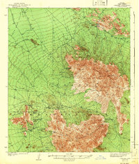
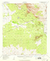
 1934 Tucson Mountains1934 Print · USGSThe desert northwest of Tucson comes into focus during the mid-1930s, showing the early footprints of the Papago Indian Reservation and the railroad corridor. Genealogists and historians can trace family-named sites and ranching outposts like Maisi Ayra Ranch, Rodriguez, and the Maish Roadside Mine.
 - 1934 Map of Silver Bell
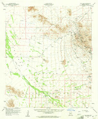
 1934 Silver Bell1934 Print · USGSPima County at the height of the New Deal era reveals a sparse network of desert settlements and remote mines. Genealogists and historians can trace the footprint of the Papago Indian Reservation through its small villages like Santa Cruz and industrial sites like the Roadside Mine.
 - 1937 Map of Comobabi
 1937 Comobabi1937 Print · USGSPima County's high-desert mining and tribal lands are captured in the late 1930s, showing the early infrastructure of the Papago Indian Reservation. Trace the locations of isolated mining operations like the Cobabi Mine and settlements at San Luis and Nolic.4 unique versions available
 - 1938 Map of San Vicente, 1967 Print
 1938 San Vicente1967 Print · USGSThe high desert of Pima County comes into focus during the late 1930s, showcasing a network of remote ranching outposts and indigenous settlements. Researchers can trace the early Ajo-Tucson Highway to sites like Schuchk and the Roadside Mine.
 - 1941 Map of San Vicente
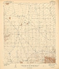 1941 San Vicente1941 Print · USGSPima County ranching and tribal lands are captured in the late 1930s before modern development altered this desert landscape. Genealogists and historians can trace family-named sites like San Ignacio Ranch and settlements including San Vicente and Haivana Nakya.
 - 1941 Map of Cocoraque Butte, 1942 Print
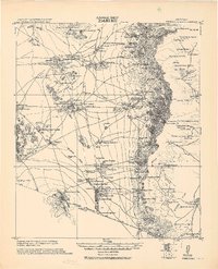
 1941 Cocoraque Butte1942 Print · USGSPima County ranching and reservation life are captured here in the early 1940s, just as the local road network began to stabilize. Researchers can trace historic property boundaries and desert outposts like Cocoraque Ranch, Robles Junction, and the indigenous settlement of Viopuli.2 unique versions available
 - 1941 Map of Baboquivari Peak, 1955 Print
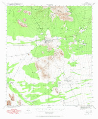
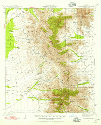 1941 Baboquivari Peak1955 Print · USGSArizona's Tohono O'odham lands come alive in this wartime survey, showing the deep connection between ranching families and the desert landscape. Genealogists and historians can trace the locations of the Allison Mine, Fresnal Canyon School, and numerous holdings like Otero Ranch.3 unique versions available
 - 1941 Map of Sells, 1969 Print
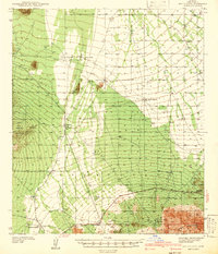
 1941 Sells1969 Print · USGSThe Papago Indian Reservation in the early 1940s reveals a desert landscape of ancestral villages and active mining. Trace family roots and desert trails through Sells, Topawa, and the historic San Solano Mission.
 - 1942 Map of San Vicente
 1942 San Vicente1942 Print · USGSThe Sonoran desert landscape of Pima County is captured here in the late 1930s, showing the early ranching and mining infrastructure of the Papago Indian Reservation. Genealogists and historians can locate remote outposts like San Ignacio Ranch, Wattle Hut, and the Roadside Mine.
 - 1942 Map of Comobabi
 1942 Comobabi1942 Print · USGSThe Papago Indian Reservation comes into focus during the late 1930s, showing a network of remote desert settlements and scattered mountain mines. Genealogists and historians can trace the foundations of Sil Nakya, Ko Vaya, and mining sites like the Picacho Mine.2 unique versions available
 - 1943 Map of Sells
 1943 Sells1943 Print · USGSThe Papago Indian Reservation in the early 1940s reveals a desert landscape of traditional settlements and active mining. Genealogists and historians can trace family roots through the San Solano Mission, Topawa P O, and villages like Artesa or Ali Chuk Son.4 unique versions available
 - 1943 Map of Cocoraque Butte
 1943 Cocoraque Butte1943 Print · USGSThe Papago Indian Reservation and Pima County ranchlands are documented here in the early 1940s during a period of transition for desert travel. Researchers can trace historic family holdings like Dill Ranch and Cocoraque Ranch or locate the old Three Points Sch.3 unique versions available
 - 1943 Map of Fresnal
 1943 Fresnal1943 Print · USGSSouthern Arizona’s borderlands and tribal territories are captured here in the 1940s, shortly after the height of early mining efforts. Researchers can trace ancestral connections in villages like Indian Oasis or locate vanished industrial sites like the Golden Age Mine & Mill.
 - 1943 Map of San Xavier Mission
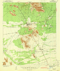
 1943 San Xavier Mission1943 Print · USGSThe desert landscape southwest of Tucson was a mix of sacred sites and cattle ranches in the early 1940s. Genealogists and historians can trace the foundations of the San Xavier del Bac Mission and locate old homesteads like Triple C Ranch and Robles Well.3 unique versions available
 - 1944 Map of Baboquivari Peak
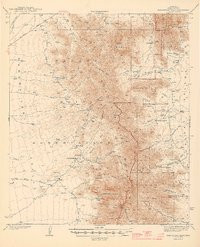 1944 Baboquivari Peak1944 Print · USGSThe Papago Indian Reservation in the early 1940s reveals a landscape of isolated ranches and tribal settlements. Genealogists can trace family holdings like Otero Ranch or locate the Fresnal Canyon Sch and the Allison Mine near the base of Baboquivari Peak.2 unique versions available
 - 1948 Map of San Vicente
 1948 San Vicente1948 Print · USGSWithin the Papago Indian Reservation in the late thirties, this survey shows a resilient desert landscape of cattle tanks and remote ranching outposts. Trace the locations of Havana Nakya, the Roadside Mine, and the Ajo-Tucson Highway as they appeared before mid-century growth.2 unique versions available
 - 1956 Map of Nogales, 1963 Print
 1956 Nogales1963 Print · USGSSouthern Arizona in the mid-fifties is captured here from the Papago tribal lands to the San Pedro valley. Genealogists and historians can trace border settlements like Sasabe, the legacy of Tombstone, and old mining sites including the Mary G Mine.4 unique versions available
 - 1956 Map of Tucson, 1967 Print
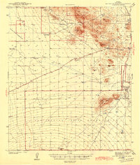
 1956 Tucson1967 Print · USGSPost-war Southern Arizona comes into focus as the copper and aviation industries expand around Tucson. Trace family roots in South Tucson or locate early mining sites like the San Manuel Mine and Silver Bell Mine near the Santa Cruz River.3 unique versions available
 - 1957 Map of San Xavier Mission, 1958 Print
 1957 San Xavier Mission1958 Print · USGSThe desert landscape south of Tucson comes alive in the late fifties, dominated by the Tucson Mountains and the Santa Cruz River valley. Genealogists and historians can trace the foundations of the San Xavier del Bac Mission, the Arizona-Sonora Desert Museum, and early regional airstrips like Ryan Field.2 unique versions available
 - 1958 Map of Nogales
 1958 Nogales1958 Print · USGSSouthern Arizona in the late fifties was a landscape of international borders and high-desert outposts, dominated by the Huachuca Mountains and the Papago Indian Reservation. Local historians can trace old mining camps like Ruby and Greaterville or locate historic military grounds at the Fort Huachuca Military Reservation.
 - 1958 Map of Tucson
 1958 Tucson1958 Print · USGSSouthern Arizona in the late fifties reveals a landscape of desert agriculture and rising military aviation. Trace the rail lines of the Southern Pacific or locate the historic San Xavier Del Bac Mission and the Casa Grande Natl Mon.
 - 1959 Map of Tucson
 1959 Tucson1959 Print · USGSSouthern Arizona in the late fifties shows a landscape of military growth and desert industry. Genealogists and historians can trace the footprint of Davis-Monthan Air Force Base and old mining sites like the San Manuel Mine near Mammoth.2 unique versions available
 - 1959 Map of Nogales
 1959 Nogales1959 Print · USGSThe Southern Arizona borderlands appear in the late fifties as a complex landscape of military ranges, tribal lands, and high-desert mining towns. Local historians can trace the Southern Pacific rail lines connecting Tombstone and Benson or locate family ranches such as Canoa Ranch.
 - 1959 Map of Vaca Hills, 1961 Print
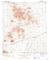
 1959 Vaca Hills1961 Print · USGSArizona's copper country comes into focus in the late 1950s as massive open-pit operations reshape the West Silver Bell Mountains. Genealogists and industrial historians can trace the Silver Bell (Site), the Daisy Shaft, and an Old Railroad Grade used for hauling ore.2 unique versions available
Showing maps 1-25 of 158
Top neighborhoods of Schuk Toak District
- Quinlin historical maps
- Nawt Vaya historical maps
- San Pedro historical maps
- Uhs Kug historical maps
- San Vicente historical maps
- Queens Well historical maps
See more
Frequently asked questions
- What are the different types of historical maps available for Schuk Toak District?
- What is the oldest map of Schuk Toak District?
- Where can I purchase historical maps of Schuk Toak District for my home or office?
- Where can I download high-res historical maps of Schuk Toak District?
- Are there historical topographic maps available for Schuk Toak District?
- Is there historical aerial imagery available for Schuk Toak District?
- Where are historical maps of Schuk Toak District sourced from?