Old Maps of Santa Cruz County, Arizona for Hiking & Exploration
Hike through history with 235 historic maps of Santa Cruz County. Explore old trails, ghost towns, and forgotten backroads — perfect for outdoor adventurers and local explorers.
- Rediscover forgotten places: Map out old mining camps, roads, and footpaths that no longer exist on modern maps.
- Layer with modern tools: Combine with LiDAR or satellite views to plan hikes through historical terrain.
- Made for exploration: Popular among hikers, overlanders, and local history lovers.
Use these maps to find adventure and explore the hidden past of Santa Cruz County.
Santa Cruz County, AZ maps
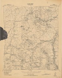
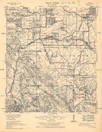
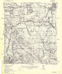
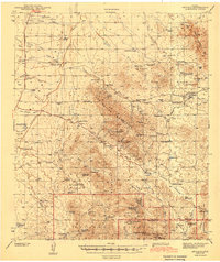
(235)- 1904 Map of Patagonia, 1955 Print
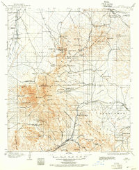 1904 Patagonia1955 Print · USGSArizona's mining and ranching frontiers are at their peak in this early century survey of the Santa Rita Mountains. Genealogists and historians can trace family operations at the Empire Ranch or the Total Wreck Mine, and locate the site of Old Ft Crittenden.
 - 1905 Map of Patagonia
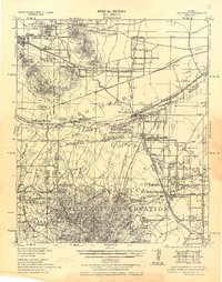
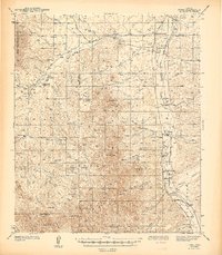
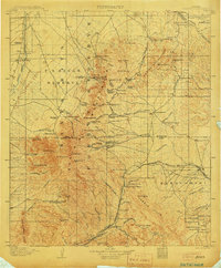 1905 Patagonia1905 Print · USGSSouthern Arizona’s mining and ranching frontier is captured here at the start of the twentieth century. Genealogists and historians can trace numerous family homesteads and active mining sites, from Empire Ranch and Helvetia to the curiously named Total Wreck Mine.4 unique versions available
 - 1905 Map of Nogales
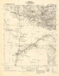
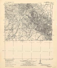
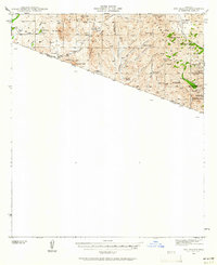
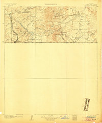 1905 Nogales1905 Print · USGSThe Arizona-Mexico borderlands are captured here at the height of the mining boom and the expansion of the Southern Pacific RR. Genealogists and historians can trace family landholdings from Calabasas to Lochiel or locate remote sites like The Mowry Mine and Fuller's Ranch.4 unique versions available
 - 1914 Map of Hereford
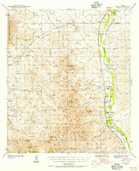
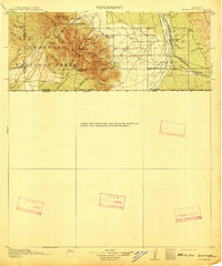 1914 Hereford1914 Print · USGSUpper Cochise County reveals its early ranching and mining character just before the Great War. Genealogists and historians can trace remote mountain settlements like Sunnyside and Hamburg or the railway path of the El Paso and Southwestern.3 unique versions available
 - 1915 Map of Benson
 1915 Benson1915 Print · USGSSouthern Arizona was a landscape of rail junctions and mining claims just before the Great War. Genealogists and historians can trace the reach of Tombstone, find the Panama Mine, and locate vanished rail stops like Fairbank and Boquillas.4 unique versions available
 - 1920 Map of Arivaca
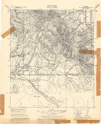
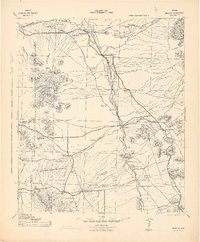
 1920 Arivaca1920 Print · USGSSouthern Arizona ranching and mining country comes into focus in this post-World War I survey of the Santa Cruz Valley. Trace family roots and early industry near the Tumacacori Mission, Oceanic Mine, and the village of Arivaca.
 - 1921 Map of Old Glory
 1921 Old Glory1921 Print · USGSThe Arizona borderlands appear as a network of cattle ranches and mining outposts in this early twentieth-century military reconnaissance. Genealogists and historians can trace family operations like Lopez, Alamito Ranch, and the Old Glory Mine.2 unique versions available
 - 1922 Map of Agus Caliente
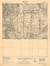
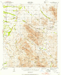
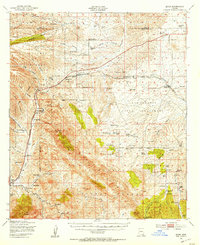
 1922 Agus Caliente1922 Print · USGSThe Santa Rita Mountains of Southern Arizona appear here in the early twenties during a period of active mountain mining and ranching. Genealogists and historians can trace family sites like Wise's Ranch or find old operations at the Mansfield Mines and Montosa Mill.
 - 1922 Map of Sunnyside, 1926 Print
 1922 Sunnyside1926 Print · USGSThe Arizona-Mexico border comes alive in the 1920s, showing the high country of the Huachucas before modern development. Genealogists and researchers can locate remote outposts like Sunnyside, trace the Southern Pacific Railroad, and find the Carr Canyon School.
 - 1932 Map of Lochiel
 1932 Lochiel1932 Print · USGSThe Arizona-Mexico borderlands come alive in this early 1930s survey of the high desert and San Rafael Valley. Researchers can trace family ranching legacies at Stevensons Ranch or explore the mining history of The Mowry Mine and Harshaw.2 unique versions available
 - 1932 Map of Elgin
 1932 Elgin1932 Print · USGSSanta Cruz County ranching culture is on full display in the early 1930s as the Southern Pacific rail line winds through the high desert. Genealogists can trace family landmarks like Gardner's Ranch and Turner-Bower Ranch or locate the site of Old Ft Crittenden.
 - 1933 Map of Calabasas
 1933 Calabasas1933 Print · USGSNogales and the Santa Cruz River valley are shown here in the 1930s, documenting a critical era of border history and ranching. Trace early landmarks like Camp Stephen D. Little, the 3R Mine, and historic family lands at Buena Vista Ranch.2 unique versions available
 - 1938 Map of Huachuca
 1938 Huachuca1938 Print · USGSSoutheastern Arizona's military and ranching landscape is captured here in the late thirties, centered on the historic Fort Huachuca. Genealogists and historians can trace early family holdings like Pyeatt Ranch and Mc Beanes, or locate the Manua Panama Mine and the Evans School.
 - 1938 Map of Sunnyside
 1938 Sunnyside1938 Print · USGSThe Arizona borderlands near the Santa Cruz and Cochise county line are shown here in the years before the second World War. Researchers can trace the layout of Fort Huachuca and locate remote outposts like the Montezuma Mine, Sunnyside, and the R.O. Cattle Co.2 unique versions available
 - 1939 Map of Tubac, 1956 Print
 1939 Tubac1956 Print · USGSSouthern Arizona ranching and valley life come into focus just before the war, centered on the Santa Cruz River corridor. Genealogists and historians can trace family locations from the Santa Lucia Ranch to Arivaca Junction, and locate the Sopori Sch near Amado.
 - 1940 Map of Elgin
 1940 Elgin1940 Print · USGSSoutheastern Arizona ranching country is shown here just before the mid-century, where the Southern Pacific railroad connects remote desert outposts. Researchers can locate early family homesteads like Gardner's Ranch and Rodgers Ranch alongside the historic site of Old Ft. Crittenden.
 - 1941 Map of Arivaca, 1956 Print
 1941 Arivaca1956 Print · USGSIn the early 1940s, this southern Arizona cattle and mining district centered around Arivaca and its surrounding family ranches. Trace the legacy of desert prospecting at the Las Guijas Mine or locate historic homesteads like Canoa Ranch and Montana Ranch.2 unique versions available
 - 1942 Map of Ruby
 1942 Ruby1942 Print · USGSThe Arizona-Mexico borderlands during the early 1940s reveal a landscape of remote mining claims and family-run cattle operations. Trace the history of the Dos Amigos Mine, the Pena Blanca CCC CAMP, and the settlement of Ruby amidst the high desert peaks.3 unique versions available
 - 1942 Map of Oro Blanco, 1961 Print
 1942 Oro Blanco1961 Print · USGSThe Arizona-Mexico borderlands come to life in this early 1940s survey of Santa Cruz County. Genealogists and historians can trace the legacy of the local mining boom through sites like Oro Blanco and the Old Glory Mine, alongside working spreads such as Garcia Ranch.3 unique versions available
 - 1943 Map of Benson
 1943 Benson1943 Print · USGSCochise County during the wartime 1940s reveals a landscape defined by the San Pedro River and the legendary town of Tombstone. Genealogists and historians can trace the foundations of Fort Huachuca and locate rural landmarks like St David, Fairbank, and Huachuca Turner PO.
 - 1943 Map of Arivaca
 1943 Arivaca1943 Print · USGSIn the early 1940s, this pocket of Pima County was a hub of hard-rock mining and cattle ranching. Researchers can trace family history through sites like Arivaca Ranch, find a lonely Cemetery, or locate dozens of mines including the Las Guijas Mine and Ajax Mine.3 unique versions available
 - 1943 Map of Old Glory
 1943 Old Glory1943 Print · USGSThe Arizona-Mexico borderlands come into focus in this mid-century reconnaissance, capturing the mining and ranching life of the high desert. Researchers can trace the locations of Old Glory Mine, Ruby P.O. (Montana), and historic outposts like Tres Bellotas.
 - 1943 Map of Tubac
 1943 Tubac1943 Print · USGSThe Santa Cruz River valley comes alive in the late 1930s, documenting the vital transport corridor through Tubac and Amado. Genealogists and historians can trace family-run operations like Moyza Ranch or locate the Sopori Sch and Tumacacori National Monument.3 unique versions available
 - 1944 Map of Oro Blanco
 1944 Oro Blanco1944 Print · USGSThe Arizona-Mexico borderlands are captured here in the early 1940s, highlighting a landscape transition from active mining to remote ranching. Genealogists and historians can locate old claims like the Yellow Jacket Mine and family sites like Garcia Ranch.2 unique versions available
 - 1947 Map of Elgin, 1953 Print
 1947 Elgin1953 Print · USGSSanta Cruz and Pima Counties are seen here in the late 1940s as a landscape of sprawling cattle ranches and historic frontier outposts. Genealogists and historians can locate family landmarks like Hacienda Los Encinos alongside the Old Fort Buchanan Ruins and Dunham Mine.2 unique versions available
Showing maps 1-25 of 235
Top cities of Santa Cruz County
- Nogales historical maps
- Town of Patagonia historical maps
- Sonoita historical maps
- Amado historical maps
Frequently asked questions
- What are the different types of historical maps available for Santa Cruz County?
- What is the oldest map of Santa Cruz County?
- Where can I purchase historical maps of Santa Cruz County for my home or office?
- Where can I download high-res historical maps of Santa Cruz County?
- Are there historical topographic maps available for Santa Cruz County?
- Is there historical aerial imagery available for Santa Cruz County?
- Where are historical maps of Santa Cruz County sourced from?