1950s Maps of Sonoita, Arizona
Explore 9 historic maps of Sonoita from the 1950s. These maps offer a rare glimpse into what life looked like during the 1950s — showing old roads, neighborhoods, homes, and landmarks that have changed or disappeared over time.
Whether you're researching your family's past, planning a metal detecting trip, or studying how Sonoita's landscape evolved across the 1950s, these high-resolution maps are a powerful tool for exploring the history of this region.
- Focus on a specific era: All maps on this page are from the 1950s, giving you a focused view of this time period.
- See what’s changed: Compare century-old streets, trails, and buildings to today's modern landscape using overlays and satellite layers.
- Research with precision: Use these maps for genealogy, historical research, land use analysis, or educational projects.
- View, download, or print: Maps are fully viewable online in high resolution, and can be downloaded or printed for your own records.
Start exploring Sonoita's history through authentic maps from the 1950s. This is your window into the past.
Sonoita, AZ maps
(9)- 1956 Map of Nogales, 1963 Print
 1956 Nogales1963 Print · USGSSouthern Arizona in the mid-fifties is captured here from the Papago tribal lands to the San Pedro valley. Genealogists and historians can trace border settlements like Sasabe, the legacy of Tombstone, and old mining sites including the Mary G Mine.4 unique versions available
 - 1958 Map of Nogales
 1958 Nogales1958 Print · USGSSouthern Arizona in the late fifties was a landscape of international borders and high-desert outposts, dominated by the Huachuca Mountains and the Papago Indian Reservation. Local historians can trace old mining camps like Ruby and Greaterville or locate historic military grounds at the Fort Huachuca Military Reservation.
 - 1958 Map of Elgin, 1959 Print
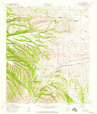
 1958 Elgin1959 Print · USGSSanta Cruz County ranching and military history are preserved here in the late fifties, from the Southern Pacific rails to the San Ignacio del Babocomari grant. Trace family ranch sites and historical markers like Fort Buchanan and the Black Oak Cemetery.3 unique versions available
 - 1958 Map of Sonoita, 1959 Print
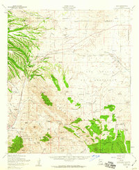
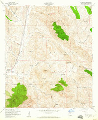
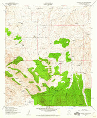
 1958 Sonoita1959 Print · USGSSanta Cruz County ranching and military history are preserved here as the area appeared in the late fifties. Researchers can locate the historic grounds of Fort Crittenden, trace the Southern Pacific railroad, or identify family holdings like the Rail X Ranch and Hacienda Los Encinos.5 unique versions available
 - 1958 Map of Mount Wrightson, 1959 Print
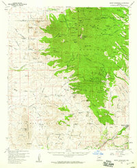 1958 Mount Wrightson1959 Print · USGSThe high peaks and mining districts of the Santa Cruz area are captured in the late fifties, featuring the towering Mt Wrightson and the Grosvenor Hills. Genealogists and historians can trace old homesteads like Salero Ranch and active workings including the Glove Mine and Montosa Mine.4 unique versions available
 - 1958 Map of Elgin, 1959 Print
 1958 Elgin1959 Print · USGSElgin sits at the intersection of rail and river in the late fifties, where the high desert meets the foothills. Genealogists and local historians can trace the Southern Pacific tracks, find the Fruitland Cemetery, and locate the Cemetery east of Elgin.4 unique versions available
 - 1958 Map of Mt. Hughes, 1960 Print
 1958 Mt. Hughes1960 Print · USGSThe Patagonia region during the late 1950s shows a landscape of active ranching and historical mining interests along the Southern Pacific line. Genealogists and researchers can locate family-named landmarks like Stevens Ranch and the Gatlin Cemetery or trace old mining claims at the Aztec Group Mines.3 unique versions available
 - 1958 Map of O'Donnell Canyon, 1960 Print
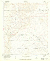
 1958 O'Donnell Canyon1960 Print · USGSSanta Cruz County rangeland and the Coronado National Forest are captured here in the late fifties. Genealogists and researchers can trace family-named homesteads such as Ewing Ranch and Frazier Ranch, or locate the Canille School and Black Oak Cemetery.3 unique versions available
 - 1959 Map of Nogales
 1959 Nogales1959 Print · USGSThe Southern Arizona borderlands appear in the late fifties as a complex landscape of military ranges, tribal lands, and high-desert mining towns. Local historians can trace the Southern Pacific rail lines connecting Tombstone and Benson or locate family ranches such as Canoa Ranch.
End of results
Showing maps 1-9 of 9
Top cities near Sonoita
Top neighborhoods of Sonoita
Frequently asked questions
- What are the different types of historical maps available for Sonoita?
- What is the oldest map of Sonoita?
- Where can I purchase historical maps of Sonoita for my home or office?
- Where can I download high-res historical maps of Sonoita?
- Are there historical topographic maps available for Sonoita?
- Is there historical aerial imagery available for Sonoita?
- Where are historical maps of Sonoita sourced from?