1960s Maps of St. Francis County, Arkansas
Explore 7 historic maps of St. Francis County from the 1960s. These maps offer a rare glimpse into what life looked like during the 1960s — showing old roads, neighborhoods, homes, and landmarks that have changed or disappeared over time.
Whether you're researching your family's past, planning a metal detecting trip, or studying how St. Francis County's landscape evolved across the 1960s, these high-resolution maps are a powerful tool for exploring the history of this region.
- Focus on a specific era: All maps on this page are from the 1960s, giving you a focused view of this time period.
- See what’s changed: Compare century-old streets, trails, and buildings to today's modern landscape using overlays and satellite layers.
- Research with precision: Use these maps for genealogy, historical research, land use analysis, or educational projects.
- View, download, or print: Maps are fully viewable online in high resolution, and can be downloaded or printed for your own records.
Start exploring St. Francis County's history through authentic maps from the 1960s. This is your window into the past.
St. Francis County, AR maps
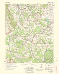
(7)- 1960 Map of Madison
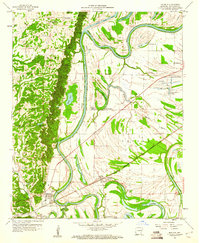 1960 Madison1960 Print · USGSEastern Arkansas at the dawn of the sixties shows a landscape shaped by the ridge and the river's winding oxbows. Genealogists can trace family names at Dorriss Cem and New Hebron Cem or locate old community hubs like Wynne Chapel.3 unique versions available
 - 1960 Map of Helena
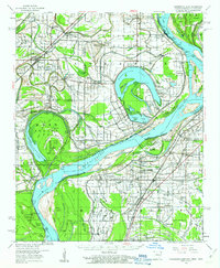
 1960 Helena1960 Print · USGSThe Arkansas and Mississippi Delta regions meet along the great river bends during a period of significant agricultural and rail expansion. Genealogists and historians can trace the paths of the Missouri Pacific railroad through Clarendon or locate landings along the Mississippi River and White River.
 - 1960 Map of Horseshoe Lake, 1963 Print
 1960 Horseshoe Lake1963 Print · USGSCrittenden and Tunica counties are shown in the early sixties as a patchwork of Delta plantations and river landings. Genealogists can trace family footprints at Joe Beck Plantation, Happy Ch & Cem, and local schoolhouses like Snowden Sch.2 unique versions available
 - 1960 Map of Whitmore, 1966 Print
 1960 Whitmore1966 Print · USGSIn the Arkansas delta during the early sixties, the river loops and rail lines shaped every community. Genealogists can trace family landmarks like Wittsburg Cem, Newcastle, and rural schools such as Campbell Sch near the Missouri Pacific RR.
 - 1962 Map of Park Place, 1965 Print
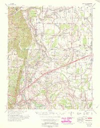
 1962 Park Place1965 Print · USGSEastern Arkansas river country is mapped here in the early sixties, showing the complex oxbows of the St Francis River. Researchers can trace old family sites and rural landmarks like Soudan Cem, Brickeys, and the rail stops of the Missouri Pacific.2 unique versions available
 - 1963 Map of Park Place
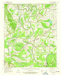
 1963 Park Place1963 Print · USGSLee County, Arkansas, at the start of the sixties reveals a river-driven landscape shaped by the St Francis River and its floodway. Local historians can trace established communities like Brickeys and find numerous country churches and cemeteries, including Gospel Temple and Soudan Cem.
 - 1965 Map of Whitmore
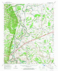
 1965 Whitmore1965 Print · USGSEastern Arkansas at the mid-century reveals a landscape shaped by the St Francis River and the high ground of Crowley s Ridge. Researchers can trace the heritage of rural communities through dozens of landmarks like Wittsburg Cemetery, Harris Chapel, and Campbell Sch.
End of results
Showing maps 1-7 of 7
Top cities of St. Francis County
- Forrest City historical maps
- Hughes historical maps
- Madison historical maps
- Palestine historical maps
- Caldwell historical maps
- Colt historical maps
See more
Frequently asked questions
- What are the different types of historical maps available for St. Francis County?
- What is the oldest map of St. Francis County?
- Where can I purchase historical maps of St. Francis County for my home or office?
- Where can I download high-res historical maps of St. Francis County?
- Are there historical topographic maps available for St. Francis County?
- Is there historical aerial imagery available for St. Francis County?
- Where are historical maps of St. Francis County sourced from?