Old Maps of St. Francis County, Arkansas for Genealogy
Trace your family roots with 166 historic maps of St. Francis County. These high-res maps reveal old neighborhoods, homesites, landmarks, and streets — helping you uncover where your ancestors lived and how the area evolved over time.
- Explore historic neighborhoods: Identify where your relatives may have lived in the 1800s or 1900s.
- Compare maps over time: Trace the changes in streets, buildings, and landmarks for multi-generational research.
- Perfect for genealogy & ancestry research: Used by family historians and researchers to map out lineage and migration.
These maps are an incredible resource for exploring your personal connection to St. Francis County's past.
St. Francis County, AR maps
(166)- 1931 Map of Horseshoe Lake
 1931 Horseshoe Lake1931 Print · USGSThe Mississippi Delta's shifting landscape is captured here in the early thirties, centered on the great oxbow of Horseshoe Lake. Genealogists and historians can trace family-named tracts like the Tucker Plantation and Seyppel Plantation, alongside rural landmarks like the Y M C A Camp and Robinsonville.
 - 1939 Map of Horseshoe Lake, 1941 Print
 1939 Horseshoe Lake1941 Print · USGSThe oxbows and plantations of the Mississippi delta are captured here in the late thirties as the river redefines state boundaries. Genealogists can locate named homesteads and community centers like the Abbey Leatherman Plantation, Robinsonville, and the Hopewell Sch & Ch.2 unique versions available
 - 1939 Map of Park Place, 1941 Print
 1939 Park Place1941 Print · USGSThe Arkansas delta near the St. Francis and L'Anguille Rivers is shown here in the late 1930s as a thriving rail and river landscape. Genealogists can locate family names and rural centers like True Love Bar Ch & Sch, Rollinson, and the Marianna Helena Land Project.2 unique versions available
 - 1939 Map of Wynne, 1941 Print
 1939 Wynne1941 Print · USGSEastern Arkansas at the end of the thirties was a region defined by the L'Anguille River and a thriving network of small rail towns and rural parishes. Researchers can trace ancestral roots through dozens of local landmarks like Wick Mill, Smith Chapel, and Bible Union Sch.2 unique versions available
 - 1939 Map of Hunter, 1942 Print
 1939 Hunter1942 Print · USGSWoodruff and Cross counties were at the peak of their rail-driven economy just before the war, when timber and agriculture dominated the Delta. Genealogists can trace family names at Odd Fellows Cem or locate rural landmarks like Hillmann Jr High Sch and the Whitehall Ch & Cem.2 unique versions available
 - 1939 Map of Edmondson, 1942 Print
 1939 Edmondson1942 Print · USGSCrittenden and St. Francis Counties are shown in the late thirties as a landscape of rail-connected farming towns and bayous. Genealogists can locate family landmarks like Garrett Cem, Macedonia Ch, and the combined Bellmeade Sch & Ch.
 - 1940 Map of Whitmore, 1942 Print
 1940 Whitmore1942 Print · USGSSt. Francis County in the early 1940s shows a complex river-and-rail landscape shaped by the meanders of the St Francis River. Researchers can trace old family settlements and rural institutions like Wittsburg, the Church of Bethlehem, and Walters Cem.2 unique versions available
 - 1940 Map of Brinkley, 1942 Print
 1940 Brinkley1942 Print · USGSBrinkley and the surrounding Delta counties are shown in the 1940s as a bustling junction of three major railroads. Researchers can trace the legacy of local agriculture and community life through sites like Bemis Plantation, Lennon High School, and Garret Grove Ch Sch & Cem.3 unique versions available
 - 1940 Map of Marianna, 1942 Print
 1940 Marianna1942 Print · USGSEastern Arkansas at the start of the 1940s is captured here in a landscape of river-bottom farms and rail-line towns. Researchers can locate numerous local landmarks including Scruggs Chapel, the Haunted Cem, and the river crossing at Felton.2 unique versions available
 - 1948 Map of Helena
 1948 Helena1948 Print · USGSEastern Arkansas and the Mississippi Delta are captured here just after the war, showing a landscape defined by its great rivers and rail lines. Genealogists can trace family locations near Bemis Plantation, Helena, and smaller rail stops like Wheatley and Moro.
 - 1950 Map of Helena
 1950 Helena1950 Print · USGSMid-century Phillips County and the surrounding Delta region are shown at a peak of rail and river commerce. Genealogists and historians can trace family locations through numerous rural communities like Old Austin, Cotton Plant, and West Helena, or follow the routes of the Missouri Pacific RR across Grand Prairie.2 unique versions available
 - 1953 Map of Memphis, 1966 Print
 1953 Memphis1966 Print · USGSEastern Arkansas and the Memphis riverfront are shown here during the mid-century period of regional growth and river management. Local historians can trace the paths of the Chicago Rock Island & Pacific RR through Forrest City or locate river landmarks like President's Island.3 unique versions available
 - 1954 Map of Horseshoe Lake
 1954 Horseshoe Lake1954 Print · USGSThe Mississippi Delta riverfront in the 1950s was a landscape of expansive plantations and river landings. Genealogists can trace family names and community hubs through features like Snowden Plantation, Rosenwald Sch, and Penton Ch & Cem.2 unique versions available
 - 1954 Map of Edmondson, 1955 Print
 1954 Edmondson1955 Print · USGSCrittenden and St. Francis counties in the mid-fifties show a landscape of intricate Delta bayous and growing rural settlements. Genealogists can trace family roots through numerous local landmarks like Truevine Ch & Cem, Greasy Corner, and Crawfordsville.2 unique versions available
 - 1955 Map of Park Place
 1955 Park Place1955 Print · USGSThe St. Francis River basin in the 1950s is a world of bayous, river landings, and family-centered rural communities. Genealogists can trace hundreds of specific sites including Soudan Ldg, True Love Crossing, and Macedonia Ch among the oxbow lakes.2 unique versions available
 - 1955 Map of Helena, 1967 Print
 1955 Helena1967 Print · USGSThe Arkansas Delta and Mississippi floodplains are captured here in the mid-fifties, during a period of expanding flood control and rail commerce. Researchers can trace the extensive Chicago Rock Island and Pacific RR lines and locate sites like the Arkansas State College Experimental Rice Farm or Friars Point.2 unique versions available
 - 1956 Map of Memphis
 1956 Memphis1956 Print · USGSThe Mississippi Delta and the bluffs of West Tennessee meet in the mid-fifties, showing a landscape defined by massive river systems and rail hubs. Researchers can trace the path of Crowleys Ridge or locate vanished river landings near Centennial Island and Island No 35.
 - 1956 Map of Whitmore, 1957 Print
 1956 Whitmore1957 Print · USGSThe St. Francis River delta was a landscape of intricate oxbows and rural congregations in the mid-fifties. Genealogists can trace family roots at Shiloh Ch & Cem or Locust Grove Ch & Cem and locate vanished school sites like Reiff Sch.
 - 1956 Map of Hunter, 1968 Print
 1956 Hunter1968 Print · USGSEastern Arkansas at the mid-century mark reveals a landscape defined by the ST LOUIS SOUTHWESTERN rail line and the CACHE RIVER bottomlands. Researchers can locate numerous family-named landmarks and rural hubs, including Woodmans Cem, Beard Sch, and Whitehall Ch & Cem.
 - 1957 Map of Marianna
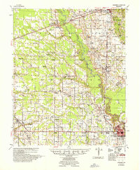 1957 Marianna1957 Print · USGSLee County's agricultural heartland is documented here in the mid-fifties, showing the intersection of rail lines and river commerce. Genealogists can trace family landmarks at Mars Hill Ch & Cem, Holub Crossing, and the rural community at Oak Forest.2 unique versions available
 - 1958 Map of Hunter
 1958 Hunter1958 Print · USGSEastern Arkansas at the dawn of the space age reveals a landscape defined by the Cache River and an extensive rail network. Genealogists and historians can trace family roots through numerous rural sites like Odd Fellows Cemetery, Beard School, and Whitehall Church and Cemetery.
 - 1958 Map of Wynne
 1958 Wynne1958 Print · USGSEastern Arkansas in the late fifties shows a landscape of vibrant rail towns and rural parishes between Wynne and Forrest City. Genealogists and historians can trace dozens of landmarks like Slonikers Mill, Cogbill Cem, and Hedge Providence Ch.2 unique versions available
 - 1958 Map of Haynes, 1959 Print
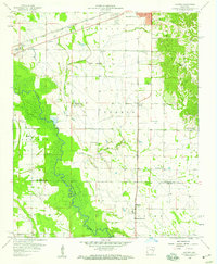 1958 Haynes1959 Print · USGSThe eastern Arkansas delta and the rise of the ridge are documented here in the late fifties. Genealogists and local historians can locate rural landmarks like Spring Grove School, the Forrest Park Cemetery, and the settlement of Haynes.3 unique versions available
 - 1958 Map of Brinkley, 1959 Print
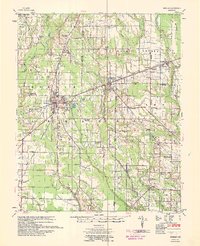 1958 Brinkley1959 Print · USGSMonroe and St. Francis counties are captured here in the late fifties, showing a landscape defined by the convergence of three major railroads. Genealogists can locate family landmarks like the Bemis Plantation and community hubs such as Beauty Spot Ch & Sch or Garrett Grove Cem.2 unique versions available
 - 1958 Map of Forrest City, 1959 Print
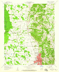 1958 Forrest City1959 Print · USGSForrest City stands at the foot of Crowleys Ridge in the late fifties, where major rail lines converge amidst a landscape of river bottoms and upland gravel pits. Genealogists can trace rural family roots through landmarks like Poplar Grove Cem, Hogan Chapel, and the Lincoln High Sch.2 unique versions available
Showing maps 1-25 of 166
Top cities of St. Francis County
- Forrest City historical maps
- Hughes historical maps
- Madison historical maps
- Palestine historical maps
- Caldwell historical maps
- Colt historical maps
See more
Frequently asked questions
- What are the different types of historical maps available for St. Francis County?
- What is the oldest map of St. Francis County?
- Where can I purchase historical maps of St. Francis County for my home or office?
- Where can I download high-res historical maps of St. Francis County?
- Are there historical topographic maps available for St. Francis County?
- Is there historical aerial imagery available for St. Francis County?
- Where are historical maps of St. Francis County sourced from?