1990s Maps of Colusa County, California
Explore 16 historic maps of Colusa County from the 1990s. These maps offer a rare glimpse into what life looked like during the 1990s — showing old roads, neighborhoods, homes, and landmarks that have changed or disappeared over time.
Whether you're researching your family's past, planning a metal detecting trip, or studying how Colusa County's landscape evolved across the 1990s, these high-resolution maps are a powerful tool for exploring the history of this region.
- Focus on a specific era: All maps on this page are from the 1990s, giving you a focused view of this time period.
- See what’s changed: Compare century-old streets, trails, and buildings to today's modern landscape using overlays and satellite layers.
- Research with precision: Use these maps for genealogy, historical research, land use analysis, or educational projects.
- View, download, or print: Maps are fully viewable online in high resolution, and can be downloaded or printed for your own records.
Start exploring Colusa County's history through authentic maps from the 1990s. This is your window into the past.
Colusa County, CA maps
(16)- 1991 Map of Colusa, 1995 Print
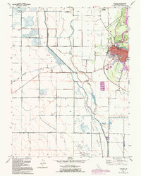 1991 Colusa1995 Print · USGSColusa and the Sacramento River bottomlands are captured here in the early nineties, showing a landscape defined by levees and wildlife conservation. Researchers can trace the town grid to find Union High Sch and St Johns Ch, or follow the Old Railroad Grade past the County Fairgrounds.
 - 1991 Map of Wilbur Springs, 1995 Print
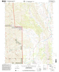
 1991 Wilbur Springs1995 Print · USGSThe mining country of the California Coast Range comes into focus in the early nineties, centered on the mineral springs and mercury claims of the Colusa-Lake county line. Genealogists and historians can trace old claims at Abbott Mine or locate the remote Schoolhouse and early settlements like Deadshot.
 - 1991 Map of Moulton Weir, 1995 Print
 1991 Moulton Weir1995 Print · USGSThe Sacramento Valley in the early nineties is revealed here as a landscape of irrigation canals, river bends, and vast wildlife preserves. Researchers can trace local history through the Colusa (Cachil Dehe) Rancheria, the Butte Creek School, and the Keller Ranch.
 - 1993 Map of Yuba City, 1994 Print
 1993 Yuba City1994 Print · USGSThe Sacramento Valley and Sierra Nevada foothills meet in the 1990s, where agricultural bypasses and river networks surround the iconic Sutter Buttes. Researchers can trace the rail corridors of the Southern Pacific and Western Pacific through hubs like Marysville and Gridley.
 - 1994 Map of Lakeport
 1994 Lakeport1994 Print · USGSCoastal mountains meet the fertile Sacramento Valley in the 1990s, where the waters of Clear Lake define the western landscape. Researchers can trace the industrial footprint of the Sulphur Bank Mine, follow the Southern Pacific RR tracks, or locate old settlements like Fouts Springs and Lodoga.
 - 1994 Map of Sacramento
 1994 Sacramento1994 Print · USGSThe Sacramento valley was a landscape of massive flood control and military aviation during the mid-nineties. Researchers can trace the complex network of the Yolo Bypass and the Sacramento River alongside McClellan Air Force Base and Zamora.2 unique versions available
 - 1996 Map of Crockett Peak, 2001 Print
 1996 Crockett Peak2001 Print · USGSThe high ridges of the Mendocino National Forest are captured in the late nineties, just as the area was being managed for its wilderness character. Trace historical sites like Marble Cabin (Site) and Milk Ranch along the slopes of Signal Peak and Crockett Peak.
 - 1996 Map of St. John Mountain, 2001 Print
 1996 St. John Mountain2001 Print · USGSGlenn County and the surrounding wilderness are captured here during the mid-1990s. Researchers can locate remote high-country landmarks like Meyers Cabin, trace the headwaters of Stony Creek, and find isolated spots such as Bonnie View and Upper Nye Camp.
 - 1996 Map of Fouts Springs, 2001 Print
 1996 Fouts Springs2001 Print · USGSMendocino National Forest in the mid-nineties shows a landscape of remote ranger stations and high-mountain glades. Researchers can trace forest management and recreational history through sites like Fouts Springs, Red Rock Cabin, and Letts Lake.
 - 1996 Map of Bartlett Springs, 2001 Print
 1996 Bartlett Springs2001 Print · USGSLake County's high ridges and mineral springs are documented in the late twentieth century as they appeared within the Mendocino National Forest. Researchers can locate old mountain settlements and remote landmarks like Bartlett Springs, Newman Springs, and the Bartlett Cemetery.
 - 1996 Map of Potato Hill, 2001 Print
 1996 Potato Hill2001 Print · USGSThe Lake County wilderness is mapped here in the late twentieth century, showing the remote ridge-and-canyon country of the Mendocino National Forest. Researchers can locate isolated landmarks like Snow Mountain House and the geothermal waters of Crabtree Hot Springs.
 - 1996 Map of Gilmore Peak, 2001 Print
 1996 Gilmore Peak2001 Print · USGSNorthern California hill country comes into focus in the mid-nineties, showing the interface of ranching and national forest. Trace historical mining sites like the Ruby King Mine and the community layout of Stonyford near the East Park Reservoir.
 - 1996 Map of Hough Springs, 2001 Print
 1996 Hough Springs2001 Print · USGSThe Lake County backcountry in the mid-1990s was a rugged landscape of high ridges and significant water resources. Researchers can trace the shoreline of the Indian Valley Reservoir and locate remote sites like Hough Springs and Davis Flat.
 - 1996 Map of Stonyford, 2001 Print
 1996 Stonyford2001 Print · USGSNear the Mendocino National Forest in the mid-1990s, this area shows a landscape of steep ridges and remote valleys. Researchers can locate the Indian Valley Sch, the Grindstone Work Center, and local landmarks like Elephant Hill.
 - 1996 Map of Benmore Canyon, 2001 Print
 1996 Benmore Canyon2001 Print · USGSLake County’s interior landscape is shown in the late twentieth century as it transitions from national forest wilderness to managed water resources. You can trace the rugged topography of Benmore Canyon and locate remote infrastructure like the Indian Valley Dam and various Prospects.
 - 1998 Map of Wilson Valley, 2002 Print
 1998 Wilson Valley2002 Print · USGSLake and Colusa counties appear here in the late twentieth century as a landscape of deep canyons and seasonal water. Researchers can trace the winding course of Cache Creek and locate remote landmarks like Dunfield Spring or the high point of Grizzly Peak.
End of results
Showing maps 1-16 of 16
Top cities of Colusa County
Frequently asked questions
- What are the different types of historical maps available for Colusa County?
- What is the oldest map of Colusa County?
- Where can I purchase historical maps of Colusa County for my home or office?
- Where can I download high-res historical maps of Colusa County?
- Are there historical topographic maps available for Colusa County?
- Is there historical aerial imagery available for Colusa County?
- Where are historical maps of Colusa County sourced from?