Old Maps of Colusa County, California for Metal Detecting
Plan your next treasure hunt with 267 historic maps of Colusa County. Find old homesites, ghost towns, trails, and gathering spots that may be lost to time — perfect for identifying promising metal detecting locations.
- Locate forgotten sites: Uncover places like long-lost settlements, abandoned rail lines, or gathering spots.
- Plan better hunts: Use map overlays combined with LiDAR or satellite views to narrow in on historically rich areas.
- Made for detectorists: Thousands of hobbyists use these maps to discover relics, coins, and hidden history.
Use these historic maps to boost your research and find new opportunities beneath the surface of Colusa County.
Colusa County, CA maps
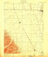
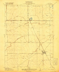
(267)- 1888 Map of Marysville
 1888 Marysville1888 Print · USGSThe Sacramento Valley in the late nineteenth century was a landscape of fertile river bottoms and emerging rail towns. Researchers can trace the river economy through Moons Ferry and Eddys Ferry or locate early family holdings like Hock Farm and Butte House.
 - 1891 Map of Marysville
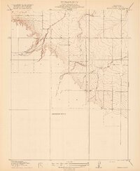
 1891 Marysville1891 Print · USGSThe Sacramento Valley in the late nineteenth century centers on the volcanic peaks of the Marysville Buttes. Genealogists and historians can trace pioneer landings and river crossings such as Hock Farm, Princeton Ferry, and the early street grids of Sutter City.
 - 1894 Map of Marysville
 1894 Marysville1894 Print · USGSThe Sacramento Valley in the 1890s is captured here as a landscape of river ferries and expanding rail lines. Genealogists can trace family footprints in Sutter City, identify old river crossings like Moons Ferry, or locate the historic Hock Farm.
 - 1895 Map of Marysville
 1895 Marysville1895 Print · USGSThe Sacramento Valley in the 1890s centered on the dramatic profile of the Marysville Buttes and a bustling river-and-rail economy. Researchers can trace early river crossings like Moons Ferry, the historic Hock Farm, and the early footprints of Marysville and Yuba City.6 unique versions available
 - 1904 Map of Logan Creek, 1956 Print
 1904 Logan Creek1956 Print · USGSGlenn and Colusa counties meet in this 1904 survey where the valley floor meets the rising foothills. Researchers can trace the original seasonal drainage paths of Logan Creek and Hunters Creek through the early land partitions of the Northern Sacramento Valley.2 unique versions available
 - 1904 Map of Sites, 1957 Print
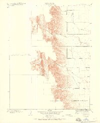
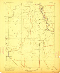
 1904 Sites1957 Print · USGSColusa County at the turn of the century shows a landscape shaped by early quarrying and the arrival of the rails. Genealogists and historians can trace the townsite of Sites, the local Cemetery, and the path of the Colusa and Lake railroad.2 unique versions available
 - 1905 Map of Harrington, 1956 Print
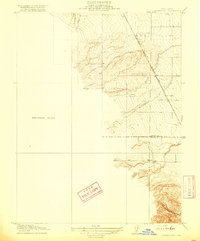
 1905 Harrington1956 Print · USGSThe Sacramento Valley at the start of the twentieth century was a landscape of rail-dependent agriculture and seasonal creeks. Genealogists and historians can trace the early layout of Harrington and the path of the Southern Pacific Railroad as it crosses from Colusa into Yolo County.
 - 1905 Map of Fairview, 1958 Print
 1905 Fairview1958 Print · USGSColusa County at the start of the century shows a landscape where early routes like the Colusa and Lake crossed the valley floor. Researchers can trace the drainage of Glenn Valley Slough and locate the historic settlement of Fairview.
 - 1906 Map of Maxwell
 1906 Maxwell1906 Print · USGSColusa and Glenn Counties at the dawn of the century show a landscape defined by massive land grants and new irrigation. Trace family roots and vanished river stops like Boggs Landing and Compton Landing along the Sacramento River.3 unique versions available
 - 1907 Map of Dunnigan
 1907 Dunnigan1907 Print · USGSThe Sacramento Valley in the early 1900s is defined by its busy river landings and the emerging rail corridor. Genealogists can trace family footprints at Zamora Blacks Station P O or follow the river to Cranmore Landing and Derby Camp.3 unique versions available
 - 1907 Map of Colusa
 1907 Colusa1907 Print · USGSColusa County at the dawn of the twentieth century shows a landscape shaped by rail expansion and irrigation. Genealogists and historians can trace the early footprints of Colusa, Arbuckle, and College City, alongside the Southern Pacific R R and Sabin Lake.3 unique versions available
 - 1911 Map of Sanborn Slough
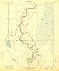
 1911 Sanborn Slough1911 Print · USGSIn the wetlands of the Sacramento Valley before modern flood control, this early century survey captures the seasonal landscape of the Colusa and Butte county lines. Trace the historical hydrology of Butte Sink and find the site of the Harmony School.
 - 1911 Map of Grimes
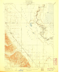
 1911 Grimes1911 Print · USGSColusa County at the start of the century is a landscape shaped by the winding Sacramento River and its intricate slough systems. Trace early riverfront life at Grimes, locate the historic Rancheria, or follow the path of the Hannum Bridge.
 - 1912 Map of Butte City
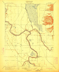
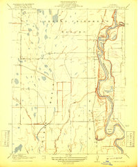
 1912 Butte City1912 Print · USGSThe Sacramento River and its complex system of sloughs dominate this Glenn County landscape in the years before intensive irrigation. Trace family roots at Marvin Chapel or locate old school sites like Carson School and Union School.
 - 1912 Map of Meridian
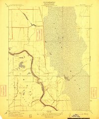
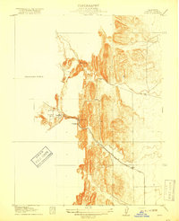
 1912 Meridian1912 Print · USGSThe Sacramento Valley riverlands and the western foothills of the volcanic buttes are captured here just before the era of modern levee and bypass systems. You can locate rural schoolhouses like Farmers School and trace the early boundaries of Butte Sink and the town of Meridian.2 unique versions available
 - 1912 Map of Tisdale Weir
 1912 Tisdale Weir1912 Print · USGSSutter and Colusa Counties appear here in the early twentieth century as a landscape defined by the river and its flood basins. Researchers can trace the river economy through Dunns Ferry, Fraziers Landing, and the namesake Tisdale Weir.
 - 1915 Map of Kirkville
 1915 Kirkville1915 Print · USGSThe Sacramento River valley at the turn of the century was a landscape of winding oxbows and essential steamboat stops. Genealogists can trace family-named river points like Poffenberger's Landing, Miller's Landing, and the early settlement at Kirkville.
 - 1916 Map of Harrington
 1916 Harrington1916 Print · USGSColusa and Yolo counties appear here in the early twentieth century as a rail-centered agricultural corridor. Genealogists and historians can trace the path of the Southern Pacific Woodland Line through the settlement of Harrington and along Petroleum Creek.3 unique versions available
 - 1916 Map of Hershey
 1916 Hershey1916 Print · USGSCentral Valley agriculture and rail transport meet in the early twentieth century near the Colusa-Yolo border. Researchers can trace the early layout of Dunnigan and the shipping point at Hershey along the Southern Pacific (Woodland Line).
 - 1917 Map of Logandale
 1917 Logandale1917 Print · USGSThe northern Sacramento Valley during the early twentieth century shows an emerging agricultural grid shaped by water and rail. Researchers can trace the path of the Southern Pacific Woodland Line through Logandale and locate the path of the Central Irrigation Canal.
 - 1917 Map of Compton Landing
 1917 Compton Landing1917 Print · USGSColusa County at the start of the twentieth century was a land of river landings and vast ranchos along the shifting Sacramento River. Researchers can trace the boundaries of the Larkins Childrens Rancho and locate historical river access points like Compton Landing and Boggs Landing.2 unique versions available
 - 1917 Map of Sites
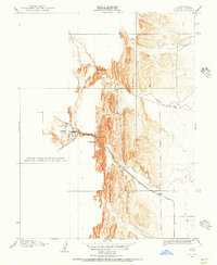
 1917 Sites1917 Print · USGSColusa County at the turn of the century was a landscape of sandstone extraction and early rail development centered on Antelope Valley. Researchers can trace the industrial footprint of the Colusa Quarry and the Colusa and Lake rail line that served the village of Sites.3 unique versions available
 - 1917 Map of Delevan
 1917 Delevan1917 Print · USGSColusa County's agricultural heartland was already defined by its rail and water infrastructure in the early twentieth century. Genealogists and local historians can trace the grid of Maxwell, locate the rural Cemetery, and follow the Southern Pacific (Woodland Line) through the valley.
 - 1918 Map of Williams
 1918 Williams1918 Print · USGSColusa County at the start of the twentieth century is centered on the railroad hub of Williams. Genealogists and historians can trace the early rail corridor of the Southern Pacific (Woodland Line) and locate the settlements at Colusa Junction and Lurline.
 - 1918 Map of Spring Valley
 1918 Spring Valley1918 Print · USGSColusa County at the turn of the century remained a landscape of open terrain and winding waterways. Researchers can trace the drainage patterns of Spring Valley and find early water landmarks like Old Cortina Creek and Chamisal Creek.2 unique versions available
Showing maps 1-25 of 267
Top cities of Colusa County
Frequently asked questions
- What are the different types of historical maps available for Colusa County?
- What is the oldest map of Colusa County?
- Where can I purchase historical maps of Colusa County for my home or office?
- Where can I download high-res historical maps of Colusa County?
- Are there historical topographic maps available for Colusa County?
- Is there historical aerial imagery available for Colusa County?
- Where are historical maps of Colusa County sourced from?