1980s Maps of Colusa County, California
Explore 8 historic maps of Colusa County from the 1980s. These maps offer a rare glimpse into what life looked like during the 1980s — showing old roads, neighborhoods, homes, and landmarks that have changed or disappeared over time.
Whether you're researching your family's past, planning a metal detecting trip, or studying how Colusa County's landscape evolved across the 1980s, these high-resolution maps are a powerful tool for exploring the history of this region.
- Focus on a specific era: All maps on this page are from the 1980s, giving you a focused view of this time period.
- See what’s changed: Compare century-old streets, trails, and buildings to today's modern landscape using overlays and satellite layers.
- Research with precision: Use these maps for genealogy, historical research, land use analysis, or educational projects.
- View, download, or print: Maps are fully viewable online in high resolution, and can be downloaded or printed for your own records.
Start exploring Colusa County's history through authentic maps from the 1980s. This is your window into the past.
Colusa County, CA maps
(8)- 1989 Map of Benmore Canyon
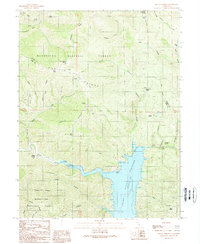
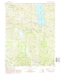 1989 Benmore Canyon1989 Print · USGSLake County's high ridges and deep canyons are captured in the late eighties, just as the Indian Valley Reservoir defined the local geography. Researchers can locate the Chalk Mountain Mine and trace the winding course of the North Fork Cache Creek.2 unique versions available
 - 1989 Map of Salt Canyon
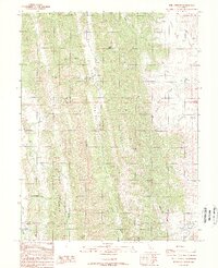
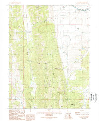 1989 Salt Canyon1989 Print · USGSColusa County's high ridges and ranching valleys are documented here in the late eighties as the region maintained its rural character. Genealogists and historians can locate family-named landmarks like Helmer Hill, the peaks of Three Sisters, and the Cortina Rancheria Indian Reservation.2 unique versions available
 - 1989 Map of Lodoga
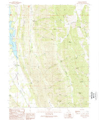 1989 Lodoga1989 Print · USGSColusa County's western foothills are documented here in the late twentieth century, centered on the community of Lodoga. Genealogists and local historians can trace the town cemetery and remote landmarks like Lodoga Peak, Little Antelope Grade, and Scotties Spring.2 unique versions available
 - 1989 Map of Leesville
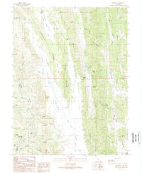 1989 Leesville1989 Print · USGSThe ranching and valley corridors of the California Coast Range are captured here in the late eighties. Researchers can trace remote routes through Leesville, locate the historic Robbers Flat, and find family-named landmarks like Stinchfield Canyon and Gaither.2 unique versions available
 - 1989 Map of Wilbur Springs
 1989 Wilbur Springs1989 Print · USGSThe rugged mineral belt along the Colusa and Lake county line is captured here in the late eighties. Metal detectorists and local historians can locate dozens of mercury and gold prospects, including the Abbott Mine, Turkey Run Mine, and the old Schoolhouse.
 - 1989 Map of Hough Springs
 1989 Hough Springs1989 Print · USGSLake and Colusa counties are shown here in the late eighties as they were being shaped by the massive Indian Valley Reservoir. Researchers can trace the winding canyons and remote landmarks like Hough Springs, Davis Flat, and Split Rock.2 unique versions available
 - 1989 Map of Bartlett Springs
 1989 Bartlett Springs1989 Print · USGSLake and Colusa Counties appear in the late eighties as a network of high-country springs and forest camps. Trace family-named landmarks and remote sites like Bartlett Springs, Wyman Flat, and the Reister Bridge along the creek forks.3 unique versions available
 - 1989 Map of Rail Canyon
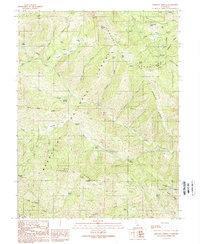
 1989 Rail Canyon1989 Print · USGSGlenn and Colusa Counties are captured here in the late eighties as a landscape of remote ridges and deep seasonal creek beds. Local historians and land researchers can trace the rugged contours of Rail Ridge, Clark Valley, and the headwaters of Funks Creek.2 unique versions available
End of results
Showing maps 1-8 of 8
Top cities of Colusa County
Frequently asked questions
- What are the different types of historical maps available for Colusa County?
- What is the oldest map of Colusa County?
- Where can I purchase historical maps of Colusa County for my home or office?
- Where can I download high-res historical maps of Colusa County?
- Are there historical topographic maps available for Colusa County?
- Is there historical aerial imagery available for Colusa County?
- Where are historical maps of Colusa County sourced from?