1950s Maps of Colusa County, California
Explore 36 historic maps of Colusa County from the 1950s. These maps offer a rare glimpse into what life looked like during the 1950s — showing old roads, neighborhoods, homes, and landmarks that have changed or disappeared over time.
Whether you're researching your family's past, planning a metal detecting trip, or studying how Colusa County's landscape evolved across the 1950s, these high-resolution maps are a powerful tool for exploring the history of this region.
- Focus on a specific era: All maps on this page are from the 1950s, giving you a focused view of this time period.
- See what’s changed: Compare century-old streets, trails, and buildings to today's modern landscape using overlays and satellite layers.
- Research with precision: Use these maps for genealogy, historical research, land use analysis, or educational projects.
- View, download, or print: Maps are fully viewable online in high resolution, and can be downloaded or printed for your own records.
Start exploring Colusa County's history through authentic maps from the 1950s. This is your window into the past.
Colusa County, CA maps
(36)- 1951 Map of Lake Pillsbury, 1953 Print
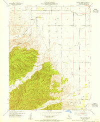
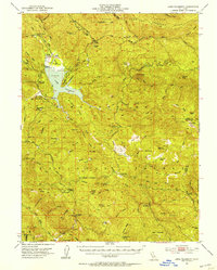 1951 Lake Pillsbury1953 Print · USGSLake County and the Mendocino National Forest are captured in the early fifties as a landscape of remote ranches and timber mills. Genealogists and historians can locate legacy sites like Fuller Ranch, Prather Mill, and the Snow Mtn House.5 unique versions available
 - 1951 Map of Stonyford, 1953 Print
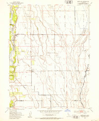
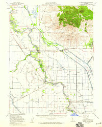
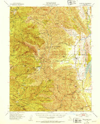 1951 Stonyford1953 Print · USGSColusa and Glenn counties were still characterized by remote forest outposts and mineral springs in the early fifties. Local historians can trace family sites like Brittan Ranch or search for the Ruby King Mine and the historical Stonyford Rancheria (Site).3 unique versions available
 - 1952 Map of Kirkville, 1953 Print
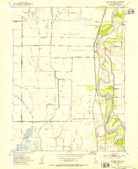
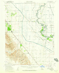
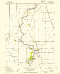 1952 Kirkville1953 Print · USGSThe Sacramento River corridor in the early fifties is mapped here in detail, showing a landscape defined by industrial pumping and river landings. Genealogists and historians can trace family-named sites like Poffenbergers Landing, Tyndall Mound, and the settlement of Cranmore.3 unique versions available
 - 1952 Map of Princeton, 1953 Print
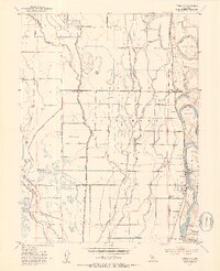 1952 Princeton1953 Print · USGSThe Sacramento Valley’s agricultural heartland is captured here in the early fifties, showing the intricate web of irrigation canals and river landings. Genealogists and historians can trace family locations from Minor Farm to Princeton, or locate the Codora School and the old Princeton Ferry crossing.3 unique versions available
 - 1952 Map of Butte City, 1953 Print
 1952 Butte City1953 Print · USGSGlenn County agriculture and flood control are in focus during the early fifties as the river plains transition into managed farmland. Genealogists can trace family footprints at Butte City Cemetery, Afton, and the local Union Sch.4 unique versions available
 - 1952 Map of Maxwell, 1953 Print
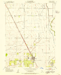
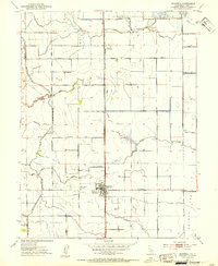 1952 Maxwell1953 Print · USGSAgricultural life in the early fifties revolves around the railroad towns of the Sacramento Valley. Genealogists and local historians can trace the foundations of Maxwell and Delevan near the Union Church and the Maxwell Cemetery.3 unique versions available
 - 1952 Map of Colusa, 1953 Print
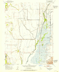
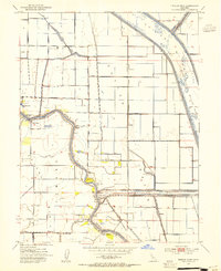
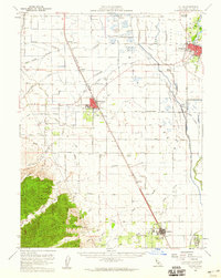
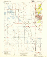 1952 Colusa1953 Print · USGSColusa sits at a vital river and rail junction in the early fifties, where the Sacramento meanders past a bustling county seat. Genealogists can trace family landmarks like the Union High Sch, find the local Cem, or locate rural outposts such as The Four Corners.4 unique versions available
 - 1952 Map of Logandale, 1953 Print
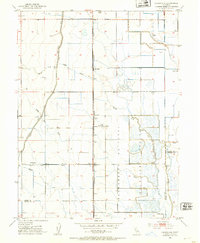 1952 Logandale1953 Print · USGSThe Central Valley landscape near Logandale comes into sharp focus during the early fifties as irrigation and conservation efforts transformed the terrain. Genealogists and local historians can trace family-named sites like Minor Farm or find landmarks such as Liberty School and the Peratis Duck Club.2 unique versions available
 - 1952 Map of Sanborn Slough, 1953 Print
 1952 Sanborn Slough1953 Print · USGSThe lowlands of the Sacramento Valley are captured here in the early fifties, showing a landscape defined by seasonal marshes and hunting heritage. Local historians can trace the intricate network of the Butte Sink, the site of the Harmony Sch (Aban'd), and numerous sportsmen's landmarks like the Tule Goose Gun Club.5 unique versions available
 - 1952 Map of Williams, 1953 Print
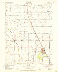 1952 Williams1953 Print · USGSColusa County's agricultural heartland is documented here in the early fifties, showing the hub of Williams and its surrounding rail-and-canal network. Genealogists and historians can trace local landmarks like Union High School, the town Cem, and rural stops at Cortena and Delphos.4 unique versions available
 - 1952 Map of Moulton Weir, 1953 Print
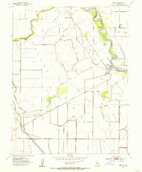
 1952 Moulton Weir1953 Print · USGSThe Sacramento Valley's agricultural and river economy comes into focus in the early fifties as irrigation and rail lines reshaped the Colusa Basin. Researchers can trace family-named sites like Stegeman and Keller Ranch or locate the Butte Creek School and Cachil Dehe Rancheria.2 unique versions available
 - 1952 Map of Arbuckle, 1953 Print
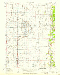
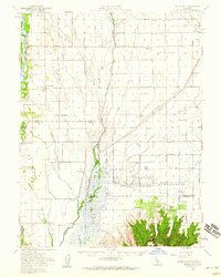
 1952 Arbuckle1953 Print · USGSThe Colusa Basin in the early fifties shows a thriving agricultural landscape defined by the Southern Pacific rail line. Researchers can trace local landmarks like Pierce Union High School, the settlement at College City, and the early boundaries of the Colusa Nat Wildlife Refuge.3 unique versions available
 - 1952 Map of Tisdale Weir, 1954 Print
 1952 Tisdale Weir1954 Print · USGSThe Sacramento Valley in the early fifties reveals a highly engineered landscape of flood bypasses and river landings. Genealogists and local historians can trace rural school sites like Winship School and historical river crossings such as Eddys Ferry.3 unique versions available
 - 1952 Map of Meridian, 1955 Print
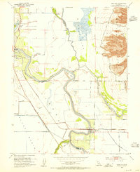 1952 Meridian1955 Print · USGSThe Sacramento River valley in the early fifties shows a landscape shaped by flood control and rail transport. Genealogists and historians can trace family-named sites like Arbee, locate the Cemetery near Meridian, and study the reach of the Southern Pacific.4 unique versions available
 - 1952 Map of Maxwell, 1958 Print
 1952 Maxwell1958 Print · USGSThe Sacramento Valley comes alive in this mid-century survey of the Maxwell and Princeton areas, showcasing a landscape of river bends and rail sidings. Genealogists can trace family roots through several rural schools like Liberty Sch and Codora Sch, or locate the historic Cachil Dehe Rancheria.2 unique versions available
 - 1953 Map of Dunnigan, 1954 Print
 1953 Dunnigan1954 Print · USGSThe agricultural heart of Yolo and Colusa counties is captured here in the early fifties, where the railroad meets the valley floor. Genealogists and historians can locate the Johns District School, the Johns Cem, and the rail stops at Dunnigan and Hershey.4 unique versions available
 - 1953 Map of Cortina Creek, 1955 Print
 1953 Cortina Creek1955 Print · USGSThe Colusa County foothills in the mid-fifties show a landscape of rising elevations and agricultural reach. Trace old property lines and water rights near Cortina Vineyard, Whisky Creek, and the Arbuckle Golf Club.2 unique versions available
 - 1953 Map of Dunnigan, 1959 Print
 1953 Dunnigan1959 Print · USGSThe Sacramento River valley in the early 1950s shows a landscape of river landings and railroad towns at the height of its mid-century agricultural reach. Genealogists and historians can trace the foundations of Dunnigan and Zamora, or locate family landmarks like Johns Cemetery and Marys Cemetery.2 unique versions available
 - 1953 Map of Colusa, 1960 Print
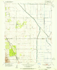
 1953 Colusa1960 Print · USGSColusa County was a thriving agricultural and rail corridor in the early fifties, centered on the Sacramento River. Genealogists can trace family footprints in Arbuckle, locate the Cachil Dehe Rancheria, or find local landmarks like the Arbuckle Golf Club.2 unique versions available
 - 1954 Map of Grimes, 1955 Print
 1954 Grimes1955 Print · USGSMid-century Colusa County comes to life along the river and rail lines during this 1950s survey. Researchers can trace local heritage at Grimes, the Grand Island Cemetery, and the Southern Pacific stop at Sycamore Siding.5 unique versions available
 - 1954 Map of Sutter Buttes, 1959 Print
 1954 Sutter Buttes1959 Print · USGSThe Sacramento Valley landscape in the mid-fifties is defined here by the volcanic profile of the Sutter Buttes and the engineered waterways of the Sutter Bypass. Genealogists and local historians can trace family roots through the Grand Island Cemetery, Winship School, and river landings like Fraziers Landing.3 unique versions available
 - 1954 Map of Butte City, 1959 Print
 1954 Butte City1959 Print · USGSThe Sacramento Valley in the mid-fifties is captured here during a period of intensive water management and rural growth. Genealogists can locate family landmarks like Butte City Cem, Union School, and several established properties including Schohr Ranch.2 unique versions available
 - 1956 Map of Sacramento
 1956 Sacramento1956 Print · USGSMid-century California unfolds from the delta to the high Sierra, capturing a landscape of growing valley cities and burgeoning military airbases. Genealogists and historians can trace the rail lines and river towns from Woodland to Lodi, or explore the foothill settlements of Placerville and Jackson.2 unique versions available
 - 1957 Map of Ukiah, 1966 Print
 1957 Ukiah1966 Print · USGSNorthern California's diverse terrain comes into focus in the mid-1950s, from the rugged timberlands of the Jackson State Forest to the productive Sacramento Valley. Genealogists and historians can trace the rail lines of the Northwestern Pacific or locate early valley settlements like Arbuckle and Paskenta.3 unique versions available
 - 1957 Map of Sacramento, 1966 Print
 1957 Sacramento1966 Print · USGSIn the mid-twentieth century, the California heartland was a hub of river transport, rail lines, and military airbases. Genealogists and historians can trace the development of Gold Country towns like Angels Camp and Sonora or follow the path of the Southern Pacific RR through the growing suburbs of Sacramento.4 unique versions available
Showing maps 1-25 of 36
Top cities of Colusa County
Frequently asked questions
- What are the different types of historical maps available for Colusa County?
- What is the oldest map of Colusa County?
- Where can I purchase historical maps of Colusa County for my home or office?
- Where can I download high-res historical maps of Colusa County?
- Are there historical topographic maps available for Colusa County?
- Is there historical aerial imagery available for Colusa County?
- Where are historical maps of Colusa County sourced from?