1940s Maps of Fresno County, California
Explore 78 historic maps of Fresno County from the 1940s. These maps offer a rare glimpse into what life looked like during the 1940s — showing old roads, neighborhoods, homes, and landmarks that have changed or disappeared over time.
Whether you're researching your family's past, planning a metal detecting trip, or studying how Fresno County's landscape evolved across the 1940s, these high-resolution maps are a powerful tool for exploring the history of this region.
- Focus on a specific era: All maps on this page are from the 1940s, giving you a focused view of this time period.
- See what’s changed: Compare century-old streets, trails, and buildings to today's modern landscape using overlays and satellite layers.
- Research with precision: Use these maps for genealogy, historical research, land use analysis, or educational projects.
- View, download, or print: Maps are fully viewable online in high resolution, and can be downloaded or printed for your own records.
Start exploring Fresno County's history through authentic maps from the 1940s. This is your window into the past.
Fresno County, CA maps
(78)- 1940 Map of Stratford, 1954 Print
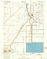 1940 Stratford1954 Print · USGSThe reclaimed basin of the San Joaquin Valley comes into focus just before the mid-century, showing a landscape defined by industrial-scale irrigation and oil. Genealogists can locate family raches and rural schools like Ramona Sch, while tracing the early footprints of Stratford and Kettleman City.
 - 1941 Map of Firebaugh
 1941 Firebaugh1941 Print · USGSFresno and Madera counties are shown here just before the mid-century, defined by the irrigation canals and rail lines of the Central Valley. Researchers can trace the industrial footprint of the Standard Oil Pump Station and family landmarks like Helm Ranch.
 - 1941 Map of Kreyenhagen Hills
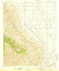
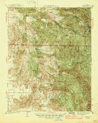
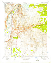
 1941 Kreyenhagen Hills1941 Print · USGSWestern Fresno County ranching and transit are captured in the late 1930s, showing the intersection of valley roads and upland canyons. Genealogists and local historians can locate early family holdings like Zuburi Ranch, Kreyenhagen Ranch, and the settlement at Alcalde.2 unique versions available
 - 1941 Map of Priest Valley
 1941 Priest Valley1941 Print · USGSThe high ridges and deep canyons of Monterey County are captured here just before the mid-century, documenting remote ranching outposts and early industrial sites. Genealogists and historians can trace old landmarks like the Stone Canyon Mine, the Priest Valley Sch, and the settlement at San Lorenzo (Randall).
 - 1942 Map of Polvadero Gap
 1942 Polvadero Gap1942 Print · USGSCentral California ranching and early rail corridors appear in high detail during the early war years. Genealogists and local historians can locate early family holdings like Kreyenhagen Ranch, the town of Huron, and the Southern Pacific line.2 unique versions available
 - 1942 Map of Parkfield, 1956 Print
 1942 Parkfield1956 Print · USGSThe Cholame Valley was a remote ranching and mining corridor in the early 1940s, centered on the settlement of Parkfield. Local historians can trace family landholdings like Durham Ranch and historic mercury operations at the Patriquin Quicksilver Mine.
 - 1942 Map of Watts Valley, 1957 Print
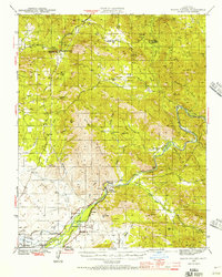 1942 Watts Valley1957 Print · USGSEastern Fresno County is captured here in the early 1940s, showing a landscape of mining claims, rural schools, and river settlements. Genealogists and historians can trace family locations near Piedra, Cold Spring Rancheria, and the Copper King Mine.4 unique versions available
 - 1942 Map of Millerton Lake, 1959 Print
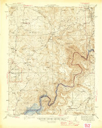
 1942 Millerton Lake1959 Print · USGSThe foothills of Madera and Fresno counties come alive in the 1940s as the San Joaquin River is transformed by the Friant Dam. Genealogists and historians can locate family homesteads like Rosedale Ranch and early rural institutions including Spring Valley Sch and Picayune Rancheria.2 unique versions available
 - 1942 Map of Dunlap, 1962 Print
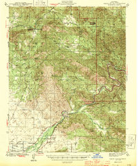
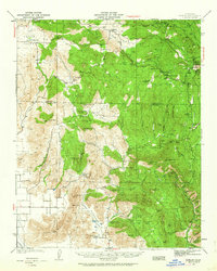 1942 Dunlap1962 Print · USGSThe Sierra Nevada foothills were a patchwork of family ranches and rural schoolhouses during the early 1940s. Genealogists can trace local roots at Auckland Ranch, Squaw Valley Sch, and the community at Miramonte.2 unique versions available
 - 1943 Map of New Idria
 1943 New Idria1943 Print · USGSSan Benito and Fresno counties were centers of intensive mercury mining in the early 1940s. Genealogists and industrial historians can trace early claims like the Spanish Mine and Florence Mack Mine or locate the remote New Idria Idria PO.2 unique versions available
 - 1943 Map of Stratford
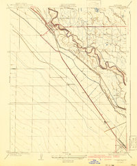
 1943 Stratford1943 Print · USGSMid-century Kings County reveals a landscape of massive water engineering projects and valley farming as the Second World War began. Researchers can trace irrigation networks from Tulare Lake, find early school sites like Ramona Sch, and locate the Pacific Southern rail stops at Westhaven Station.
 - 1943 Map of Ortigalita Peak
 1943 Ortigalita Peak1943 Print · USGSThe Merced and San Benito county line was a landscape of remote cattle ranches and early Central Valley irrigation works during the 1940s. Genealogists and local historians can trace family-named sites like Langan Ranch, Hamburg Ranch Sch, and the Oil Pumping Sta.2 unique versions available
 - 1943 Map of Joaquin Rocks
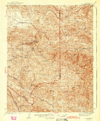
 1943 Joaquin Rocks1943 Print · USGSThe Fresno County foothills meet the San Joaquin Valley floor during the early 1940s. Researchers can trace remote ranching outposts like Lillis Ranch, the Cantua Sch, and the notable geological formations of the Joaquin Rocks.2 unique versions available
 - 1943 Map of Parkfield
 1943 Parkfield1943 Print · USGSMonterey County ranching and mining operations are captured here during the early years of the war. Researchers can locate family homesteads like Durham Ranch or trace the mercury mining history at the Patriquin Quicksilver Mine.
 - 1944 Map of Watts Valley
 1944 Watts Valley1944 Print · USGSFresno County’s foothills and river canyons are captured here during the mid-1940s as rural life centered on the Kings River. Researchers can locate family sites near Hazelton Cem or trace early mining at the Copper King Mine.2 unique versions available
 - 1944 Map of Coalinga
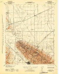
 1944 Coalinga1944 Print · USGSCoalinga and its surrounding oilfields are captured here during the 1940s, showcasing the intersection of heavy industry and California ranching life. Researchers can trace the layout of the Coalinga Oil Refinery and locate legacy sites like Alcalde Ranch or the Claremont Sch.3 unique versions available
 - 1944 Map of Panoche Valley
 1944 Panoche Valley1944 Print · USGSPanoche Valley and the high ridges of the Diablo Range are captured here during the 1940s, showcasing the region's rural ranching and mining history. Genealogists and historians can locate old landmarks like Panoche Sch, Llanada, and the Le Grant Mine nestled among the hills.2 unique versions available
 - 1944 Map of Priest Valley
 1944 Priest Valley1944 Print · USGSThe central Coast Ranges come alive in the 1940s, showing the intersection of Monterey, San Benito, and Fresno counties. Genealogists and local historians can trace rural school locations like Priest Valley Sch and industry at the Stone Canyon Mine.2 unique versions available
 - 1944 Map of Dunlap
 1944 Dunlap1944 Print · USGSThe Sierra Nevada foothills come alive in this mid-forties survey of the rugged Fresno and Tulare county line. Genealogists can trace early homesteads and family holdings like Auckland Ranch, Baker Ranch, and the Squaw Valley Sch.2 unique versions available
 - 1945 Map of Millerton Lake
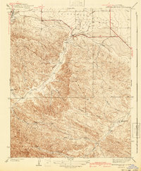
 1945 Millerton Lake1945 Print · USGSThe Madera and Fresno County foothills come alive in the 1940s, showing the early years of Millerton Lake and the San Joaquin River gorge. Genealogists and historians can locate remote family sites like Venter and Hildreth, alongside the Picayune Rancheria and Walker Cemetery.2 unique versions available
 - 1946 Map of Malaga
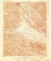
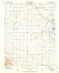
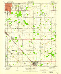 1946 Malaga1946 Print · USGSFresno and the surrounding vineyards and settlements are captured here in the mid-1940s. Genealogists and researchers can trace the agricultural landscape of Malaga, Fowler, and Lone Star while locating local landmarks like Adams Airport and the De Wolf Sch.
 - 1946 Map of Fresno South, 1947 Print
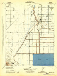
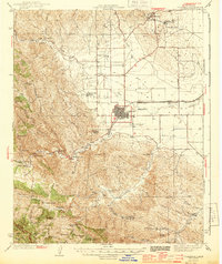
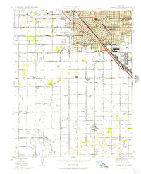 1946 Fresno South1947 Print · USGSThe Central Valley hub of Fresno is captured just after the war, showing the city's transition from a rail-dependent center to a modern agricultural and aviation base. Genealogists can trace family roots through neighborhood schools like Edison Technical Sch and sites such as Ararat Cemetery.
 - 1946 Map of Friant, 1947 Print
 1946 Friant1947 Print · USGSThe San Joaquin River frontier was being reshaped by industrial engineering in the late 1940s. Genealogists and historians can trace the foundations of the regional water system at Friant Dam and find local landmarks like Gordon, Millerton Sch, and the Southern Pacific rail line.
 - 1946 Map of Tranquillity, 1953 Print
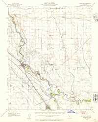
 1946 Tranquillity1953 Print · USGSAgricultural life in Fresno County during the mid-1940s revolved around rail transport and water management. Genealogists and historians can trace family operations like Coit Ranch and Englebrecht Ranch or follow the Southern Pacific through Tranquillity.
 - 1946 Map of Firebaugh, 1954 Print
 1946 Firebaugh1954 Print · USGSThe Central Valley ranching and rail corridor comes to life in the mid-1940s as irrigation projects began reshuffling the landscape. Trace the Southern Pacific line through Firebaugh and Mendota, or locate family-named sites like Helm Ranch and Arbios.2 unique versions available
Showing maps 1-25 of 78
Top cities of Fresno County
- Fresno historical maps
- Clovis historical maps
- Reedley historical maps
- Sanger historical maps
- Selma historical maps
- Coalinga historical maps
See more
Frequently asked questions
- What are the different types of historical maps available for Fresno County?
- What is the oldest map of Fresno County?
- Where can I purchase historical maps of Fresno County for my home or office?
- Where can I download high-res historical maps of Fresno County?
- Are there historical topographic maps available for Fresno County?
- Is there historical aerial imagery available for Fresno County?
- Where are historical maps of Fresno County sourced from?