1920s Maps of Fresno County, California
Explore 59 historic maps of Fresno County from the 1920s. These maps offer a rare glimpse into what life looked like during the 1920s — showing old roads, neighborhoods, homes, and landmarks that have changed or disappeared over time.
Whether you're researching your family's past, planning a metal detecting trip, or studying how Fresno County's landscape evolved across the 1920s, these high-resolution maps are a powerful tool for exploring the history of this region.
- Focus on a specific era: All maps on this page are from the 1920s, giving you a focused view of this time period.
- See what’s changed: Compare century-old streets, trails, and buildings to today's modern landscape using overlays and satellite layers.
- Research with precision: Use these maps for genealogy, historical research, land use analysis, or educational projects.
- View, download, or print: Maps are fully viewable online in high resolution, and can be downloaded or printed for your own records.
Start exploring Fresno County's history through authentic maps from the 1920s. This is your window into the past.
Fresno County, CA maps
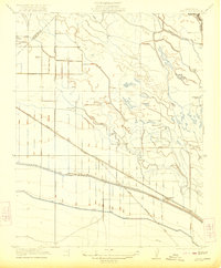
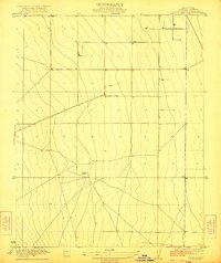
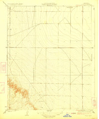
(59)- 1920 Map of Santa Rita Bridge
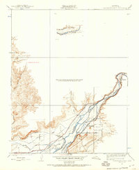
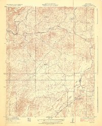
 1920 Santa Rita Bridge1920 Print · USGSThe central San Joaquin Valley appears here as an intricate network of waterways and early ranching outposts just after the turn of the century. Researchers can trace the legacy of large land holdings like Santa Rita Ranch and find specific sites like the Temple Gun Club or Lucerne Farm.
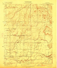
 - 1920 Map of Orangedale School, 1957 Print
 1920 Orangedale School1957 Print · USGSThe foothills of eastern Fresno County meet the valley floor in the 1920s as a complex network of irrigation canals begins to reshape the land. Genealogists and local historians can trace the rail-and-river economy through the Atchison Topeka and Santa Fe line and settlements like Piedra, Avocado, and Gravesboro.
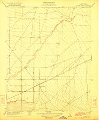
 - 1921 Map of Laguna Seca Ranch
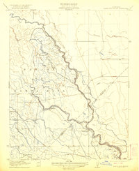
 1921 Laguna Seca Ranch1921 Print · USGSThe Fresno and Merced borderlands come into focus in the early 1920s, showing the intersection of these two counties along the foothills. Researchers can trace the winding course of Little Panoche Creek and study the elevation of Merced Co and Fresno Co.
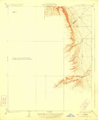
 - 1921 Map of Squaw Valley
 1921 Squaw Valley1921 Print · USGSSettlement and irrigation transform the Sierra foothills in the early twenties as the citrus industry takes root. Genealogists and historians can trace the early grid of Orange Cove and the development of the Citrus Cove School along the Atchison Topeka and Santa Fe line.
 - 1921 Map of Bullard
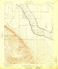
 1921 Bullard1921 Print · USGSNorth Fresno and the San Joaquin River corridor were undergoing rapid development in the early twenties as the city expanded toward the Madera County line. Genealogists and local historians can trace early neighborhood schools like Lincoln School and rail junctions such as Biola Junction or the Fresno Interurban.
 - 1921 Map of Mendota
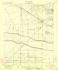
 1921 Mendota1921 Print · USGSAgricultural ranching and water management define this Fresno County landscape in the early twenties. Genealogists and historians can trace the specific boundaries of White House Ranch and Columbia Ranch or locate early industrial sites like Aliso Mill.
 - 1921 Map of Tierra Loma School
 1921 Tierra Loma School1921 Print · USGSWestern Fresno County ranching country is captured here in the early 1920s, showing the intersection of valley agriculture and steep foothills. Researchers can trace the exact location of the Tierra Loma School and historical holdings like the (Laguna Seca Ranch) and (Chaney Ranch).
 - 1922 Map of Oxalis
 1922 Oxalis1922 Print · USGSThe Fresno and Merced borderlands are captured here in the early twenties during a period of significant irrigation and ranching expansion. Local historians can trace the foundations of the regional economy through the San Joaquin River canals and operations like Hog Ranch and Oxalis.3 unique versions available
 - 1922 Map of Santa Rita Bridge
 1922 Santa Rita Bridge1922 Print · USGSThe braided channels of the San Joaquin Valley are captured here in the early twentieth century, showing a landscape of sprawling ranches and water rights. Genealogists and historians can trace old property lines and river crossings like Santa Rita Bridge, Santa Rita Ranch, and the Temple Gun Club.2 unique versions available
 - 1922 Map of Charleston School
 1922 Charleston School1922 Print · USGSMerced County agriculture was being transformed in the early twenties as irrigation grids expanded across the valley floor. Genealogists and researchers can trace the location of the Charleston School and the path of the San Joaquin and Kings River Canal alongside Swamp Road.2 unique versions available
 - 1922 Map of Dos Palos
 1922 Dos Palos1922 Print · USGSThe San Joaquin Valley comes into focus in the early twenties as irrigation and rail infrastructure transformed the landscape. Map collectors can trace the San Joaquin and Kings River Canal alongside the Old Southern Pacific Grade and the settlement at Oro Loma.2 unique versions available
 - 1922 Map of Tufts Ranch
 1922 Tufts Ranch1922 Print · USGSThe Fresno County landscape in the early twenties reveals an era of developing ranchland and agricultural expansion. Researchers can locate the central operations of Tufts Ranch and trace the grid of section lines that organized this part of the San Joaquin Valley.
 - 1922 Map of Round Mountain
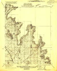
 1922 Round Mountain1922 Print · USGSFresno County's agricultural expansion is on full display in the early 1920s as irrigation canals and rural schools spread across the plains. Trace family roots and local history at Redbank Cemetery, the Fresno Interurban railroad, and Gray Colony School.2 unique versions available
 - 1922 Map of Trimmer
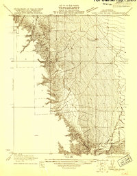
 1922 Trimmer1922 Print · USGSThe foothills of eastern Fresno County meet the San Joaquin Valley floor during a period of booming citrus and rail development. Researchers can trace early family-run rangelands and specialized sites like the Wahtoke Winery, the Sunnyside Mine, and the Sycamore Creek Indian School.
 - 1922 Map of Lanes Bridge
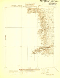
 1922 Lanes Bridge1922 Print · USGSThe San Joaquin River valley at the Madera-Fresno county line comes to life in this early 1920s survey. Historians can trace the rural landscape through landmarks like Deep Well School, the crossing at Lanes Bridge, and the Little Table Mountain foothills.
 - 1922 Map of Friant
 1922 Friant1922 Print · USGSFresno County at the edge of the Sierra foothills is captured here during the heyday of the railroad and early copper mining. Researchers can trace the legacy of rural education at Pollasky School or locate the Fresno Copper Mine and Gordon Siding.2 unique versions available
 - 1922 Map of Pozo Farm
 1922 Pozo Farm1922 Print · USGSThe San Joaquin River and its complex system of canals define the Madera and Fresno county line in the early 1920s. Researchers can trace early irrigation at Pozo Farm or locate landmarks like the Rasin City Gun Club and the Southern Pacific rail line.2 unique versions available
 - 1922 Map of Chaney Ranch
 1922 Chaney Ranch1922 Print · USGSWestern Fresno County appears as a vast network of arroyos and range lands in the early 1920s. Genealogists and historians can trace the remote Chaney Ranch and the winding course of Panoche Creek across this detailed topographic survey.2 unique versions available
 - 1923 Map of Kearney Park
 1923 Kearney Park1923 Print · USGSAgricultural development in the San Joaquin Valley is caught at a pivotal moment in the 1920s. Genealogists can trace the rural school districts of Dunkard School and Perrin School or find the early rail stops at Rolinda and McMullin.
 - 1923 Map of Laguna Seca Ranch
 1923 Laguna Seca Ranch1923 Print · USGSRanching and rugged terrain define the Merced and Fresno county line during the early twenties. Genealogists and land historians can trace the early boundaries of Laguna Seca Ranch and the winding course of Little Panoche Creek.3 unique versions available
 - 1923 Map of Sultana
 1923 Sultana1923 Print · USGSCentral Valley agriculture and rail lines dominate the landscape during the early 1920s. Genealogists can trace family footprints near Sultana, Orosi, and Cutler, or locate rural school sites like Mt Olive School.
 - 1923 Map of Malaga
 1923 Malaga1923 Print · USGSFresno and its southern agricultural suburbs are captured here in the early 1920s, a landscape defined by irrigation canals and rail-side packing towns. Trace the locations of early rural landmarks like Mattei Packing Co Plant, Magnolia School, and the County Fair Grounds Auto Speedway.
 - 1923 Map of Herndon
 1923 Herndon1923 Print · USGSCentral California's agricultural landscape comes into focus in the early twenties as the grid of Fresno County takes shape. Trace the early rail stops at Herndon, Barstow, and Dickerson along the San Joaquin River and major lines.2 unique versions available
 - 1923 Map of Academy
 1923 Academy1923 Print · USGSFresno County ranching and quarrying culture is documented here in the early 1920s as the Sierra foothills began to develop. Researchers can locate specific family operations like Blasingame Ranch and the vital Academy Granite Quarry near the settlement of Academy.
 - 1923 Map of Levis
 1923 Levis1923 Print · USGSFresno County oil and ranching lands come into focus during the early twenties as the valley floor meets the western hills. Researchers can trace the legacy of petroleum at the Oil Pumping Sta and locate early landholdings such as Englebrecht Ranch near Levis.2 unique versions available
Showing maps 1-25 of 59
Top cities of Fresno County
- Fresno historical maps
- Clovis historical maps
- Reedley historical maps
- Sanger historical maps
- Selma historical maps
- Coalinga historical maps
See more
Frequently asked questions
- What are the different types of historical maps available for Fresno County?
- What is the oldest map of Fresno County?
- Where can I purchase historical maps of Fresno County for my home or office?
- Where can I download high-res historical maps of Fresno County?
- Are there historical topographic maps available for Fresno County?
- Is there historical aerial imagery available for Fresno County?
- Where are historical maps of Fresno County sourced from?