Old Maps of Fresno County, California for Genealogy
Trace your family roots with 1,042 historic maps of Fresno County. These high-res maps reveal old neighborhoods, homesites, landmarks, and streets — helping you uncover where your ancestors lived and how the area evolved over time.
- Explore historic neighborhoods: Identify where your relatives may have lived in the 1800s or 1900s.
- Compare maps over time: Trace the changes in streets, buildings, and landmarks for multi-generational research.
- Perfect for genealogy & ancestry research: Used by family historians and researchers to map out lineage and migration.
These maps are an incredible resource for exploring your personal connection to Fresno County's past.
Fresno County, CA maps
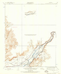
(1,042)- 1901 Map of Mt. Lyell
 1901 Mt. Lyell1901 Print · USGSThe High Sierra at the end of the century is captured here in immense detail, showing the early boundaries of Yosemite National Park. Researchers can trace old mountain routes past Soda Springs, Tuolumne Meadows, and Miller Bridge.12 unique versions available
 - 1903 Map of Tehipite, 1953 Print
 1903 Tehipite1953 Print · USGSThe High Sierra backcountry in the early twentieth century shows a landscape of early timber works and newly formed preserves. Trace family roots and old park outposts near Hume, Kanawyers, and the historic Abbott Mill.
 - 1904 Map of Kaiser
 1904 Kaiser1904 Print · USGSThe central Sierra Nevada high country is captured here during the first years of the twentieth century, showing the early logging and mining trails of the Sierra Forest Reserve. Researchers can locate historic mills and camps like Damon Mill, Tollhouse, and Ockenden before the expansion of mountain reservoirs.8 unique versions available
 - 1905 Map of Tehipite
 1905 Tehipite1905 Print · USGSThe High Sierra at the start of the twentieth century shows a landscape where early tourism and timber industry met. Researchers can trace the original footprint of General Grant National Park and find old lumber sites like Millwood and Harts Sawmill.8 unique versions available
 - 1907 Map of Mt. Whitney
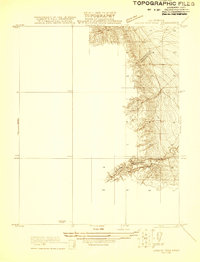
 1907 Mt. Whitney1907 Print · USGSThe Owens Valley and Sierra high country come alive in this early survey of the Inyo and Tulare border. Genealogists can trace the early layout of Independence and Lone Pine or locate sites like the Bluebell Mine and Old Camp Independence.10 unique versions available
 - 1912 Map of Coalinga
 1912 Coalinga1912 Print · USGSThe western San Joaquin Valley comes into focus in the early twentieth century as oil and rail transform the landscape. Genealogists and historians can trace the industrial roots of Oilfields and Coalinga or locate the San Joaquin Valley Coal Mine.4 unique versions available
 - 1912 Map of Mariposa
 1912 Mariposa1912 Print · USGSThe California Sierra foothills in the early twentieth century are mapped here as a hive of mining and timber activity. Researchers can trace the legacy of remote settlements and family lands including Grub Gulch, the Indian Settlement, and Knowles.6 unique versions available
 - 1912 Map of Mt. Goddard
 1912 Mt. Goddard1912 Print · USGSThe high Sierra crest at the opening of the twentieth century remains a land of seasonal camps and early hydroelectric power. Trace the old trails to Andrews Camp, the Old Brewery near Bishop, and early wilderness outposts at Hot Springs.10 unique versions available
 - 1913 Map of Bishop
 1913 Bishop1913 Print · USGSThe Owens Valley was a landscape of high-altitude industry and burgeoning towns in the years before massive water diversions. Trace the path of the Southern Pacific Railroad through Laws and Big Pine, or locate family sites like Roberts Ranch and the Riverside School.8 unique versions available
 - 1913 Map of Panoche
 1913 Panoche1913 Print · USGSThe San Joaquin Valley and its ranching foothills appear in the early twentieth century before modern expansion. Genealogists can find remote rural schools and outposts like Mercy School, Laguna Seca Ranch, and the Mercy Mine.4 unique versions available
 - 1914 Map of Mt. Morrison
 1914 Mt. Morrison1914 Print · USGSThe High Sierra and Mono Basin are seen here in the early twentieth century, showing a network of remote ranches and early timber camps. Researchers can trace historic sites like Mono Mills, the remote Dutch Petes Ranch, and the Casa Diablo Mine.8 unique versions available
 - 1914 Map of Cholame
 1914 Cholame1914 Print · USGSCentral California ranching and rugged topography meet at the turn of the century across the Temblor Range. Genealogists and historians can trace early outposts like Devils Den, Dudley, and Carter's Ranch.
 - 1915 Map of Priest Valley
 1915 Priest Valley1915 Print · USGSCoastal range life in the early 1900s centered on remote mines and valley ranching hubs. Researchers can trace rural school districts like Columbus School and explore early mining operations such as the Monterey Coalmine or the New Idria Idria P O.5 unique versions available
 - 1915 Map of Cholame, 1956 Print
 1915 Cholame1956 Print · USGSThe ranchlands of the Central Coast and western San Joaquin Valley were still largely defined by mining and cattle during the early 1900s. Genealogists and researchers can trace family-run operations at Cholame Ranch or find vanished rural schoolhouses like Eagle School and Alliance School.
 - 1916 Map of Santa Rita Bridge, 1948 Print
 1916 Santa Rita Bridge1948 Print · USGSThe San Joaquin River valley was a landscape of ambitious ranching and irrigation in the mid-1940s. Genealogists and local historians can trace legacy holdings like Wolfsen Mill, Belmont Ranch, and Temple Ranch across this three-county border region.2 unique versions available
 - 1916 Map of Sulphur Springs, 1959 Print
 1916 Sulphur Springs1959 Print · USGSThe canyon lands of the Sierra foothills appear here as they were before the creation of Millerton Lake. Researchers can trace the original riverbanks and historic sites like Old Millerton, Old Fort Miller, and Belleview.2 unique versions available
 - 1917 Map of Cholame
 1917 Cholame1917 Print · USGSSan Luis Obispo and Monterey counties in the early twentieth century reveal a landscape of remote quicksilver mines and isolated ranching outposts. Genealogists and researchers can trace family-named landmarks like Carter's Ranch and early rural education at Eagle School or Choice Valley School.4 unique versions available
 - 1919 Map of Mt. Whitney
 1919 Mt. Whitney1919 Print · USGSOwens Valley life and the High Sierra peaks are captured here in the years following the railroad's arrival. Genealogists and historians can trace early settlements and transit routes, from the streets of Independence to the Bluebell Mine and the grounds of Old Camp Independence.
 - 1919 Map of Sulphur Springs
 1919 Sulphur Springs1919 Print · USGSThe San Joaquin River foothills appear at a crossroads during the late teens, just as the regional landscape began to modernize. Researchers can locate the early sites of Old Fort Miller and Old Millerton or trace the winding Friant and O'neals Road.2 unique versions available
 - 1920 Map of Santa Rita Bridge
 1920 Santa Rita Bridge1920 Print · USGSThe central San Joaquin Valley appears here as an intricate network of waterways and early ranching outposts just after the turn of the century. Researchers can trace the legacy of large land holdings like Santa Rita Ranch and find specific sites like the Temple Gun Club or Lucerne Farm.
 - 1920 Map of Orangedale School, 1957 Print
 1920 Orangedale School1957 Print · USGSThe foothills of eastern Fresno County meet the valley floor in the 1920s as a complex network of irrigation canals begins to reshape the land. Genealogists and local historians can trace the rail-and-river economy through the Atchison Topeka and Santa Fe line and settlements like Piedra, Avocado, and Gravesboro.
 - 1921 Map of Laguna Seca Ranch
 1921 Laguna Seca Ranch1921 Print · USGSThe Fresno and Merced borderlands come into focus in the early 1920s, showing the intersection of these two counties along the foothills. Researchers can trace the winding course of Little Panoche Creek and study the elevation of Merced Co and Fresno Co.
 - 1921 Map of Squaw Valley
 1921 Squaw Valley1921 Print · USGSSettlement and irrigation transform the Sierra foothills in the early twenties as the citrus industry takes root. Genealogists and historians can trace the early grid of Orange Cove and the development of the Citrus Cove School along the Atchison Topeka and Santa Fe line.
 - 1921 Map of Bullard
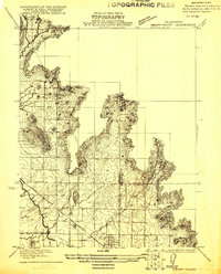
 1921 Bullard1921 Print · USGSNorth Fresno and the San Joaquin River corridor were undergoing rapid development in the early twenties as the city expanded toward the Madera County line. Genealogists and local historians can trace early neighborhood schools like Lincoln School and rail junctions such as Biola Junction or the Fresno Interurban.
 - 1921 Map of Mendota
 1921 Mendota1921 Print · USGSAgricultural ranching and water management define this Fresno County landscape in the early twenties. Genealogists and historians can trace the specific boundaries of White House Ranch and Columbia Ranch or locate early industrial sites like Aliso Mill.
Showing maps 1-25 of 1,042
Top cities of Fresno County
- Fresno historical maps
- Clovis historical maps
- Reedley historical maps
- Sanger historical maps
- Selma historical maps
- Coalinga historical maps
See more
Frequently asked questions
- What are the different types of historical maps available for Fresno County?
- What is the oldest map of Fresno County?
- Where can I purchase historical maps of Fresno County for my home or office?
- Where can I download high-res historical maps of Fresno County?
- Are there historical topographic maps available for Fresno County?
- Is there historical aerial imagery available for Fresno County?
- Where are historical maps of Fresno County sourced from?