1990s Maps of Fresno County, California
Explore 38 historic maps of Fresno County from the 1990s. These maps offer a rare glimpse into what life looked like during the 1990s — showing old roads, neighborhoods, homes, and landmarks that have changed or disappeared over time.
Whether you're researching your family's past, planning a metal detecting trip, or studying how Fresno County's landscape evolved across the 1990s, these high-resolution maps are a powerful tool for exploring the history of this region.
- Focus on a specific era: All maps on this page are from the 1990s, giving you a focused view of this time period.
- See what’s changed: Compare century-old streets, trails, and buildings to today's modern landscape using overlays and satellite layers.
- Research with precision: Use these maps for genealogy, historical research, land use analysis, or educational projects.
- View, download, or print: Maps are fully viewable online in high resolution, and can be downloaded or printed for your own records.
Start exploring Fresno County's history through authentic maps from the 1990s. This is your window into the past.
Fresno County, CA maps
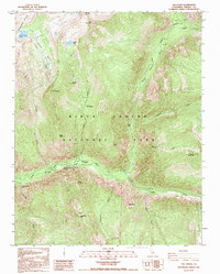
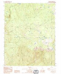
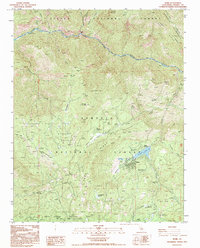
(38)- 1990 Map of Mammoth Pool Dam
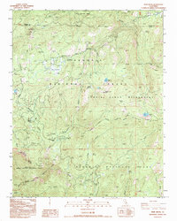
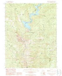 1990 Mammoth Pool Dam1990 Print · USGSThe upper San Joaquin River basin is captured here as the century drew to a close, showing the intersection of hydroelectric power and forest recreation. Trace high-country landmarks like Wissman Mine, the remote Daulton Station, and Kaiser Ridge.2 unique versions available
 - 1990 Map of Squaw Dome
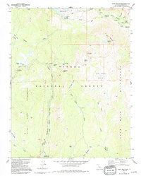
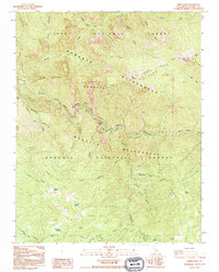
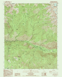
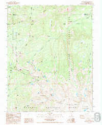
 1990 Squaw Dome1990 Print · USGSThe high Sierra backcountry is mapped here in the early 1990s as it spans the rugged Madera and Fresno county line. Researchers can locate remote seasonal sites like Minarets FS Station and trace paths through Graveyard Meadow or the namesake Squaw Dome.2 unique versions available
 - 1990 Map of Ward Mountain, 1994 Print
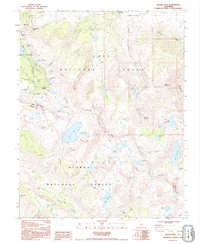
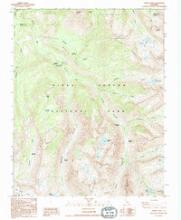
 1990 Ward Mountain1994 Print · USGSThe High Sierra in the 1990s reveals a wilderness of geothermal springs and alpine reservoirs. Trace the Muir Trail past Muir Trail Ranch to Hot Springs and the camps at Blayney Meadows.
 - 1990 Map of Bloody Mountain, 1995 Print
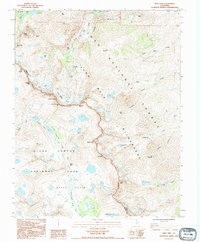
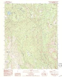
 1990 Bloody Mountain1995 Print · USGSHigh Sierra mining history and wilderness recreation intersect in the 1990s near the crest of the Sierra Nevada. Trace old mineral workings at Old Mammoth Mine and the Mill City (Site) alongside high-altitude waters like Duck Lake and Bloody Lake.
 - 1990 Map of Split Mtn, 1995 Print
 1990 Split Mtn1995 Print · USGSHigh Sierra wilderness and industrial history meet in the 1990s as the Pacific Crest National Scenic Trail crosses the alpine peaks. Trace the rugged terrain of the Blue Star Mines and the shoreline of Palisade Lakes.
 - 1992 Map of The Sphinx, 1994 Print
 1992 The Sphinx1994 Print · USGSKings Canyon is captured in the early nineties as a landscape of dramatic river gorges and granite heights. Researchers can trace the location of Kanawyers (Site) and find landmarks like The Sphinx, Zumwalt Meadows, and Roaring River Falls.
 - 1992 Map of Kearsarge Peak, 1994 Print
 1992 Kearsarge Peak1994 Print · USGSThe Sierra Nevada high country appears in detail during the early nineties, showing the remote peaks and protected habitats of the Inyo National Forest. Trace trails to Onion Valley or explore landmarks like Seven Pines and Mount Baxter.
 - 1992 Map of Slide Bluffs, 1994 Print
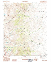
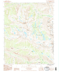
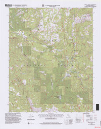
 1992 Slide Bluffs1994 Print · USGSHigh Sierra wilderness dominates this 1990s survey of Fresno County, showing the intersection of several national forests and protected lands. Hikers and cartographers can trace remote features like the Gorge of Despair, Volcanic Lakes, and the high crossing at Tunemah Pass.2 unique versions available
 - 1992 Map of Mt. Pinchot, 1994 Print
 1992 Mt. Pinchot1994 Print · USGSThe High Sierra backcountry of Fresno and Inyo Counties is captured here in the early nineties, centered on the crossing of the Pacific Crest National Scenic Trail. Mountaineers and researchers can trace the routes through Pinchot Pass and Taboose Pass or locate remote water bodies like Lake Marjorie.
 - 1992 Map of Rough Spur, 1994 Print
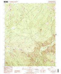
 1992 Rough Spur1994 Print · USGSFresno County high country in the early nineties shows a landscape of deep canyons and alpine basins at the edge of the wilderness. Trace the routes between Cliff Camp, Statham, and remote water bodies like Spanish Lake and Duck Lake.
 - 1992 Map of Wren Peak, 1995 Print
 1992 Wren Peak1995 Print · USGSThe high Sierra Nevada backcountry of Fresno County comes alive here in the early nineties. Forest historians and researchers can trace the locations of numerous sequoia stands, including Evans Grove and Kennedy Grove, alongside landmarks like Boyden Cave and the Camp Seven (Site).2 unique versions available
 - 1992 Map of Mt. Clarence King, 1995 Print
 1992 Mt. Clarence King1995 Print · USGSThe High Sierra backcountry is captured here during the 1990s, centering on the high basins and peaks of the Sierra Crest. Hikers and historians can trace the Pacific Crest National Scenic Trail as it passes Bullfrog Lake and crosses Glen Pass.2 unique versions available
 - 1992 Map of Cattle Mtn, 1995 Print
 1992 Cattle Mtn1995 Print · USGSHigh Sierra territory in the early nineties comes to life through this detailed mapping of the San Joaquin River headwaters. Trace the networks of named alpine meadows like Naked Lady Meadow and Soldier Meadow, or locate high-country features such as Chetwood and the Granite Stairway.
 - 1992 Map of Tehipite Dome, 1995 Print
 1992 Tehipite Dome1995 Print · USGSFresno County's high wilderness is detailed in the early 1990s as it transitions between national forest and park lands. Researchers can trace remote backcountry features like Crown Valley Station, Randle Corral, and the dramatic Tehipite Dome.
 - 1992 Map of Hume, 1995 Print
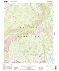
 1992 Hume1995 Print · USGSHigh in the Sierra Nevada during the early nineties, this landscape reveals the intersection of timber history and mountain recreation. Researchers can trace the legacy of giant sequoia logging through landmarks like the Chicago Stump and Boole Tree near Hume Lake.
 - 1992 Map of Crystal Crag, 1995 Print
 1992 Crystal Crag1995 Print · USGSThe High Sierra backcountry of Madera and Mono Counties is documented here in the early nineties, centered on the unique basalt columns of Devils Postpile. Trace the historic routes of the John Muir Trail past Reds Meadow and the alpine shores of Lake Mary.
 - 1992 Map of Cedar Grove, 1995 Print
 1992 Cedar Grove1995 Print · USGSKings Canyon and the surrounding Sierra Nevada backcountry are documented in the early 1990s as the recreational landscape of the South Fork was fully established. Tracing family camping trips or hiking routes is easy via Cedar Grove, the Deer Cove Trail, and landmarks like Grizzly Falls.
 - 1993 Map of Visalia
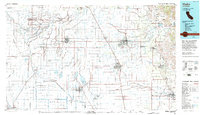 1993 Visalia1993 Print · USGSThe San Joaquin Valley comes alive in the early nineties, showing a landscape defined by the Tulare Lake Bed and its vast network of canals. Trace family roots and local history near Santa Rosa Rancheria, Pixley Nat Wildlife Ref, and the Tulare Co Fairgrounds.2 unique versions available
 - 1993 Map of Mt. Brewer, 1994 Print
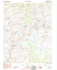 1993 Mt. Brewer1994 Print · USGSThe High Sierra backcountry of Tulare County is charted here during the early nineties, revealing the intersection of two national parks. Trace the Pacific Crest National Scenic Trail and high-altitude landmarks like Mt Brewer, Lake Reflection, and Milestone Mtn.2 unique versions available
 - 1993 Map of Muir Grove, 1994 Print
 1993 Muir Grove1994 Print · USGSThe High Sierra backcountry of Tulare County is captured here in the early nineties, showing where the national park and forest lands meet. Researchers can trace the developed corridor of Generals Hwy to find Stony Creek Village, Lost Grove, and the Lookout atop Buck Rock.
 - 1993 Map of Mt. Silliman, 1995 Print
 1993 Mt. Silliman1995 Print · USGSThe High Sierra backcountry of Tulare and Fresno counties is mapped here in the early nineties, showing the intersection of two iconic national parks. Hikers and historians can trace the paths through Marvin Pass and Silliman Pass to reach remote waters like Seville Lake and Lost Lake.2 unique versions available
 - 1993 Map of Sphinx Lakes, 1995 Print
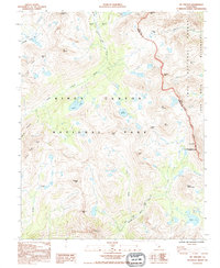
 1993 Sphinx Lakes1995 Print · USGSKings Canyon National Park in the mid-1990s reveals a managed wilderness of remote backcountry outposts and glacial terrain. Hikers and historians can trace routes to the Barton-Lackey Cabin, Roaring River Ranger Station, and the high waters of Big Bird Lake.
 - 1993 Map of General Grant Grove, 1995 Print
 1993 General Grant Grove1995 Print · USGSThe High Sierra backcountry of Tulare and Fresno counties is captured here in the early nineties, centered on the ancient giants of the Kings Canyon Grant Grove. Researchers can locate established mountain communities like Wilsonia, trace the path of the Generals Highway, and identify specific groves such as Big Baldy Grove.2 unique versions available
 - 1993 Map of Dinkey Creek, 2002 Print
 1993 Dinkey Creek2002 Print · USGSThe Sierra National Forest reveals its late-twentieth-century management patterns in this detailed topographic record. Researchers can trace forest service history through the Dinkey Creek Work Center, Camp Fresno, and the Bald Mountain Lookout.
 - 1993 Map of Cascadel Point, 2002 Print
 1993 Cascadel Point2002 Print · USGSThe High Sierra foothills come alive in the early nineties as hydroelectric power and forest recreation shape the Madera and Fresno county line. Trace the local impact of energy production and mountain life through Chawanakee Sch, Italian Bar, and Cascadel Woods.
Showing maps 1-25 of 38
Top cities of Fresno County
- Fresno historical maps
- Clovis historical maps
- Reedley historical maps
- Sanger historical maps
- Selma historical maps
- Coalinga historical maps
See more
Frequently asked questions
- What are the different types of historical maps available for Fresno County?
- What is the oldest map of Fresno County?
- Where can I purchase historical maps of Fresno County for my home or office?
- Where can I download high-res historical maps of Fresno County?
- Are there historical topographic maps available for Fresno County?
- Is there historical aerial imagery available for Fresno County?
- Where are historical maps of Fresno County sourced from?