2020s Maps of Fresno County, California
Explore 147 historic maps of Fresno County from the 2020s. These maps offer a rare glimpse into what life looked like during the 2020s — showing old roads, neighborhoods, homes, and landmarks that have changed or disappeared over time.
Whether you're researching your family's past, planning a metal detecting trip, or studying how Fresno County's landscape evolved across the 2020s, these high-resolution maps are a powerful tool for exploring the history of this region.
- Focus on a specific era: All maps on this page are from the 2020s, giving you a focused view of this time period.
- See what’s changed: Compare century-old streets, trails, and buildings to today's modern landscape using overlays and satellite layers.
- Research with precision: Use these maps for genealogy, historical research, land use analysis, or educational projects.
- View, download, or print: Maps are fully viewable online in high resolution, and can be downloaded or printed for your own records.
Start exploring Fresno County's history through authentic maps from the 2020s. This is your window into the past.
Fresno County, CA maps
(147)- 2021 Map of Reedley, 2021 Print
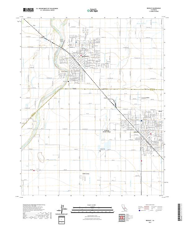 2021 Reedley2021 Print · USGSThe agricultural corridor of the San Joaquin Valley is shown in detail during the early 2020s, centered on the communities of Reedley and Dinuba. Genealogists and local historians can trace the irrigation networks and family-settled areas like Delft Colony, Lacjac, and the Reedley Cem.
 - 2021 Map of Marion Peak, 2021 Print
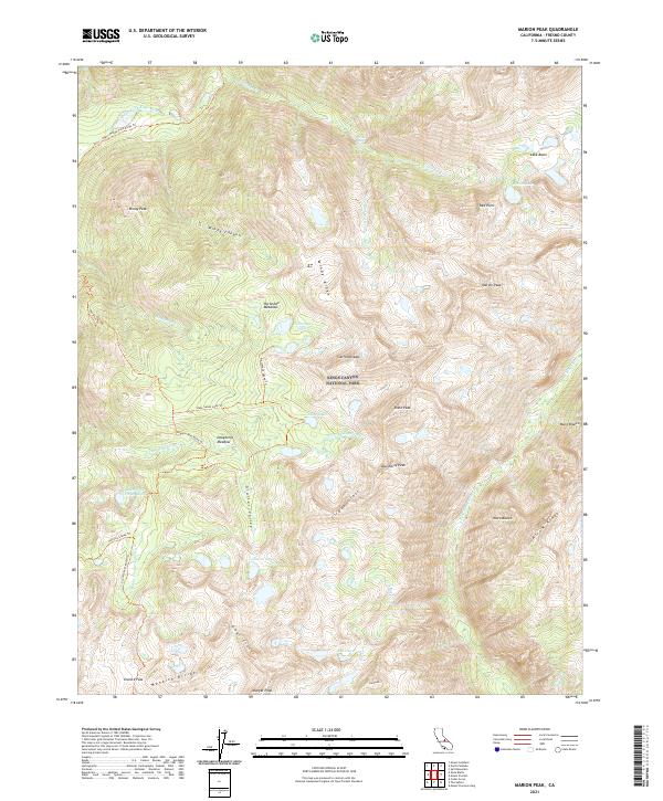 2021 Marion Peak2021 Print · USGSKings Canyon National Park in the early 2020s remains a high-altitude wilderness defined by the Kings Wild and Scenic River. Backcountry travelers can trace the routes to Granite Pass, the shores of State Lakes, and the peak of Marion Peak.
 - 2021 Map of Chaney Ranch, 2021 Print
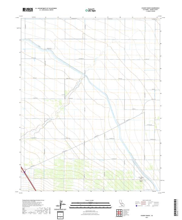 2021 Chaney Ranch2021 Print · USGSFresno County's agricultural heartland is captured here in the early 2020s, dominated by the massive California Aqueduct. Researchers can trace local names like Annadale, Millux, and the seasonal path of Panoche Cr through the valley floor.
 - 2021 Map of Lanes Bridge, 2021 Print
 2021 Lanes Bridge2021 Print · USGSThe northern edge of the Fresno metropolitan area meets the Madera County line in the early 2020s. Researchers can trace the modern development of Rolling Hills and Fort Washington or locate landmarks like Cobbs Island and the Madera Canal.
 - 2021 Map of Mendota Dam, 2021 Print
 2021 Mendota Dam2021 Print · USGSAgricultural life in the San Joaquin Valley comes into focus in this contemporary survey of the Fresno-Madera county line. Researchers can trace irrigation history through Mendota Pool and the path of the San Joaquin River near Mendota.
 - 2021 Map of Charleston School, 2021 Print
 2021 Charleston School2021 Print · USGSWestern Merced County is captured here at the junction of the San Joaquin Valley and the Diablo Range mountains. Researchers can trace the sophisticated irrigation grid of Hamburg Farms and major infrastructure like the Delta-Mendota Canal and Camp Thirteen Slough.
 - 2021 Map of Tranquillity, 2021 Print
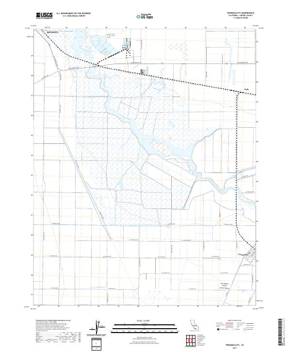 2021 Tranquillity2021 Print · USGSThe agricultural heart of the San Joaquin Valley comes into focus in this recent survey of Fresno County. Researchers can trace the water networks of Fresno Slough and James Bypass alongside local landmarks like Tranquillity and Ingle.
 - 2021 Map of Raisin, 2021 Print
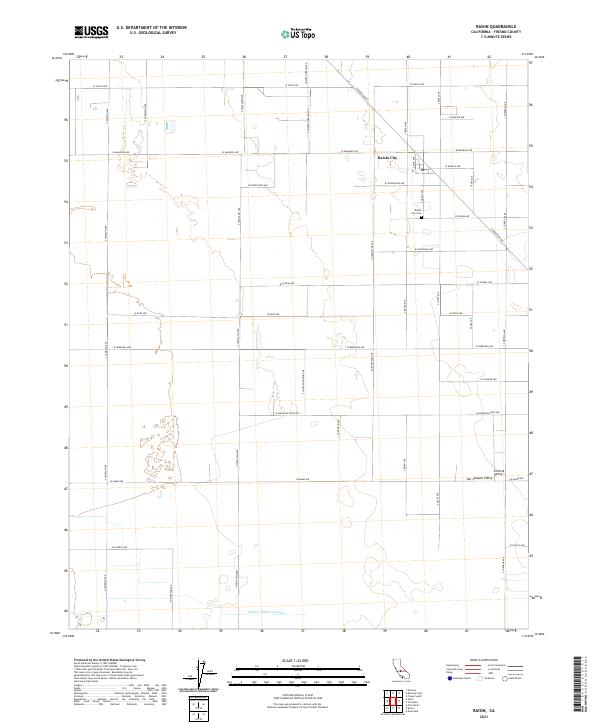 2021 Raisin2021 Print · USGSAgricultural life in the San Joaquin Valley is captured here during a period of modern farming and irrigation. Researchers can trace local heritage at the Raisin City Cem or follow the path of the Liberty Millrace Canal through the fertile Central Valley.
 - 2021 Map of Avenal, 2021 Print
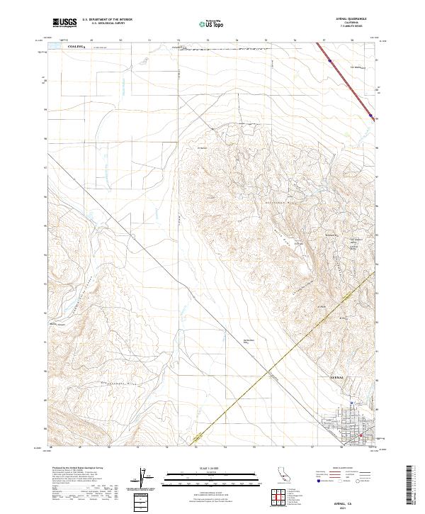 2021 Avenal2021 Print · USGSKings County's western edge comes into focus in this recent survey of the petroleum and agricultural lands surrounding the Kettleman Hills. Genealogists and historians can trace the streets of Avenal and navigate the natural drainages of Zapato Chino Canyon and Arroyo Ciervo.
 - 2021 Map of Riverdale, 2021 Print
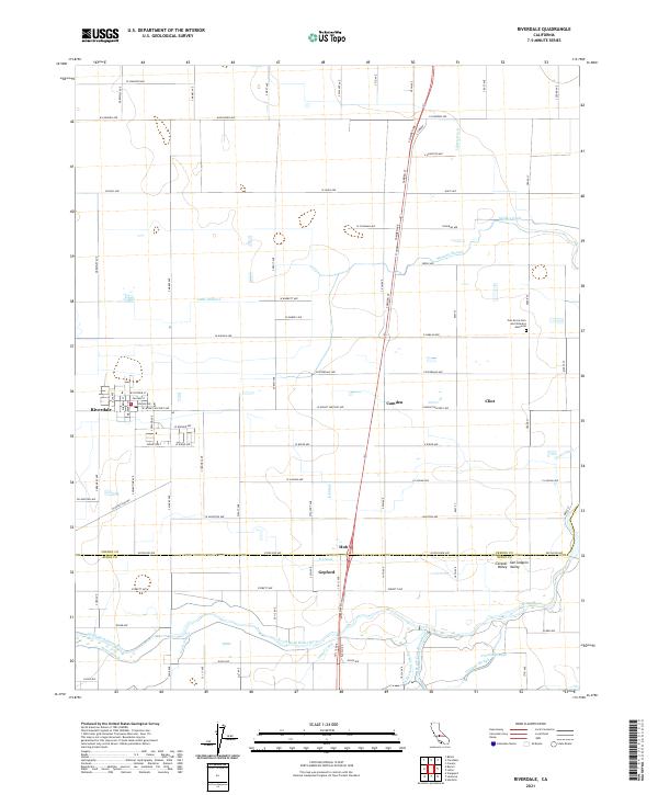 2021 Riverdale2021 Print · USGSThe San Joaquin Valley is captured here during the early twenty-first century, showing a landscape of precise irrigation and rural settlement. Researchers can trace the complex water networks of the North Fork Kings River and find local landmarks like Gepford and the Oak Grove Cem and Veterans Memorial.
 - 2021 Map of Mount Brewer, 2021 Print
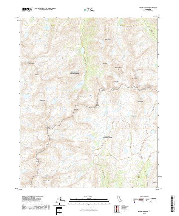 2021 Mount Brewer2021 Print · USGSThe high Sierra Nevada crest comes into focus in this recent survey, capturing the meeting point of two major national parks. Hikers and researchers can trace the high-altitude route of the Pacific Crest National Scenic Trl past landmarks like Mt Brewer and the alpine Lake South America.
 - 2021 Map of San Joaquin, 2021 Print
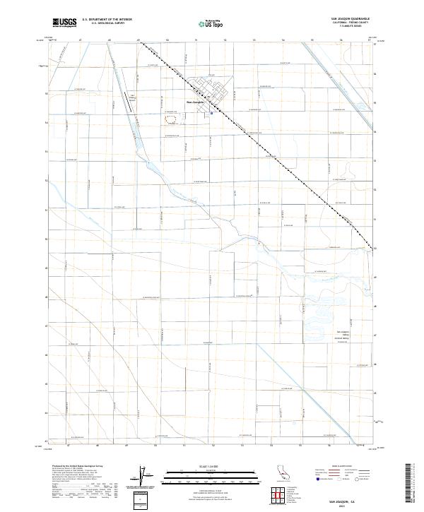 2021 San Joaquin2021 Print · USGSSan Joaquin sits at the heart of Fresno County's agricultural network in the early twenty-first century. Researchers can trace the layout of the town's core along Railroad St and map the vital water systems of the Fresno Slough and Beta Canal.
 - 2021 Map of Wahtoke, 2021 Print
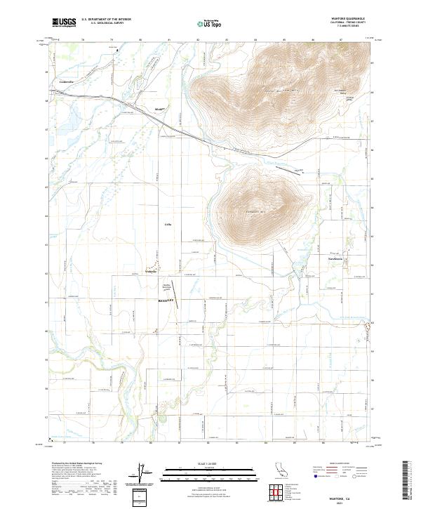 2021 Wahtoke2021 Print · USGSFresno County's agricultural heartland is documented here in the early twenty-first century as the valley floor meets the Sierras' foothills. Researchers can trace the complex irrigation networks of the Friant-Kern Canal and locate local landmarks like Acres Cem and Wahtoke Lake.
 - 2021 Map of Burrel, 2021 Print
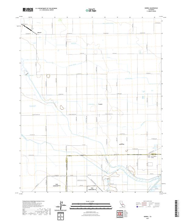 2021 Burrel2021 Print · USGSThe agricultural heart of the San Joaquin Valley is mapped here during a period of modern irrigation and military presence. Researchers can trace the water-rights history of the region through landmarks like Fresno Slough, the Liberty Millrace Canal, and the northern edge of the Lemoore Naval Air Station.
 - 2021 Map of Trimmer, 2021 Print
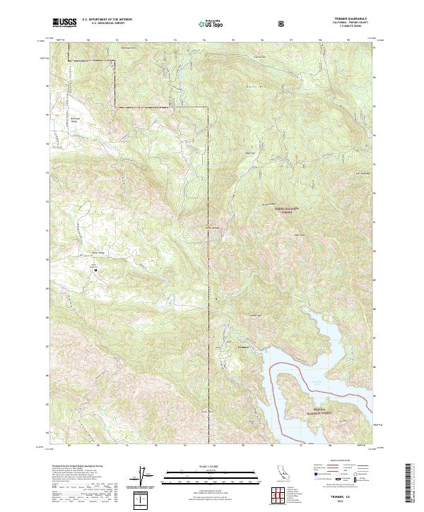 2021 Trimmer2021 Print · USGSThe foothills of Fresno County meet the waters of Pine Flat Lake in this modern survey of the Sierra Nevada. Researchers can trace rural landmarks like the Watts Valley Cem, the settlement of Trimmer, and the boundaries of the Sierra National Forest.
 - 2021 Map of Biola, 2021 Print
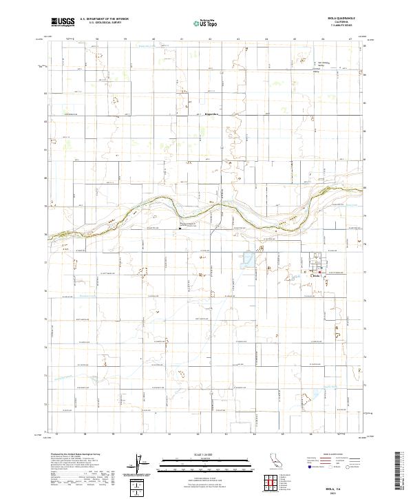 2021 Biola2021 Print · USGSThe agricultural heart of the San Joaquin Valley is revealed in this modern survey of the Fresno-Madera county line. Researchers can trace the path of the San Joaquin River and locate local landmarks like the Bethany Evangelical Lutheran Church Cem and Biola.
 - 2021 Map of Humphreys Station, 2021 Print
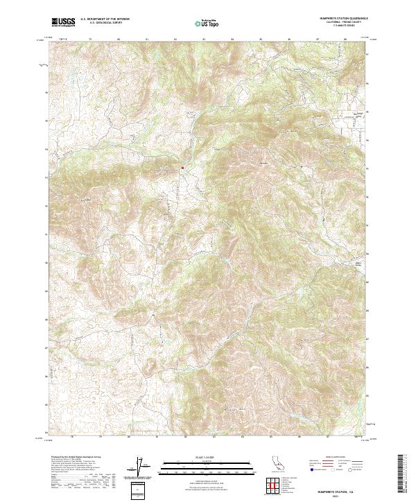 2021 Humphreys Station2021 Print · USGSFresno County foothills in the early 2020s show a landscape of rising peaks and winding canyon roads. Researchers can trace rural property access and modern settlement patterns around Burrough Valley, Watts Valley, and landmarks like Wildcat Mtn.
 - 2021 Map of Academy, 2021 Print
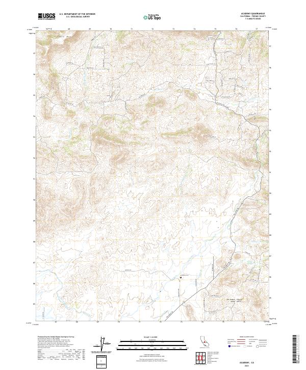 2021 Academy2021 Print · USGSFresno County's transition from the valley floor to the Sierra foothills is captured here in the early 2020s. Genealogists and local historians can locate the Academy Cem and trace the path of the Friant-Kern Canal and Tollhouse Rd.
 - 2021 Map of Patterson Mountain, 2021 Print
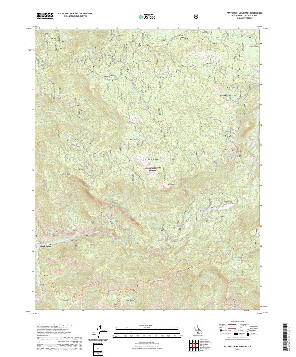 2021 Patterson Mountain2021 Print · USGSHigh Sierra forest and river canyons define this Fresno County landscape in the early twenty-first century. Outdoor researchers can trace the routes to Balch Camp or locate high-country landmarks like Patterson Mtn, Sawmill Flat, and Indian Rock.
 - 2021 Map of Calflax, 2021 Print
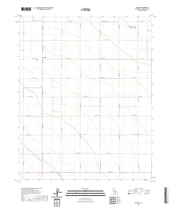 2021 Calflax2021 Print · USGSFresno County's agricultural heartland is shown in detail during the early 2020s, revealing the precise grid of the San Joaquin Valley. Researchers can trace the massive California Aqueduct and the local crossroads at Calflax.
 - 2021 Map of Round Mountain, 2021 Print
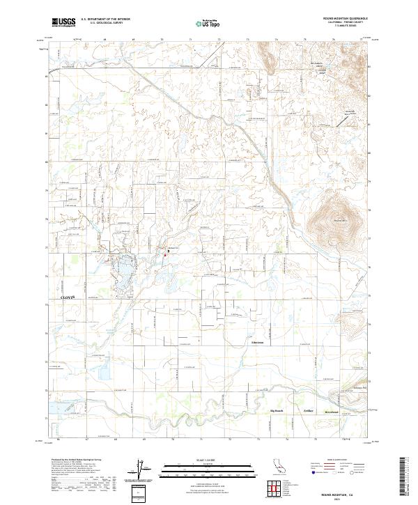 2021 Round Mountain2021 Print · USGSFresno County's agricultural heartland meets the Sierra foothills in the early 2020s, showing a landscape defined by irrigation and small settlements. Trace water history and genealogy through the Redbank Cemetery or rural hubs like Edmiston, Zediker, and Big Bunch.
 - 2021 Map of Kerman, 2021 Print
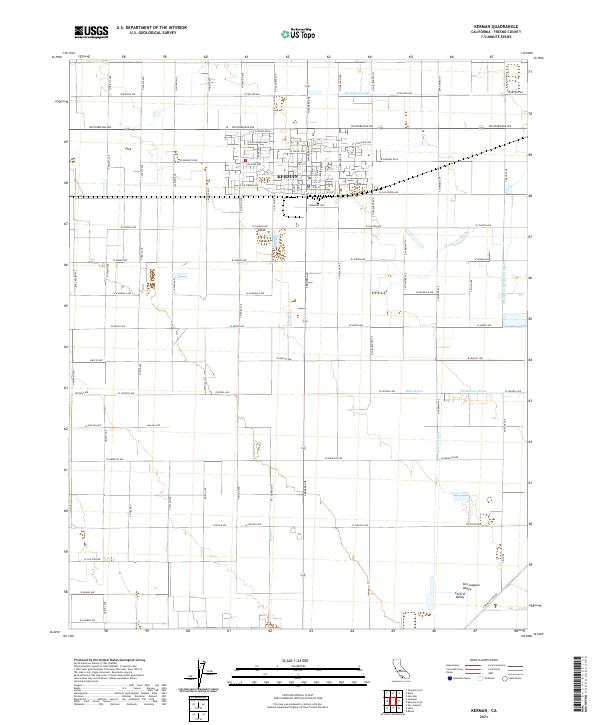 2021 Kerman2021 Print · USGSKerman and the surrounding San Joaquin Valley are captured here during a period of modern agricultural dominance. Researchers can trace the sophisticated irrigation network that supports the region, including the Houghton Canal, Deadwood Ditch, and Dry Cr Canal.
 - 2021 Map of Conejo, 2021 Print
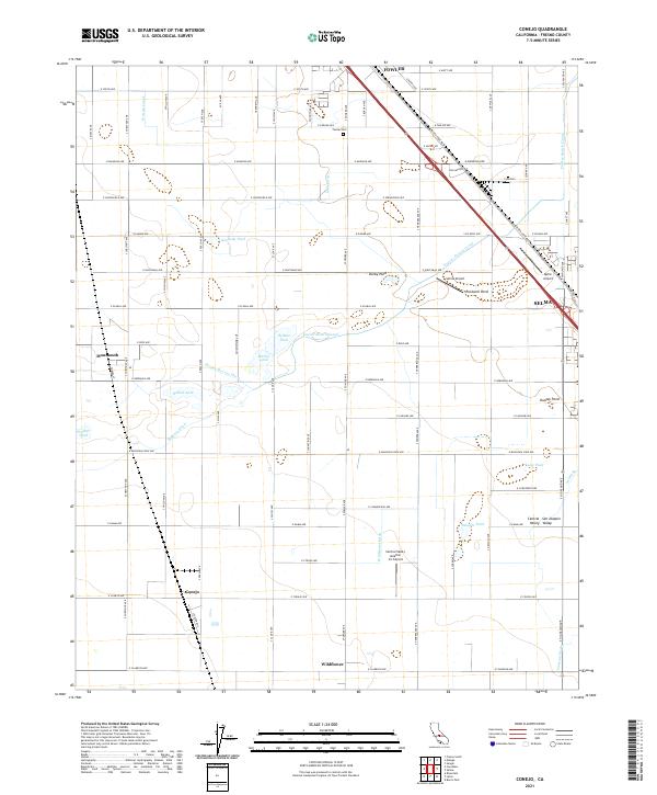 2021 Conejo2021 Print · USGSThe agricultural landscape of the San Joaquin Valley is on full display here, dominated by the diagonal transit corridor through Fowler and Selma. Researchers can trace the water history of the area through features like Fowler Switch Canal and the community of Wildflower.
 - 2021 Map of Mount Clarence King, 2021 Print
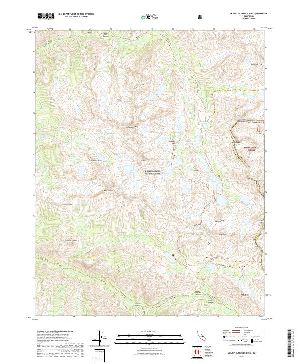 2021 Mount Clarence King2021 Print · USGSThe High Sierra divide comes alive in this modern survey of the wilderness where Fresno and Inyo counties meet. Hikers and historians can trace the iconic Pacific Crest National Scenic Trail as it summits Glen Pass and passes by Rae Lakes and Bullfrog Lake.
 - 2021 Map of Curry Mountain, 2021 Print
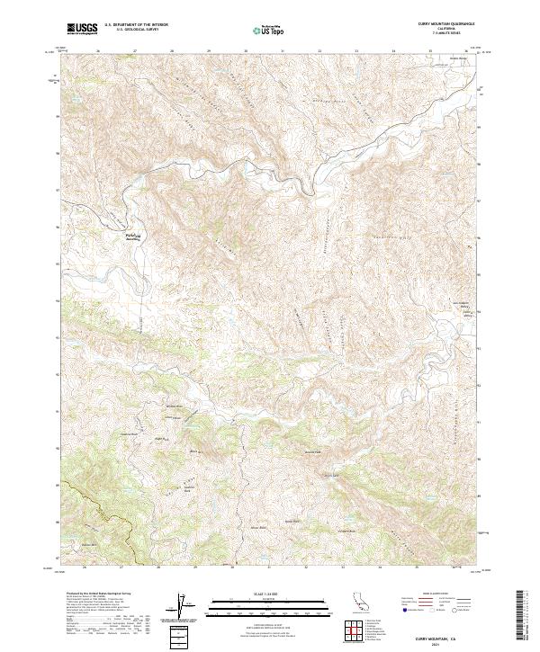 2021 Curry Mountain2021 Print · USGSWestern Fresno County is shown at the edge of the Diablo Range in this modern survey of high ridges and deep canyons. You can trace seasonal water sources and named landmarks like Parkfield Junction, Devils Gate, and Marcelin Spring.
Showing maps 1-25 of 147
Top cities of Fresno County
- Fresno historical maps
- Clovis historical maps
- Reedley historical maps
- Sanger historical maps
- Selma historical maps
- Coalinga historical maps
See more
Frequently asked questions
- What are the different types of historical maps available for Fresno County?
- What is the oldest map of Fresno County?
- Where can I purchase historical maps of Fresno County for my home or office?
- Where can I download high-res historical maps of Fresno County?
- Are there historical topographic maps available for Fresno County?
- Is there historical aerial imagery available for Fresno County?
- Where are historical maps of Fresno County sourced from?