Old Maps of Glenn County, California for Academic Research
Study the evolution of Glenn County with 260 high-resolution historic maps. Whether you're teaching, researching, or modeling changes in land use, these maps provide essential visual documentation of urban, environmental, and geographic change.
- Analyze long-term change: Track patterns in development, transportation, and natural features.
- Ideal for environmental or urban studies: Support academic projects with primary historical map data.
- Use in the classroom or lab: Educators and researchers rely on these maps to bring historical context to life.
These maps are a powerful tool for teaching, research, and visualizing how Glenn County has changed over the decades.
Glenn County, CA maps
(260)- 1888 Map of Marysville
 1888 Marysville1888 Print · USGSThe Sacramento Valley in the late nineteenth century was a landscape of fertile river bottoms and emerging rail towns. Researchers can trace the river economy through Moons Ferry and Eddys Ferry or locate early family holdings like Hock Farm and Butte House.
 - 1891 Map of Chico
 1891 Chico1891 Print · USGSUpper Sacramento Valley life in the late nineteenth century revolved around the rail lines and river landings of Chico and Oroville. Genealogists and researchers can trace the early layout of mountain settlements like Magalia and Nimshew or locate old industrial sites including Keefers Old Mill and Doons Mill.
 - 1891 Map of Marysville
 1891 Marysville1891 Print · USGSThe Sacramento Valley in the late nineteenth century centers on the volcanic peaks of the Marysville Buttes. Genealogists and historians can trace pioneer landings and river crossings such as Hock Farm, Princeton Ferry, and the early street grids of Sutter City.
 - 1893 Map of Chico
 1893 Chico1893 Print · USGSNorthern California at the height of the nineteenth-century rail and ranching era reveals a network of valley landings and mountain mining camps. Genealogists and historians can trace family locations from Chico to remote spots like Helltown, Old Lovelock, and the Lucretia Mine.
 - 1894 Map of Marysville
 1894 Marysville1894 Print · USGSThe Sacramento Valley in the 1890s is captured here as a landscape of river ferries and expanding rail lines. Genealogists can trace family footprints in Sutter City, identify old river crossings like Moons Ferry, or locate the historic Hock Farm.
 - 1895 Map of Marysville
 1895 Marysville1895 Print · USGSThe Sacramento Valley in the 1890s centered on the dramatic profile of the Marysville Buttes and a bustling river-and-rail economy. Researchers can trace early river crossings like Moons Ferry, the historic Hock Farm, and the early footprints of Marysville and Yuba City.6 unique versions available
 - 1895 Map of Chico
 1895 Chico1895 Print · USGSNorthern California at the close of the nineteenth century reveals a landscape defined by the Southern Pacific R. R. and early foothill industry. Trace the locations of historic lumber and mining operations like Keefer's Mill, Lucky Jim Mine, and Chapman's Mill.8 unique versions available
 - 1904 Map of Vina
 1904 Vina1904 Print · USGSThe Sacramento Valley comes alive in this early century study of the river corridor between Tehama and Butte counties. Trace the rail-and-river economy through the Winery at Vina, the Squaw Hill Ferry, and the planned Lemon Home Colony.3 unique versions available
 - 1904 Map of Walker Creek
 1904 Walker Creek1904 Print · USGSGlenn County ranching country is captured during the early years of California’s state engineering efforts. Trace the natural drainage of the foothills through Walker Cr, Wilson Creek, and the headwaters of White Cabin Creek as they appeared over a century ago.
 - 1904 Map of Logan Creek, 1956 Print
 1904 Logan Creek1956 Print · USGSGlenn and Colusa counties meet in this 1904 survey where the valley floor meets the rising foothills. Researchers can trace the original seasonal drainage paths of Logan Creek and Hunters Creek through the early land partitions of the Northern Sacramento Valley.2 unique versions available
 - 1906 Map of Maxwell
 1906 Maxwell1906 Print · USGSColusa and Glenn Counties at the dawn of the century show a landscape defined by massive land grants and new irrigation. Trace family roots and vanished river stops like Boggs Landing and Compton Landing along the Sacramento River.3 unique versions available
 - 1906 Map of Willows
 1906 Willows1906 Print · USGSThe northern Sacramento Valley is captured here at the dawn of the irrigation era, centered on the growing railroad hubs of the western plains. Researchers can trace early water infrastructure like the Central Irrigation Canal alongside vanished river landings such as Sidds Ldg and Jacinto.2 unique versions available
 - 1911 Map of Landlow
 1911 Landlow1911 Print · USGSNorthern California's agricultural heartland is captured here in the early twentieth century, showing a landscape defined by new irrigation and transport. Researchers can locate Landlow School and trace the original path of the Cherokee Canal and the Oroville and Butte City Road.
 - 1912 Map of Butte City
 1912 Butte City1912 Print · USGSThe Sacramento River and its complex system of sloughs dominate this Glenn County landscape in the years before intensive irrigation. Trace family roots at Marvin Chapel or locate old school sites like Carson School and Union School.
 - 1912 Map of Nord
 1912 Nord1912 Print · USGSThe northern Sacramento Valley thrived as a rail-dependent agricultural corridor in the early twentieth century. Genealogists can trace early homesteads near the Southern Pacific RR and locate rural landmarks like Antelope School and Cana.2 unique versions available
 - 1912 Map of Chico Landing
 1912 Chico Landing1912 Print · USGSThe Sacramento River corridor near Butte County was a landscape of winding sloughs and emerging rail lines in the early twentieth century. Researchers can trace the footprints of riverside settlements like Munroeville, find old schools such as River Road School, and locate historical crossings of the Northern Electric RR.2 unique versions available
 - 1912 Map of Nelson
 1912 Nelson1912 Print · USGSThe Central Valley's agricultural and rail-driven landscape comes into focus in the years before the Great War. Researchers can trace the diverging paths of the Southern Pacific RR and Northern Electric RR through Nelson and Esquon.2 unique versions available
 - 1912 Map of Newhard
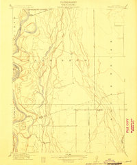 1912 Newhard1912 Print · USGSThe Sacramento River valley in the early twentieth century was a land of sprawling ranchos and vital river landings. Genealogists and historians can trace the foundations of local education at Aguas Frias School and locate former river hubs like Newhard Landing.
 - 1914 Map of Kirkwood
 1914 Kirkwood1914 Print · USGSThe northern Sacramento Valley's agricultural transition is on display here in the years before the Great War. Genealogists and researchers can trace early rail sidings and water networks like Kirkwood, Malton, and the Lemon Home Colony Canal.
 - 1914 Map of Orland
 1914 Orland1914 Print · USGSGlenn County agriculture and rail travel are captured in the early twentieth century, centered on the growing town of Orland. Genealogists and historians can trace property lines and transport routes near Greenwood and the Southern Pacific Woodland Line.
 - 1914 Map of Hamilton
 1914 Hamilton1914 Print · USGSNorthern Glenn County comes into focus in this early twentieth-century survey of the Sacramento Valley's emerging agricultural landscape. Trace the tracks of the S P R R and Northern El R R as they converge near Hamilton and the Swift Point Warehouse.
 - 1914 Map of McIntosh Landing
 1914 McIntosh Landing1914 Print · USGSThe Sacramento River corridor north of Hamilton City is shown here in the early twentieth century as a complex landscape of shifting islands and landings. Trace the historic riverfront at McIntosh Landing or follow the path of the Central Irrigation Canal.
 - 1917 Map of Kurand
 1917 Kurand1917 Print · USGSThe foothills of Glenn County meet the valley floor in the early twentieth century, showing a landscape defined by ranching and rail. You can trace the path of the Southern Pacific Fruto Branch as it approaches the settlement of Kurand.3 unique versions available
 - 1917 Map of Lyman
 1917 Lyman1917 Print · USGSGlenn County agriculture was entering a transformative period of rail and water development during the late teens. Historians can trace the early rail junctions at Willows and follow the path of the Woodland Line and the Irrigation Canal.2 unique versions available
 - 1917 Map of Jacinto
 1917 Jacinto1917 Print · USGSIn the early twentieth century, the banks of the Sacramento River were transitioning from ranching to irrigation-fed farming. Genealogists and researchers can trace the old landing sites at Sidds Landing and the namesake settlement of Jacinto.2 unique versions available
Showing maps 1-25 of 260
Top cities of Glenn County
Frequently asked questions
- What are the different types of historical maps available for Glenn County?
- What is the oldest map of Glenn County?
- Where can I purchase historical maps of Glenn County for my home or office?
- Where can I download high-res historical maps of Glenn County?
- Are there historical topographic maps available for Glenn County?
- Is there historical aerial imagery available for Glenn County?
- Where are historical maps of Glenn County sourced from?