1960s Maps of Glenn County, California
Explore 21 historic maps of Glenn County from the 1960s. These maps offer a rare glimpse into what life looked like during the 1960s — showing old roads, neighborhoods, homes, and landmarks that have changed or disappeared over time.
Whether you're researching your family's past, planning a metal detecting trip, or studying how Glenn County's landscape evolved across the 1960s, these high-resolution maps are a powerful tool for exploring the history of this region.
- Focus on a specific era: All maps on this page are from the 1960s, giving you a focused view of this time period.
- See what’s changed: Compare century-old streets, trails, and buildings to today's modern landscape using overlays and satellite layers.
- Research with precision: Use these maps for genealogy, historical research, land use analysis, or educational projects.
- View, download, or print: Maps are fully viewable online in high resolution, and can be downloaded or printed for your own records.
Start exploring Glenn County's history through authentic maps from the 1960s. This is your window into the past.
Glenn County, CA maps
(21)- 1960 Map of Ukiah
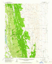
 1960 Ukiah1960 Print · USGSNorthern California during the late fifties reveals a landscape of deep timber forests and valley agriculture before modern expansion. Trace the historic rail lines of the California Western RR and the Northwestern Pacific RR through settlements like Fort Bragg and Ukiah.2 unique versions available
 - 1960 Map of Chico
 1960 Chico1960 Print · USGSThe Northern California high country and Sacramento Valley meet in this 1960s-era landscape of mining towns and river settlements. Trace the rail-and-water economy of the gold country through the Empire Mine, Beale Air Force Base, and the Western Pacific Railroad.
 - 1960 Map of Lodoga, 1962 Print
 1960 Lodoga1962 Print · USGSLodoga and the rugged ridges of the Colusa and Glenn county border are captured here in the early sixties. Genealogists and local historians can locate early rural landmarks like Little Stony Sch, Mills Orchards, and the historic Swifts Stone Corral.2 unique versions available
 - 1967 Map of Black Butte Dam, 1968 Print
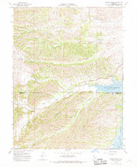
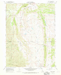
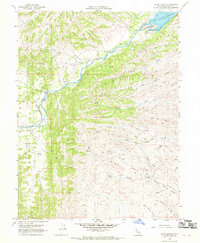
 1967 Black Butte Dam1968 Print · USGSThe Tehama and Glenn county line meets at the newly formed Black Butte Reservoir during the late sixties. Researchers can trace the massive water projects of the era, from the Black Butte Dam to the Lemon Home Colony Canal and the quiet Graves Cem.3 unique versions available
 - 1967 Map of Sehorn Creek, 1968 Print
 1967 Sehorn Creek1968 Print · USGSThe foothills of the Northern Sacramento Valley meet the newly formed Black Butte Reservoir in the late 1960s. Researchers can trace ancestral locations like the Elmore Cemetery or follow the early paths of Newville Road and Butte Road through the hollows.3 unique versions available
 - 1967 Map of Plaskett Ridge, 1969 Print
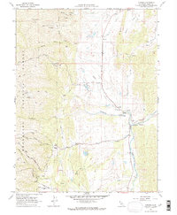
 1967 Plaskett Ridge1969 Print · USGSThe Mendocino and Glenn county line runs through this remote forest territory in the late sixties. Genealogists and historians can trace isolated mountain life through sites like O'Neil Place, the Grizzly Flat Station, and the Black Butte River.
 - 1967 Map of Plaskett meadows, 1969 Print
 1967 Plaskett meadows1969 Print · USGSThe high Mendocino range in the late sixties remained a land of rugged pack trails and seasonal wilderness camps. Researchers can trace historic access routes and named locations like Copper City, Jenks Place, and the remote Garnett Camp.2 unique versions available
 - 1967 Map of Log Spring, 1969 Print
 1967 Log Spring1969 Print · USGSThe high ridges of the Mendocino National Forest are captured here in the late sixties as a network of seasonal camps and trails. Local researchers can trace old mountain outposts like Saturday Camp, find isolated structures such as Bodkin Cabin, and follow the remote Hokey Jeep Trail.
 - 1967 Map of Kneecap Ridge, 1969 Print
 1967 Kneecap Ridge1969 Print · USGSLake and Glenn Counties in the late sixties are seen here through a network of remote ridges and forest trails. Researchers can trace historic backcountry routes like the Middle Creek Trail or locate wilderness landmarks including the Corbin Work Center and High Point.
 - 1967 Map of Newville, 1970 Print
 1967 Newville1970 Print · USGSThe Glenn and Tehama county line area in the late sixties reveals a landscape of isolated ridges and ranching outposts. Researchers can locate the settlement of Newville, trace the Indian Treaty Boundary Road, or find a local Cem near the banks of Thomes Creek.2 unique versions available
 - 1967 Map of Hull Mountain, 1970 Print
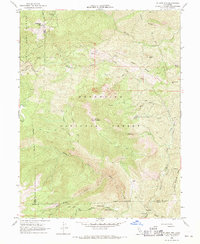
 1967 Hull Mountain1970 Print · USGSThe high country of the Mendocino National Forest is mapped here during the late sixties, showing a landscape of remote ridges and mountain camps. Genealogists and historians can trace family-named sites like Hulls Grave, Mendenhall Camp, and Graves Cabin.2 unique versions available
 - 1967 Map of Hall Ridge, 1970 Print
 1967 Hall Ridge1970 Print · USGSThe Tehama and Glenn county line crosses this high-elevation forest landscape during the mid-1960s, revealing a network of remote camps and orchards. Genealogists and historians can trace family-named sites like Davies Orchard and Whitlock Place or locate the Valley View Lookout Tower.
 - 1967 Map of Mendocino Pass, 1970 Print
 1967 Mendocino Pass1970 Print · USGSThe high ridges and remote canyons of the California Coast Range are captured here during the late sixties. Researchers can trace historic family landmarks and outposts such as Barras Ranch, Hardy Place, and the high-elevation Government Flat.2 unique versions available
 - 1967 Map of Alder Springs, 1970 Print
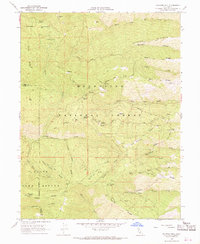
 1967 Alder Springs1970 Print · USGSGlenn County and the Mendocino National Forest are captured here in the late sixties, showing a wilderness crisscrossed by ridges and seasonal camps. Researchers can trace historic landmarks like Camp Ellendale, Valley View Orchard, and numerous water sources including Fiddlers Green.3 unique versions available
 - 1968 Map of Chrome, 1969 Print
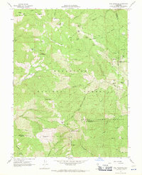
 1968 Chrome1969 Print · USGSIn the Glenn County foothills during the late 1960s, the ranching and mining landscape of the Coast Range comes into focus. Genealogists and local historians can trace family locations like Gillaspy Ranch and find specific landmarks such as Watson Grave or the Grindstone Cem.3 unique versions available
 - 1968 Map of Elk Creek, 1969 Print
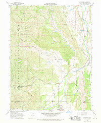
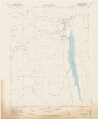 1968 Elk Creek1969 Print · USGSThe community of Elk Creek is shown just before the end of the sixties, nestled between the Mendocino National Forest and the Stony Gorge Reservoir. Researchers can trace old ranching boundaries at the Diamond M Ranch or locate the Stony Gorge Dam and local High Sch.3 unique versions available
 - 1968 Map of Felkner Hill, 1969 Print
 1968 Felkner Hill1969 Print · USGSGlenn and Lake counties are captured here in the late sixties, showing a landscape defined by forestry and remote ranching. Researchers can trace historic timber operations near Ivory Mill and find isolated camps and settlements like Dogtown, Smiley Camp, and Dixon Orchard.2 unique versions available
 - 1968 Map of St. John Mtn., 1969 Print
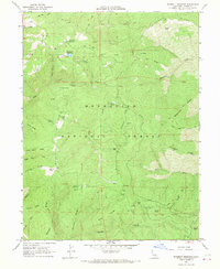
 1968 St. John Mtn.1969 Print · USGSUpper Glenn County was a landscape of remote lookouts and wilderness camps in the late sixties. Researchers can trace the path of old jeep trails through the Mendocino National Forest to landmarks like Meyers Cabin and Upper Nye Camp.2 unique versions available
 - 1968 Map of Julian Rocks, 1969 Print
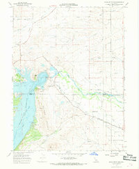
 1968 Julian Rocks1969 Print · USGSGlenn County ranching and water resources are captured here in the late sixties, as the local landscape adapted to the new reservoir. Researchers can trace historic property markers and backcountry routes near Julian Rocks, Stone Valley Ranch, and Wilson Place.2 unique versions available
 - 1968 Map of Stonyford, 1969 Print
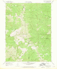
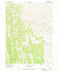
 1968 Stonyford1969 Print · USGSStonyford and the eastern edges of the Coast Range appear here in the late sixties, where the valley ranching country meets the forest. Researchers can locate the Indian Valley Sch, trace Jeep Trails up Elephant Hill, or follow the waters of Stony Creek through the foothills.3 unique versions available
 - 1968 Map of Fruto, 1970 Print
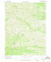
 1968 Fruto1970 Print · USGSGlenn County ranching country and the foothills surrounding Clark Valley are captured here during the late sixties. Researchers can trace family-named sites like Bunnell Ranch, locate the rural Cem near Nye, and follow old Jeep Trails through Hubbard Valley.3 unique versions available
End of results
Showing maps 1-21 of 21
Top cities of Glenn County
Frequently asked questions
- What are the different types of historical maps available for Glenn County?
- What is the oldest map of Glenn County?
- Where can I purchase historical maps of Glenn County for my home or office?
- Where can I download high-res historical maps of Glenn County?
- Are there historical topographic maps available for Glenn County?
- Is there historical aerial imagery available for Glenn County?
- Where are historical maps of Glenn County sourced from?