1950s Maps of Humboldt County, California
Explore 42 historic maps of Humboldt County from the 1950s. These maps offer a rare glimpse into what life looked like during the 1950s — showing old roads, neighborhoods, homes, and landmarks that have changed or disappeared over time.
Whether you're researching your family's past, planning a metal detecting trip, or studying how Humboldt County's landscape evolved across the 1950s, these high-resolution maps are a powerful tool for exploring the history of this region.
- Focus on a specific era: All maps on this page are from the 1950s, giving you a focused view of this time period.
- See what’s changed: Compare century-old streets, trails, and buildings to today's modern landscape using overlays and satellite layers.
- Research with precision: Use these maps for genealogy, historical research, land use analysis, or educational projects.
- View, download, or print: Maps are fully viewable online in high resolution, and can be downloaded or printed for your own records.
Start exploring Humboldt County's history through authentic maps from the 1950s. This is your window into the past.
Humboldt County, CA maps
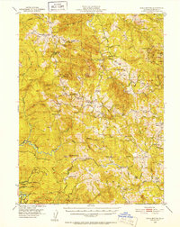
(42)- 1950 Map of Weed
 1950 Weed1950 Print · USGSSiskiyou County and the surrounding Klamath mountains appear in the mid-century before extensive modern development. Genealogists and local historians can locate remote outposts like the Lee Brown Ranch and the specialized settlement of Darlingtonia.
 - 1950 Map of Iaqua Buttes, 1952 Print
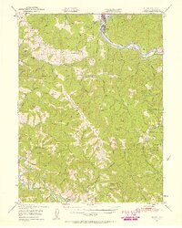
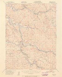
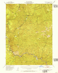
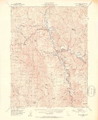
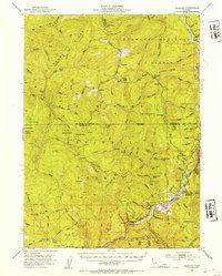
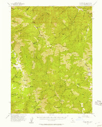
 1950 Iaqua Buttes1952 Print · USGSHumboldt County ranching and timber lands are captured here in the early fifties, showing a landscape of remote ridges and river valleys. Researchers can locate family outposts like Iaqua Ranch and Shaws Ranch or trace the old school districts of Kneeland Sch and Showers Pass Sch.3 unique versions available
 - 1950 Map of Cape Mendocino, 1955 Print
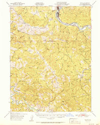
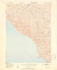
 1950 Cape Mendocino1955 Print · USGSCoastal Humboldt County in the mid-fifties reveals a landscape of isolated ranches and maritime outposts at the continent's edge. Genealogists and historians can trace family holdings like Bonanza Ranch or locate the abandoned school near Petrolia.
 - 1950 Map of Scotia, 1957 Print
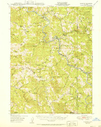
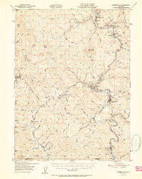
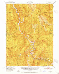
 1950 Scotia1957 Print · USGSHumboldt County’s river valleys and ranch lands are captured here just after the war. Researchers can trace the Northwestern Pacific line through Scotia or locate remote homesteads like McClellan Ranch and the Upper Mattole School.2 unique versions available
 - 1951 Map of Scotia
 1951 Scotia1951 Print · USGSThe Eel River timber and ranching country thrives in the early fifties, centering on the mill town of Scotia and the Redwood Highway corridor. Researchers can trace family-named landmarks like the Chase Ranch, the Upper Mattole School, and rural outposts like Hacketsville.
 - 1951 Map of Alderpoint
 1951 Alderpoint1951 Print · USGSSouthern Humboldt County is captured here at a time when the river-and-rail economy still shaped life along the Eel River. Researchers can trace old family holdings like Ware Ranch and Marr Ranch or locate the Harris PO and the Lumber Mill at Alderpoint.2 unique versions available
 - 1951 Map of Weott
 1951 Weott1951 Print · USGSHumboldt County’s redwood heartland is mapped here in the early fifties as the legendary highway network began to take shape. Genealogists and historians can trace riverside settlements like Weott and Dyerville alongside the Northwestern Pacific Railroad and the famed Tallest Tree.2 unique versions available
 - 1951 Map of Garberville
 1951 Garberville1951 Print · USGSSouthern Humboldt County is defined by the winding course of the river and the redwoods in the early fifties. Genealogists and historians can trace the development of river towns like Garberville or locate rural schools such as Oakdale Sch and South Fork Union H S.2 unique versions available
 - 1951 Map of Point Delgada
 1951 Point Delgada1951 Print · USGSThe Humboldt County coast in the early fifties remains a wilderness of steep ridges and isolated settlements. Researchers can trace the original Humboldt Road and locate mid-century landmarks like the Airstrip at Shelter Cove and the remote Honeydew post office.2 unique versions available
 - 1951 Map of Blocksburg
 1951 Blocksburg1951 Print · USGSHumboldt County ranching and timber country are captured here in the early fifties, spanning the divide between the Eel and Mad Rivers. Genealogists and historians can locate remote family holdings like Payton Ranch, the Buck Mtn School, and the Northwestern Pacific rail line at Eel Rock.2 unique versions available
 - 1951 Map of Cape Mendocino
 1951 Cape Mendocino1951 Print · USGSCoastal Humboldt County in the early fifties shows a landscape of isolated ranches and maritime outposts along the Pacific. Researchers can trace the layout of Petrolia, locate the Coast Guard Reservation, and find family-named landmarks like Green Pond Ranch and Bonanza Ranch.2 unique versions available
 - 1951 Map of Pilot Creek, 1952 Print
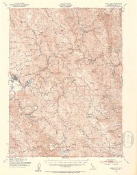
 1951 Pilot Creek1952 Print · USGSHumboldt and Trinity counties are shown during the early fifties, a time when remote cabins and mountain ranches still defined the high country. Genealogists and local historians can locate Ackley Ranch (Site of Fort Baker), Showers Pass, and the Cold Springs Lookout.5 unique versions available
 - 1951 Map of Eureka, 1953 Print
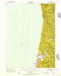
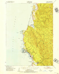
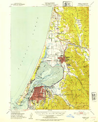 1951 Eureka1953 Print · USGSThe Humboldt coast is captured here during a period of significant mid-century growth and industrial activity. Genealogists and historians can trace the foundations of Eureka and Arcata, locating Humboldt State College and waterfront sites like Samoa and Fairhaven.2 unique versions available
 - 1951 Map of Blue Lake, 1953 Print
 1951 Blue Lake1953 Print · USGSCoastal Humboldt County in the early 1950s shows the deep connection between the timber industry and the high-prairie ranching life. Genealogists can trace family landmarks and rural infrastructure like Blue Lake, the Ford Ranch, and the Redwood School.5 unique versions available
 - 1951 Map of Ferndale, 1953 Print
 1951 Ferndale1953 Print · USGSCoastal Humboldt County and the Eel River delta are captured here in the early fifties during a period of active ranching and maritime surveillance. Genealogists can trace family landmarks like Fern Cottage and Arlynda Corners or locate several local schoolhouses including Eel River Sch and Table Bluff Sch.2 unique versions available
 - 1951 Map of Ironside Mountain, 1953 Print
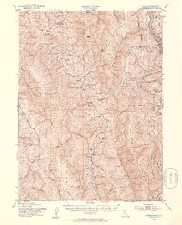
 1951 Ironside Mountain1953 Print · USGSTrinity County's deep river canyons and forest ridges are captured here in the early fifties, showing a remote landscape defined by mining and mountain ranching. Researchers can locate family landmarks like Gray Ranch, old mining sites such as Index Mine, and riverside camps including Del Loma and Sandy Bar.4 unique versions available
 - 1952 Map of Willow Creek, 1954 Print
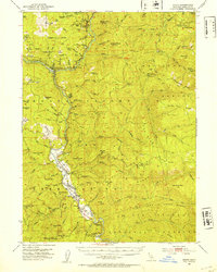
 1952 Willow Creek1954 Print · USGSThe Trinity River valley in the early fifties shows a mountain landscape of remote ranches and forest stations. Genealogists and historians can locate family landmarks like Russell Cabin, the Horse Mtn Mine, and the Cedar Grove Ranch.4 unique versions available
 - 1952 Map of Orick, 1954 Print
 1952 Orick1954 Print · USGSThe northern California coast and its redwood forests appear here in the early fifties, centering on the valley of Redwood Creek. Local historians can trace the foundations of the park system and early settlements like Orick, Hufford Ranch, and the State Fish Hatchery.2 unique versions available
 - 1952 Map of Coyote Peak, 1954 Print
 1952 Coyote Peak1954 Print · USGSHumboldt County ranching and tribal lands are documented here in the early fifties, from the ridges above Redwood Creek to the river banks. Genealogists can trace family holdings and rural education at the Anton Lyons Ranch, Bald Hills School, and Rube Ranch.5 unique versions available
 - 1952 Map of Hoopa, 1954 Print
 1952 Hoopa1954 Print · USGSThe Trinity and Klamath rivers converge in this early 1950s survey of the Hoopa Valley. Genealogists and researchers can trace riverside settlements and cultural landmarks like Hoopa, Weitchpec, and The Rain Rock Indian Ceremonial Site.4 unique versions available
 - 1952 Map of Orleans, 1954 Print
 1952 Orleans1954 Print · USGSThe Klamath River corridor near the tri-county border appears here in the early fifties, showing a landscape of forest service outposts and family ranching. Researchers can locate the Reece Homestead, the Hunter Little Ranch, and historical mining sites like the Owl Mine.3 unique versions available
 - 1952 Map of Tectah Creek, 1954 Print
 1952 Tectah Creek1954 Print · USGSThe Klamath River corridor in the early fifties shows a landscape of river-dependent settlements and isolated mountain ranches. Genealogists and researchers can locate Mc Covey Ranch, the Pecwan Union School, and riverside points like Johnsons.3 unique versions available
 - 1952 Map of Trinidad, 1954 Print
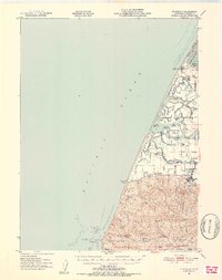
 1952 Trinidad1954 Print · USGSThe Humboldt County coast in the early fifties shows a landscape of timber industry and maritime heritage. Genealogists and historians can trace the Hammond Lumber Co rail lines, the community of Crannell, and coastal landmarks like Trinidad Head and the Lighthouse.2 unique versions available
 - 1952 Map of Arcata North, 1974 Print
 1952 Arcata North1974 Print · USGSCoastal Humboldt County was undergoing significant postwar growth and industrial expansion during this era. Genealogists and local historians can trace family locations near McKinleyville and old school sites like Fieldbrook School and Morris Sch.
 - 1955 Map of Salmon Mtn, 1957 Print
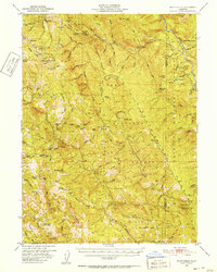
 1955 Salmon Mtn1957 Print · USGSThe Salmon Mountains in the early fifties were a rugged frontier of mining and forestry across the Trinity and Siskiyou county lines. Researchers can trace historic extraction sites like Old Denny, Marysville (Site), and the Jumbo Mine.3 unique versions available
Showing maps 1-25 of 42
Top cities of Humboldt County
- Eureka historical maps
- Arcata historical maps
- McKinleyville historical maps
- Fortuna historical maps
- Fortuna historical maps
- Rio Dell historical maps
See more
Frequently asked questions
- What are the different types of historical maps available for Humboldt County?
- What is the oldest map of Humboldt County?
- Where can I purchase historical maps of Humboldt County for my home or office?
- Where can I download high-res historical maps of Humboldt County?
- Are there historical topographic maps available for Humboldt County?
- Is there historical aerial imagery available for Humboldt County?
- Where are historical maps of Humboldt County sourced from?