1970s Maps of Humboldt County, California
Explore 41 historic maps of Humboldt County from the 1970s. These maps offer a rare glimpse into what life looked like during the 1970s — showing old roads, neighborhoods, homes, and landmarks that have changed or disappeared over time.
Whether you're researching your family's past, planning a metal detecting trip, or studying how Humboldt County's landscape evolved across the 1970s, these high-resolution maps are a powerful tool for exploring the history of this region.
- Focus on a specific era: All maps on this page are from the 1970s, giving you a focused view of this time period.
- See what’s changed: Compare century-old streets, trails, and buildings to today's modern landscape using overlays and satellite layers.
- Research with precision: Use these maps for genealogy, historical research, land use analysis, or educational projects.
- View, download, or print: Maps are fully viewable online in high resolution, and can be downloaded or printed for your own records.
Start exploring Humboldt County's history through authentic maps from the 1970s. This is your window into the past.
Humboldt County, CA maps
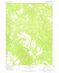
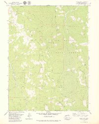
(41)- 1970 Map of Scotia, 1974 Print
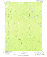
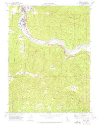 1970 Scotia1974 Print · USGSHumboldt County’s river-bound lumber towns are shown in the early 1970s as they transition from industrial hubs into parklands. You can trace the Northwestern Pacific railroad corridor and locate named clearings like Barkdull Prairie and Harrow Springs.
 - 1970 Map of Miranda, 1974 Print
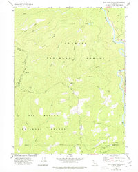
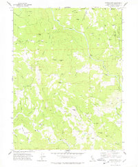
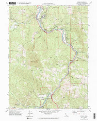 1970 Miranda1974 Print · USGSHumboldt County’s redwood corridor is captured here in the early 1970s as the river and road networks shaped local life. Genealogists and historians can trace the foundations of Miranda, Phillipsville, and Redway alongside the iconic Avenue of the Giants.2 unique versions available
 - 1970 Map of Honeydew, 1974 Print
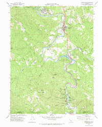
 1970 Honeydew1974 Print · USGSHumboldt County in the late sixties and early seventies is defined by the winding Mattole River and the high ridges of the King Range National Conservation Area. Trace family-named sites and remote landmarks like Westlund Place, Landergen Airstrip, and King Peak.
 - 1970 Map of Garberville, 1974 Print
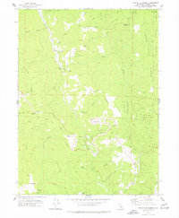
 1970 Garberville1974 Print · USGSCoastal canyon life along the South Fork Eel River is captured here during the 1970s. Local researchers can trace family landmarks and rural holdings from Boyer Ranch and Pauli Ranch to the early resort grounds of Benbow.
 - 1970 Map of Buckeye Mtn, 1974 Print
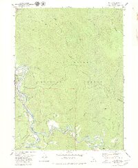
 1970 Buckeye Mtn1974 Print · USGSHumboldt County’s river valleys and ridgelines are captured here in the early 1970s, showing a landscape defined by ranching and timber. Researchers can locate the Upper Mattole Sch, Camp Mattole, and the remote Oil Well tucked near Apple Tree Ridge.
 - 1973 Map of Lord-Ellis Summit, 1977 Print
 1973 Lord-Ellis Summit1977 Print · USGSHumboldt County’s timbered ridges and high prairies are captured here in the early 1970s before modern development altered these remote drainages. Genealogists and historians can locate the Redwood School, the Camp Anderson (Site), and family-named landmarks like Berry Summit.2 unique versions available
 - 1974 Map of Orleans Mtn., 1977 Print
 1974 Orleans Mtn.1977 Print · USGSThe Salmon Mountains and the Klamath River confluence appear here in the mid-seventies, showing a landscape defined by deep canyons and high lookouts. Researchers can trace remote mining history at the Morehouse Mine or locate river landmarks like Murderers Bar and Butler Flat.2 unique versions available
 - 1974 Map of Lonesome Ridge, 1977 Print
 1974 Lonesome Ridge1977 Print · USGSNorthern California’s high backcountry in the 1970s reveals a landscape defined by deep gulches and forest service boundaries. Researchers can trace the paths to Onion Lake, Louse Camp, and the high reaches of Lonesome Ridge.
 - 1974 Map of Bark Shanty Gulch, 1977 Print
 1974 Bark Shanty Gulch1977 Print · USGSThe Klamath River corridor in the mid-1970s reveals a landscape of remote mountain camps and rugged forest management. Researchers can locate vanished outposts and landmarks such as Bark Shanty Camp, Beans Camp, and the riverfront Cem.2 unique versions available
 - 1974 Map of Fish Lake, 1977 Print
 1974 Fish Lake1977 Print · USGSThe Siskiyou Mountains within the Six Rivers National Forest come alive in this mid-seventies survey of the rugged Klamath River backcountry. Researchers can locate the Wright Place (Site) or trace old routes like the Pack Trail past Fish Lake and Onion Mountain.
 - 1977 Map of Board Camp Mtn
 1977 Board Camp Mtn1977 Print · USGSHumboldt County’s high forest ridges and the Mad River valley are documented here in the late seventies. Researchers can trace the locations of isolated outposts and seasonal camps including Nolan Cabin, Ridge Cabin, and the Deer Creek Ranch.3 unique versions available
 - 1977 Map of Dinsmore, 1978 Print
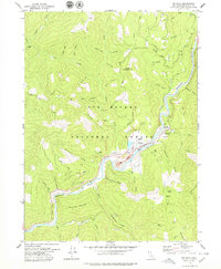
 1977 Dinsmore1978 Print · USGSThe Humboldt and Trinity county line meets in this 1970s survey of the mountain forests and river valleys. Researchers can trace the local infrastructure of Dinsmore, from the Southern Trinity High School to the Dinsmore-Humboldt County Airport.2 unique versions available
 - 1977 Map of Maple Creek, 1978 Print
 1977 Maple Creek1978 Print · USGSHumboldt County ranching and timber lands are documented here in the late seventies, showing the remote outposts of the northern coast ranges. Researchers can trace family-named landmarks like Russ Ranch, Ayres Cabin, and the small settlement at Maple Creek.
 - 1977 Map of Mad River Buttes, 1978 Print
 1977 Mad River Buttes1978 Print · USGSNorthern California timberlands and the winding Mad River are documented here in the late seventies. Researchers can trace remote homesteads like Big Bend Ranch and Mt View Ranch or navigate the trails near Snow Camp Mtn.2 unique versions available
 - 1977 Map of Larabee Valley, 1978 Print
 1977 Larabee Valley1978 Print · USGSHumboldt County ranching and mountain life are captured here during the 1970s, showcasing a network of isolated homesteads and high-country landmarks. Genealogists and local historians can locate the Buck Mtn Sch, the Indian Cabin (Site), and family lands like Cottrell Ranch.
 - 1978 Map of Tish Tang Point
 1978 Tish Tang Point1978 Print · USGSHumboldt County’s steep interior is captured in the late seventies, showing the meeting of tribal and forest service lands. Trace the remote terrain via Marshall Crossing, Tish Tang Point, and the winding Horse Linto Creek.
 - 1978 Map of Blake Mountain
 1978 Blake Mountain1978 Print · USGSThe Humboldt and Trinity county lines meet in the late 1970s along the ridges of the Six Rivers National Forest. Researchers can trace old mountain sites and trails like Becker Cabin (Site), Eightmile Lookout, and the Blake Trail.
 - 1978 Map of Salmon Mtn.
 1978 Salmon Mtn.1978 Print · USGSThe Salmon Mountains reach their peak in the late 1970s within this high-country wilderness where three national forests converge. Trace remote ridge routes like Devils Backbone and Horse Trail Ridge to reach Mullens Camp or Red Cap Lake.2 unique versions available
 - 1978 Map of Black Lassic
 1978 Black Lassic1978 Print · USGSThe high peaks of the Six Rivers National Forest are captured in the late seventies, showing the boundary between Humboldt and Trinity counties. Researchers can trace remote locales like the Dutchman Camp (site), the Fingal Ranch, and landmarks like Black Lassic and Pine Mountain.
 - 1978 Map of Showers Mtn
 1978 Showers Mtn1978 Print · USGSHumboldt County ranching and forest lands are captured in the late 1970s, revealing a landscape of family holdings and old mountain passes. Genealogists and local historians can trace legacy properties like Stapp Ranch and the historical Ackley Ranch (Site of Fort Baker).2 unique versions available
 - 1978 Map of Orleans, 1979 Print
 1978 Orleans1979 Print · USGSThe Klamath River corridor in the late seventies reveals a landscape of mining claims and remote homesteads. Genealogists and researchers can trace family landmarks like the Reece Homestead and Short Ranch or locate the Peach Creek Mine near Orleans.3 unique versions available
 - 1979 Map of Salyer
 1979 Salyer1979 Print · USGSIn the late 1970s, the Klamath Mountains landscape was defined by the winding waters of the Trinity River. Genealogists and historians can trace riverside settlements like Salyer and Trinity Village, or locate the Cem and Mine sites tucked along the ridges.2 unique versions available
 - 1979 Map of Grouse Mtn
 1979 Grouse Mtn1979 Print · USGSHumboldt County’s high country is captured here during the late 1970s, showing a landscape of national forest ridges and remote mountain outposts. Researchers can trace old mountain life through sites like Ammon Station, the Horse Mountain Mine, and Janes Place.2 unique versions available
 - 1979 Map of Sims Mountain
 1979 Sims Mountain1979 Print · USGSHumboldt and Trinity counties meet along the river in the late seventies, a time of remote forest management and high-country ranching. Genealogists and local historians can trace isolated landmarks like Margarita Ranch, the Dan East Cabin, and the crossing at Mule Bridge.
 - 1979 Map of Blue Lake
 1979 Blue Lake1979 Print · USGSBlue Lake and the surrounding Humboldt County timberlands are captured here in the late seventies. Researchers can trace the river-centered economy through features like Camp Bauer, the Mad River gaging station, and family-named landmarks like Liscom Hill.3 unique versions available
Showing maps 1-25 of 41
Top cities of Humboldt County
- Eureka historical maps
- Arcata historical maps
- McKinleyville historical maps
- Fortuna historical maps
- Fortuna historical maps
- Rio Dell historical maps
See more
Frequently asked questions
- What are the different types of historical maps available for Humboldt County?
- What is the oldest map of Humboldt County?
- Where can I purchase historical maps of Humboldt County for my home or office?
- Where can I download high-res historical maps of Humboldt County?
- Are there historical topographic maps available for Humboldt County?
- Is there historical aerial imagery available for Humboldt County?
- Where are historical maps of Humboldt County sourced from?